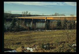
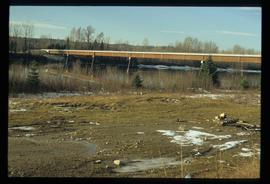
Image depicts the new Hansard Bridge. Map coordinates 54°04'57.9"N 121°51'10.1"W
Image depicts the new Hansard Bridge. Map coordinates 54°04'57.9"N 121°51'10.1"W
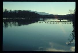
Image depicts the Hansard railroad bridge taken from the new Hansard vehicle bridge. Map coordinates 54°04'58.1"N 121°50'58.0"W
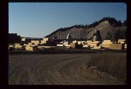
Image depicts numerous piles of wood planks at the Canadian National Railway Yards in Prince George, B.C. The cutbanks are seen in the background.
Image depicts logs being stripped of their bark at a saw mill in Prince George, B.C.
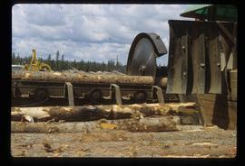
Image depicts a saw cutting a log in half at a saw mill in Prince George, B.C.
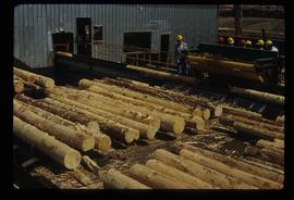
Image depicts numerous stripped logs and several unidentified individuals in hard hats at a saw mill somewhere in Prince George, B.C.
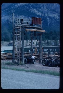
Image depicts a man attaching a logging trailer to a crane on a wooden structure to stack the trailer on the truck. A Crestbrook Forest Industries sawmill is located in the background.
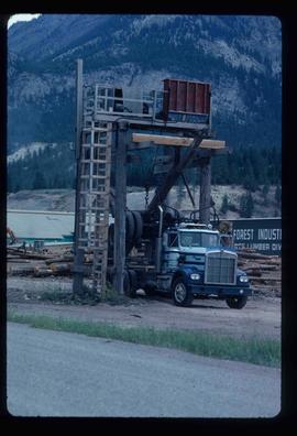
Image depicts a logging truck with its trailer being attached on top of it. A Crestbrook Forest Industries sawmill is located in the background.
Image depicts a view of Prince George from Gunn Point in the L.C. Gunn Park looking north. Map coordinates 53°54'26.2"N 122°43'35.8"W.
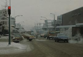
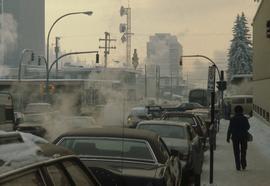
Image depicts 3rd Ave at Brunswick Street in -35 degree weather. Map coordinates 53°55'03.0"N 122°44'51.7"W
Image depicts Brunswick Street at 3rd Ave in -35 degree weather. Map coordinates 53°55'03.0"N 122°44'51.7"W
Image depicts a view of Prince George from Gunn Point in the L.C. Gunn Park looking north. Map coordinates 53°54'26.2"N 122°43'35.8"W.
Image depicts a view of Prince George from Gunn Point in the L.C. Gunn Park looking north. Map coordinates 53°54'26.2"N 122°43'35.8"W.
Image depicts a view of Prince George from Gunn Point in the L.C. Gunn Park looking north. Map coordinates 53°54'26.2"N 122°43'35.8"W.
Image depicts a view of Prince George from Gunn Point in the L.C. Gunn Park looking north. Map coordinates 53°54'26.2"N 122°43'35.8"W.
Image depicts a view of Prince George from Gunn Point in the L.C. Gunn Park looking north. Map coordinates 53°54'26.2"N 122°43'35.8"W.
Image depicts a view of Prince George from Gunn Point in the L.C. Gunn Park looking north. Map coordinates 53°54'26.2"N 122°43'35.8"W.
Image depicts a view of Prince George from Gunn Point in the L.C. Gunn Park looking north. Map coordinates 53°54'26.2"N 122°43'35.8"W.
Image depicts a view of Prince George from Gunn Point in the L.C. Gunn Park looking north. Map coordinates 53°54'26.2"N 122°43'35.8"W.
Image depicts a view of Prince George from Gunn Point in the L.C. Gunn Park looking north. Map coordinates 53°54'26.2"N 122°43'35.8"W.
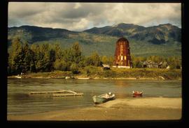
Image depicts several boats on what appears to be a river, and an old beehive burner in Penny, B.C.
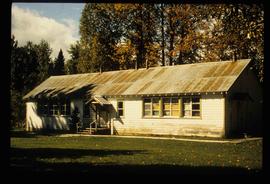
Image depicts a two-room schoolhouse in Penny, B.C.
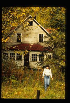
Image depicts an old house in Penny and a woman, possibly Sue Sedgwick, standing in front of it. The location is uncertain.
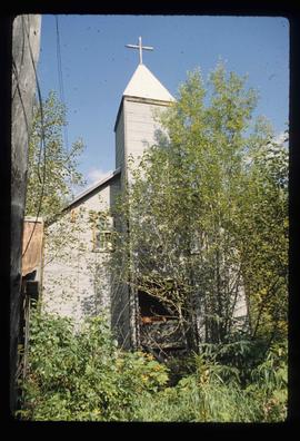
Image depicts the Catholic Church in Penny, B.C.
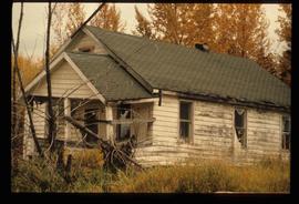
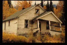
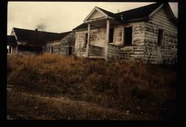
Image depicts a dilapidated house in Sinclair Mills, B.C.
Image depicts a dilapidated house in Sinclair Mills, B.C.
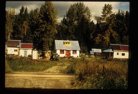
Image depicts a small house with brightly coloured door and window frames in Penny, B.C.
Image depicts two dilapidated houses in Sinclair Mills, B.C.
File consists of notes, clippings, and reproductions relating to the South Fort George townsite. Includes "Name change from Glenora Park to Paddlewheel Park" typescript letter from Kent Sedgwick to The Mayor and Council (12 Sept. 1988).
File consists of a photocopy of "Note on the distribution of some of the more important trees of British Columbia" by George Dawson, circa 1880.
File consists of a pamphlet titled "The Fort Fraser-Fort George Bulletin Area" prepared by the Department of Lands, Forests, and Water Resources from the Province of British Columbia.
File consists of notes, clippings, and reproductions relating to the Grand Canyon of the Fraser River. The Grand Canyon of the Fraser is a short gorge on the upper Fraser River, about 6 kilometres south-southwest of Hutton. The canyon head was about 171 kilometres by river from Fort George, and is about 100 kilometres due east of downtown Prince George.
File consists of notes, clippings, and reproductions relating to historical agriculture in Prince George. Includes material on the Prince George Farmer's Institute; experimental plots surrounding Prince George; farming in areas surrounding Prince George including Pineview, Mud River, and Blackburn; ranching; gardening; and the Prince George Experimental Farm. Includes: "Moose in British Columbia, Canada" an educational pamphlet from the Fish and Wildlife Branch of the Department of Recreation and Conservation in British Columbia.
File consists of notes, clippings, and reproductions relating to dairying and dairy farming in Prince George. Includes material on Harry Moffat; cattle in Mud River; Mr. Hewlett and Centralia Dairy (established in 1923); Interior Creamery, located at the corner of Brunswick and First Avenue; and pasteurization.
File consists of notes, clippings, and reproductions relating to British Columbia historical bibliographies and reference material. Includes: "Rural British Columbia: A Bibliography of Social and Economic Research" typescript document compiled by Dean S. Goard (1967); "Photo chronicler of B.C. a century ago" clipped article from Canadian Photography magazine (Feb. 1977); and "A Guide to British Columbia Stop of Interest Plaques" pamphlet by the Parks Branch of British Columbia (1969).
File consists of notes and reproductions relating to climate in Prince George. Includes: "Annual meteorology summary Prince George, B.C". document from Environment Canada (1989).
File consists of notes, clippings, and reproductions relating to the Prince George Rivers Committee. Includes: "Report of the Rivers Committee" spiral bound typescript reports submitted to City Council of the City of Prince George (26 Sept. 1983) and "Submission to Rivers Committee by Heritage Advisory Committee" typescript document by Kent Sedgwick (Apr. 1983).
File consists of notes, clippings, and reproductions relating to forest fires in Prince George and region. Includes: "Significant Fire Years in the Prince George Area - A Media Perspective Taken from the Prince George Citizen Newspaper (1912-1961)" typed document by Brad C. Hawkes (June 1997).
File consists of notes, clippings, and reproductions relating to the central interior rainforest and the Ancient Forest/Chun T'oh Whudujut Provincial Park and Protected Area.
File consists of a report titled "Nechako and Stuart River Corridors" prepared by the Ministry of Forests for the Province of British Columbia. The report has background data and reference information for a recreation planning study of the Nechako and Stuart River Corridors.
File consists of notes, clippings, and reproductions relating to the planning of Millennium Park at First Avenue and George Street in Prince George. Includes: "Cairn at Millennium Park" typed document by Kent Sedgwick (Mar. 2000) and correspondence letters between Kent Sedgwick, The City of Prince George, and Environment Canada (1987).
File consists of notes, reproductions, and letters relating to L.C. Gunn Park in Prince George. Includes: "Signage for Gunn Park" letter from Kent Sedgwick to the Mayor and Council (21 Dec. 1989); "L.C. Gunn viewpoint a proposal" documents within a duotang (1987); and "Donation to the City of Prince George" typescript letter from Graham Farstad to the Administration Committee ( 1 June 1988). Includes photographs depicting the opening of L.C. Gunn Park and the sign unveiling (3 Oct. 1988).
File consists of notes and reproductions relating to the Heritage River Trails in Prince George that follow the shores of the Nechako and Fraser Rivers. Includes: "Heritage River Trails" brochure prepared by Kent Sedgwick (1984).
File consists of reproductions and bibliographic references relating to Monkman Provincial Park.
File consists of notes, clippings, and reproductions relating to rivers in Prince George. Includes: "Proposal for Cottonwood Island as a park reserve" typescript document by the New Caledonia Institute of Environmental Studies [ca. 1980]; "Ministry of Provincial Secretary and Government Services" typescript letter from John McMurdo to Graham Farstad (15 Dec. 1982); "Rip-rap for Goat Island" typescript letter from Kent Sedgwick to Ernie Obst (23 Oct. 1986); "Ted Williams' river tour notes" typescript document by Ted Williams (June 1991); and "RE: Moffat A.L.R Exclusion and Archaeological Site F1Rq 2" typescript letter from Steve Acheson to Daniel Guerrette (11 May 1982).
File consists of notes, clippings, and reproductions relating to the Monkman Pass area. Includes: "Monkman Pass Memorial Trail" brochure prepared by Tumbler Ridge (2006); "The trail to Monkman Pass" clipped article from BC Outdoors magazine (July 1983); "Regional District of Fraser-Fort George" typescript letter from Y.D. Kennedy to Kent Sedgwick (5 Sept. 1973); and "Alberta Wilderness Association Newsletter" newspaper vol. 13 no. 1 (1983).
File consists of notes, clippings, and reproductions relating to the Volksport trail in Prince George. The trail starts at the Prince George Railway and Forestry Museum and follows the Heritage River Trail through parks along the Fraser and Nechako Rivers with some residential walking. Includes: "Prince George Railway & Forestry Museum 11 km trail for Volkssporting members" typed document (2004) and "Presentation for Railway and Forestry Museum Directors Meeting" typed document by Audrey L'Heureux (Jan. 2004).
File consists of a typescript report in a duotang titled "Carp Lake Park Report: 1973" by Leon E. Pavlick.
File consists of notes, clippings, and reproductions relating to the Monkman Pass mentioned in newspapers.
