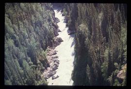
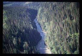
Image depicts a view of the Herrick River in what is possibly McGregor Canyon; the slide is simply labelled "McG Canyon."
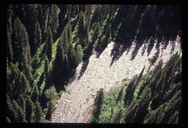
Image depicts a view of the Herrick River in what is possibly McGregor Canyon; the slide is simply labelled "McG above Canyon."
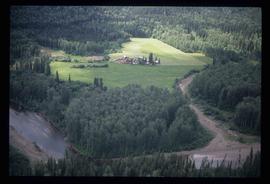
Image depicts an aerial view of what appears to be a small farm, possibly in the McGregor Canyon.
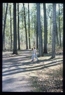
Image depicts a couple walking through a nature trail in Cottonwood Island Park. Map coordinates 53°55'23.6"N 122°43'53.8"W
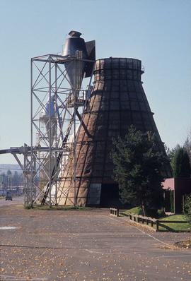
Image depicts a Beehive Burner along the Nechako on River Road. Map coordinates 53°55'34.1"N 122°44'58.0"W.
Image depicts the cutbanks on the other side of the Nechako, taken from the nature trail at Island Cache. Map coordinates 53°55'34.6"N 122°45'52.4"W
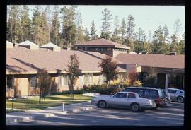
Image depicts Parkside Intermediate Care Home on Ospika Boulevard in Prince George. Map coordinates 53°55'02.6"N 122°47'41.6"W
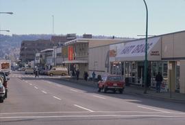
Image depicts 4th Ave at Brunswick St. and the following businesses: Hart Drugs, The Yarn Barn, and Saveco. Map coordinates 53°54'59.9"N 122°44'52.9"W
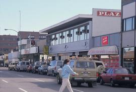
Image depicts 4th Ave at Quebec St, showing the following businesses: The Yarn Barn, Golden Chalice Jewellers, Dandy Lines, Ultrasport, and Saveco. Map coordinates 53°54'58.6"N 122°44'47.5"W
Image depicts the Northwood pulpmill in Prince George B.C.
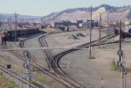
Image depicts a number of trains in the CNR train yard taken from River Road in Prince George, B.C. Map coordinates 53°54'51.5"N 122°43'29.6"W
Image depicts a view of Blackburn Schools, possibly taken from Tabor Mountain.
Image depicts Prince George, possibly with the Northwood Pulpmill in the background.
Image depicts the Nechako Subdivision in Prince George, B.C.
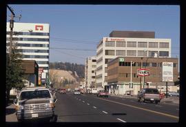
Image depicts downtown Prince George, B.C.
Image depicts a bridge in Prince George, B.C.
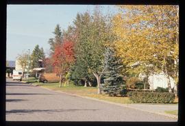
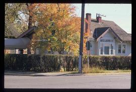
Image depicts a house on the corner of 7th Ave and Vancouver Street in Prince George, B.C.
Item is an original 1989 map depicting Bella Coola in British Columbia, published by the Department of Energy Mines and Resources in Ottawa, Canada. The map also includes Kent Sedgwick's travels in the Bella Coola area highlighted in red.
File consists of notes, letters, and reproductions relating to the "Arrival of Steel" CN Railway plaque in Prince George. Includes: "Invitation" from the City of Prince George for the unveiling of the CN plaque (27 Jan. 1989) and correspondence letters between CN and the City of Prince George (1987-1989). Also includes photographs depicting the CN plaque and the unveiling ceremony (Jan. 1989).
The item is a photograph depicting the unveiling of the Arrival of Steel monument at 772 1st Avenue, Prince George. Bruce Anderson and Mayor John Backhouse are in front of the monument. A crowd is standing around the monument watching the unveiling. Tilden Truck Rentals can be seen in the background.
The item is a photograph depicting the unveiling of the Arrival of Steel monument at 772 1st Avenue, Prince George. The focus is on the crowd surrounding the monument.
The item is a photograph depicting the unveiling of the Arrival of Steel monument at 772 1st Avenue, Prince George. Ted Williams, Bryan Gardiner, Bruce Strachan and John Backhouse are standing in front of the monument with another woman.
The item is a photograph depicting the unveiling of the Arrival of Steel monument at 772 1st Avenue, Prince George. Ted Williams, Bryan Gardiner, Bruce Strachan and John Backhouse are standing in front of the monument with another woman. Annotation on the reverse side of the photograph states, "Ted Williams Bryan Gardiner MP Bruce Strachan MLA assistant? John Backhouse Mayor CN Rail."
The item is a photograph depicting the unveiling of the Arrival of Steel monument at 772 1st Avenue, Prince George. Ted Williams and a woman are photographed looking at the plaque on the monument.
The item is a photograph depicting the unveiling of the Arrival of Steel monument at 772 1st Avenue, Prince George. Ted Williams and a woman are photographed looking at the plaque on the monument.
File consists of notes, reproductions, and letters relating to L.C. Gunn Park in Prince George. Includes: "Signage for Gunn Park" letter from Kent Sedgwick to the Mayor and Council (21 Dec. 1989); "L.C. Gunn viewpoint a proposal" documents within a duotang (1987); and "Donation to the City of Prince George" typescript letter from Graham Farstad to the Administration Committee ( 1 June 1988). Includes photographs depicting the opening of L.C. Gunn Park and the sign unveiling (3 Oct. 1988).
Image depicts a view of the Herrick River in what is possibly McGregor Canyon; the slide is simply labelled "McG Canyon - above Herrick."
File contains slides depicting geomorhp diagrams.
File consists of notes and reproductions relating to the survey of Prince George. Includes material on survey plans, lots in Prince George, original town planning, subdivision plans, and Kent Sedgwick's handwritten notes on surveying and town planning in Prince George. File primarily includes photopied maps depicting town lots and planning in Prince George. Includes: "RE: Title Search for Fairgrounds" typescript letter from Kent Sedgwick to Dr. Dick Rowe (26 Apr. 1990) and "Map showing South Fort George, Fort George (Central) and the additions surveyed in 1910 or later" reproduced map from the Fort George Tribune newspaper.
File consists of maps and town surveys of early Prince George. Includes various reproduced 1915 maps and surveys depicting Prince George, Central Fort George, and Fort George: "Subdivision of part of Indian Reserve no. 1 lot 343 Cariboo District BC"; "Parcel Z map 1268"; "Plan of Subdivision lot 933"; "First addition to townsite of Central Fort George"; "Subdivision of lot 1511 Cariboo District BC"; "Townsite of Fort George" map originally made by R.H. Holland; "Plan of Subdivision of lot 1426 Fort George Collins Addition"; "Plan of subdivision of lot 932 Cariboo District"; and "Plan of subdivision of part of lot 2507."
The item is a reproduction of a survey map drafted in January 1910. The reproduction was likely created in 1990. The subdivision is Lot 936 G. I. Cariboo District, B.C. The area covered is North of Twenty First Avenue, East of Quinn Street, South of Eighth Avenue and West of Carney Street. Annotations highlight "Owner Edgar McMickiny," "696" and "Jordan Brothel" written in red pen pointing to a specific location.
The item is a reproduction of a survey map drafted in September 1909. The reproduction was likely created in 1990. The annotations highlight owners of different lots up to approximately 1959. Th area covered is North of Fifteenth Avenue, East of Irwin Street, South of Eighth Avenue and West of Carney Street. Annotations on attached papers indicate different means of scale and measurement for the map.
The item is a reproduction of a survey map likely drafted in the 1910s. The reproduction was likely created in 1990. The area covered is South of Anderson Street, East of Simpson Street, North of Van Bien Avenue and West of 9th Street. Annotations state, "Pl 721 DL 1426."
The item is a reproduction of a survey map drafted on 1 March 1910. The reproduction was likely created in 1990. The area covered is South of Bernhardt Avenue, East of Simpson Street, North of the Fraser River and West of 9th Street. Annotations state, "DL 1426 Plan 721."
The item is a reproduction of a survey map drafted in 1909. The reproduction was likely created in 1990. The area covered are lots 931 and 417. Annotations state, "Plan 701," and various names are highlighted.
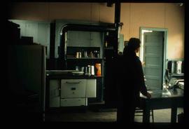
Image depicts the interior of a kitchen at an uncertain location.
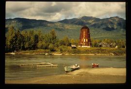
Image depicts several boats on what appears to be a river, and an old beehive burner in Penny, B.C.
File contains slides depicting places in or near Pine Pass and along the Peace River.
The item is a photograph reproduction of Prince George's City Hall circa. 1922. The building is approximately two stories high. There is an artillery canon next to the building.
The item is a photograph depicting the interior of the original Knox United Church built in 1922, located at the corner of Brunswick Street and 5th Avenue, Prince George. The photograph depicts the front area of the church from an elevated position.
The item is a photograph depicting the plaque at the corner of 1st Avenue and George Street. The plaque is titled "Arrival of Steel."
File consists of notes, clippings, and reproductions relating to lava beds in British Columbia, including Aiyansh, also known as the Tseax Cone, in the Nisga'a Memorial Lava Bed Provincial Park. Includes: "Craters of the Moon Guide" special edition newspaper from the United States National Park Service (1990); and "Craters of the Moon: National Monument, Idaho" pamphlet published from the United States National Park Service (1975). File also contains photographs depicting the Nisga'a Memorial Lava Bed Provincial Park.
The item is a photograph that depicts Erle's Iron Works shop with a man outside welding the turrets for the Sikh temple. Annotation states, "Erle Muntz."
The item is a photograph depicting the front and side view of a house at 1085 Vancouver Street in Prince George.
File consists of notes, reproductions, and graphs relating to the moving climate averages in Prince George.
File consists of notes and reproductions relating to sign technology and placement. Includes: "RE: Information on Plaques" from Kent Sedgwick to Trelle Morrow (16 Mar. 1990); "Interpretive signs for heritage river trails" typescript letter from Kent Sedgwick to Mike Maguire (4 May 1988).
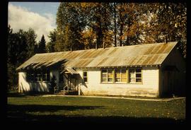
Image depicts a two-room schoolhouse in Penny, B.C.
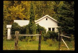
Image depicts a house with ivy growing over it. The location is uncertain.
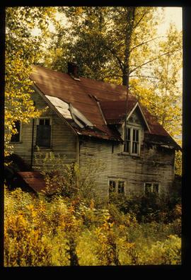
Image depicts an old house with a torn up roof. The location is uncertain.
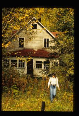
Image depicts an old house in Penny and a woman, possibly Sue Sedgwick, standing in front of it. The location is uncertain.
