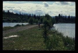
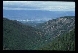
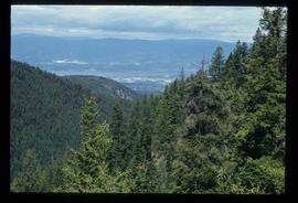
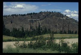
File consists of maps depicting the Salmon River Portage area.
File consists of notes and clippings relating to Jasper and the Yellowhead Pass.
File contains slides depicting Revelstoke.
Image depicts the Kenney Dam near Cheslatta, B.C.
Image depicts the Cheslatta River.
Image depicts the Cheslatta Falls.
Image depicts what appears to be a tour group at Cheslatta.
Image depicts the Cheslatta Falls.
File contains slides depicting the Okanagan Kettle Valley.
Image depicts a man fishing in the Kettle River.
Image depicts a small, ruined shed somewhere in the Okanagan Kettle Valley.
Image depicts a view of the Okanagan Kettle Valley.
Image depicts an unknown figure standing inside a tunnel from the old Kettle Valley Rail Road.
Image depicts the old Kettle Valley Rail Road.
File consists of clippings, notes, and reproductions relating to Moore's Meadow in Prince George. Includes: "Charles W. Moore" handwritten notes by Kent Sedgwick (2000); "The origin of Moore's Meadow" typescript by Kent Sedgwick; and "Moore's Meadow" typescript document by Mary Fallis (Jan. 1991).
Image depicts the Cheslatta River.
Image depicts a view of the Okanagan Kettle Valley.
Image depicts a tunnel from the old Kettle Valley Rail Road.
Image depicts a woman standing inside a tunnel from the old Kettle Valley Rail Road.
Image depicts several unknown individuals standing on the old Kettle Valley Rail Road.
Image depicts a hill and some power lines in Kettle Valley, B.C.
Image depicts the Kenney Dam near Cheslatta, B.C.
Image depicts the Cheslatta River.
Image depicts the Cheslatta Falls.
File contains slides depicting the Okanagan Brigade Trail.
Image depicts the Okanagan Kettle Valley, with the Kettle Rail Road faintly visible among the trees
Image depicts the trail of the old Kettle Valley Rail Road.
Image depicts a woman standing inside a tunnel from the old Kettle Valley Rail Road.
Image depicts the mouth of a tunnel from the Kettle Valley Rail Road.
Image depicts a woman standing on the old Kettle Valley Rail Road.
File consists of notes, clippings, and reproductions relating to various communities along the East Line. Includes material regarding Penny; the Robson Valley; the Ancient Rainforest; Dome Creek; Bend; Loos; Crescent Spur; and Dewey. File includes photographs depicting the Fraser River and Morkill Forest Service Road near Crescent Spur and Dome Creek (2010).
File consists of notes and reproductions relating to the survey of Prince George. Includes material on survey plans, lots in Prince George, original town planning, subdivision plans, and Kent Sedgwick's handwritten notes on surveying and town planning in Prince George. File primarily includes photopied maps depicting town lots and planning in Prince George. Includes: "RE: Title Search for Fairgrounds" typescript letter from Kent Sedgwick to Dr. Dick Rowe (26 Apr. 1990) and "Map showing South Fort George, Fort George (Central) and the additions surveyed in 1910 or later" reproduced map from the Fort George Tribune newspaper.
File consists of maps and town surveys of early Prince George. Includes various reproduced 1915 maps and surveys depicting Prince George, Central Fort George, and Fort George: "Subdivision of part of Indian Reserve no. 1 lot 343 Cariboo District BC"; "Parcel Z map 1268"; "Plan of Subdivision lot 933"; "First addition to townsite of Central Fort George"; "Subdivision of lot 1511 Cariboo District BC"; "Townsite of Fort George" map originally made by R.H. Holland; "Plan of Subdivision of lot 1426 Fort George Collins Addition"; "Plan of subdivision of lot 932 Cariboo District"; and "Plan of subdivision of part of lot 2507."
Image depicts a field of yellow plants at an uncertain location.
Image depicts an old, collapsing cabin which is sloped sideways. The location is uncertain.
Image depicts Sue Sedgwick and a dog standing next to an old, collapsing cabin which is sloped sideways. The location is uncertain.
Item is an original map depicting British Columbia published by the National Atlas Information Geographical Services Division.
Image depicts the Cottonwood House Historic Site along Barkerville Highway, east of Quesnel, B.C. A sign posted by the fence reads: "For over half a century the Boyd family operated this haven for man and beast. Here weary travellers found lodging, food, and drink. Here fresh horses were hitched to stage-coaches and miners bought supplies. This historic road-house, built in 1864, stood as an oasis of civilization on the frontier of a rich new land."
Image depicts an old abandoned cabin at an uncertain location.
Image depicts an unidentified man cross country skiing somewhere on Tabor Mountain in Prince George, B.C.
Image depicts an aerial view of a forest somewhere in the area of Divide Lake.
Image depicts an aerial view of the land in the area of Divide Lake.
Image depicts the "Divides Lake Waterfall."
Image depicts the "Divides Lake Waterfall" as well as a man in front of a helicopter in the foreground.
Image depicts the "Divides Lake Waterfall."
Image depicts a view of James Creek Valley.
Image depicts a view of the Herrick River in what is possibly McGregor Canyon; the slide is simply labelled "McG above Canyon."
Image depicts the cutbanks on the other side of the Nechako, taken from the nature trail at Island Cache. Map coordinates 53°55'34.6"N 122°45'52.4"W