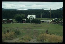
Photograph depicting a dirt road winding between grass and trees in Soda Creek.
Photograph depicting a garden and backyard in someone's personal residence.
Photograph depicting Kent Sedgwick and a dog in someone's garden and personal residence.
Photograph depicting a dog laying in the grass in someone's backyard of a personal residence.
The item is a photograph and negative of a survey map of the Prince George townsite south of the Nechako River and West of the Fraser River. Notation states map was originally made in May 1915.
The item is a photograph negative of a survey map of the Prince George townsite south of the Nechako River and West of the Fraser River. Notation states map was originally made in May 1915.
The item is a photograph and negative of the Fort George Herald from 12 April 1913. The front-page article is titled, "The Grand Trunk Pacific Railway CO.'s Townsite of Prince George" and contains a survey map of the Prince George townsite.
The item is a photograph negative of a man and woman sitting in front of a house. They are dressed in formal attire and are drinking what appears to be a glass of wine.
File consists of notes and reproductions relating to British Columbia's provincial government land reserves. Includes material regarding railway land reserves on the Upper Fraser in 1912; homesteading land reserves; and pre-emptor land reserves for settlement. File predominantly consists of photocopied clipped articles regarding provincial government land reserves in northern and central British Columbia, particularly surrounding Fort George.
File consists of notes and reproductions relating to Joseph Hunter, a Scottish-born surveyor, civil engineer and political figure in British Columbia. Joseph Hunter was the first European to find and cross the Pine Pass. He was sent by the Canadian Pacific Railway in 1877 to locate the pass. Hunter later represented Cariboo from 1871 to 1875 and from 1900 to 1904 and Comox from 1890 to 1898 in the Legislative Assembly of British Columbia.
File consists of notes and reproductions relating to Vanderhoof and area.
File consists of notes and reproductions relating to Soda Creek, BC. Also includes photographs depicting Soda Creek (2006).
Image depicts a forest and river in Soda Creek, B.C.
Image depicts the old jail house in Soda Creek, B.C.
Image depicts an old building located somewhere are the Pickard farm north of Soda Creek, B.C.
The item is a photograph depicting a house at 1705 Fir Street, Prince George. Annotation on the back of the photograph states, "1705 Fir St. - N. of F-C school at 17th. 1st Cath. Church off reserve Sept. 13? Rev. Rivet."
The item is a photograph depicting the exterior of old damaged buildings on the Moffat farmland. There is a fence at the entrance to the driveway with an address sign that reads "1820." Annotation on the back of the photograph states, "Moffatt (Gunn) farm 2005."
The item is a photograph depicting the exterior of old damaged buildings on the Moffat farmland. There is a fence at the entrance to the driveway with an address sign that reads "1820."
The item is a photograph depicting the exterior of old damaged house on the Moffat farmland. There is a broken fence at the rear of the house, broken windows and a collapsed roof.
File consists of notes and printed emails relating to a guest lecture by Kent Sedgwick for UNBC course "HIST 407 Local History/Methodology".
The photograph depicts a two-story white house at 4486 Zilkie Rd. Prince George. Annotation on reverse side of photograph states, "Zilkie Rd."
The photograph depicts a two-story white house at 7295 Cummings Road outside of Prince George. Annotation on reverse side of photograph states, "7295 Cummings Rd, relocated 1976."
The photograph depicts a blurred image of a yellow carpet with colourful designs.
The photograph depicts a duplex on the lot located at 4084 Old Cariboo Highway outside of Prince George, BC. The house is white stucco with a sheet metal roof. The duplex on the right side has Halloween decorations on the door and in the window.
The photograph depicts a duplex on the lot located at 4084 Old Cariboo Highway outside of Prince George, BC. The house is white stucco with a sheet metal roof.
The photograph depicts an airplane hangar at the Prince George airport. The sign on the building reads, "nt air." A white building and beige building are shown at a distance in front of the hangar.
Image depicts the Harrison House in Kersley, B.C.
Image depicts two rows of houses in an unknown location.
Image depicts the Dunlevy Creek area somewhere near Dawson Creek, B.C. The slide is simply labelled "Dunlevy irrigation" for uncertain reasons.
Image depicts the old jail house in Soda Creek, B.C.
The item is a photograph depicting the exterior of old damaged buildings on the Moffat farmland. There is a fence at the entrance to the driveway with an address sign that reads "1820."
The item is a CD-R containing 310 jpg. photographs related to the June Chamberland Project.
Photograph depicts the graves of Edmund Shepherd, Elsie Rankin, and Elize Shepherd at the Soda Creek Cemetery.
Photograph depicts a monument and grave stone for Captain Frank Odin of the Steamboat Charlotte. Annotation on verso: "Capt. Odin Monument, Soda Creek cemetery, 2010".
Photograph depicting an abandoned building in Soda Creek, the building surrounded by overgrown grass and trees.
Photograph depicting a dirt field surrounded by green trees.
Photograph depicting a garden and backyard in someone's personal residence.
Photograph depicting Kent Sedgwick and a dog in someone's garden and personal residence.
The item is a photograph and negative of a survey map of the Prince George townsite South of the Nechako River and West of the Fraser River.
The item is a photograph and negative of a survey map of the Prince George townsite surrounding Connaught Park.
The item is a photograph and negative of a survey map of the Prince George townsite surrounding Connaught Park, South of the Grand Trunk Pacific railway.
The item is a photograph and negative of a survey map of the Prince George townsite surrounding Connaught Park.
The item is a photograph and negative of a survey map of the Prince George townsite. Areas highlighted are in the Nechako and Fraser River area, including Connaught Park.
The item is a photograph negative of a man and woman sitting in front of a house. They are dressed in formal attire and are drinking what appears to be a glass of wine.
File consists of notes, clippings, and reproductions relating to research conducted by Kent Sedgwick on Simon Fraser, Canadian explorer and fur trader. Includes: "Simon Fraser: The Birth of Modern British Columbia" special edition issue of the Vancouver Sun newspaper (3 Jan. 2006).
File consists of a typed document titled "Fraser Canyon Park: A proposal to the British Columbia Government" prepared by the Fraser Canyon Ad Hoc Committee.