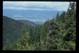
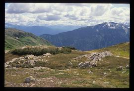
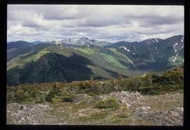
Image depicts the Cheslatta River.
Image depicts a view of the Okanagan Kettle Valley.
Image depicts a tunnel from the old Kettle Valley Rail Road.
Image depicts a woman standing inside a tunnel from the old Kettle Valley Rail Road.
Image depicts several unknown individuals standing on the old Kettle Valley Rail Road.
Image depicts a hill and some power lines in Kettle Valley, B.C.
Image depicts the Kenney Dam near Cheslatta, B.C.
Image depicts the Cheslatta River.
Image depicts the Cheslatta Falls.
Image depicts the Okanagan Kettle Valley, with the Kettle Rail Road faintly visible among the trees
Image depicts the trail of the old Kettle Valley Rail Road.
Image depicts a woman standing inside a tunnel from the old Kettle Valley Rail Road.
Image depicts the mouth of a tunnel from the Kettle Valley Rail Road.
Image depicts a woman standing on the old Kettle Valley Rail Road.
Trees in foreground, hills in background. Unidentified man stands on far left.
Photograph is one of 11 images taken during a World Health Organization (WHO) trip, Human Rights of Women and Children, Peru, 1990. Possibly affiliated with World Council of Churches, International Ecumenical Delegation to Lima, Peru, 14-25 October 1990. See also items 2009.6.1.505 - 2009.6.1.515.
Image depicts a field of yellow plants at an uncertain location.
Image depicts an old, collapsing cabin which is sloped sideways. The location is uncertain.
Image depicts Sue Sedgwick and a dog standing next to an old, collapsing cabin which is sloped sideways. The location is uncertain.
Rock pile, unknown building, and hills can be seen in background.
Photograph is one of 11 images taken during a World Health Organization (WHO) trip, Human Rights of Women and Children, Peru, 1990. Possibly affiliated with World Council of Churches, International Ecumenical Delegation to Lima, Peru, 14-25 October 1990. See also items 2009.6.1.505 - 2009.6.1.515.
Image depicts the Cottonwood House Historic Site along Barkerville Highway, east of Quesnel, B.C. A sign posted by the fence reads: "For over half a century the Boyd family operated this haven for man and beast. Here weary travellers found lodging, food, and drink. Here fresh horses were hitched to stage-coaches and miners bought supplies. This historic road-house, built in 1864, stood as an oasis of civilization on the frontier of a rich new land."
Image depicts an old abandoned cabin at an uncertain location.
Campagnolo stands on right in blue floral dress.
Photograph is one of three images from 'Suture' newsletter (see file 2009.6.5.6), published by St. Mary's General Hospital, New Brunswick Department of Education, Women in Leadership Workshop, 11 May 1989. See also items 2009.6.1.503 and 2009.6.1.504.
Image depicts an unidentified man cross country skiing somewhere on Tabor Mountain in Prince George, B.C.
Image depicts an aerial view of a forest somewhere in the area of Divide Lake.
Image depicts an aerial view of the land in the area of Divide Lake.
Image depicts the "Divides Lake Waterfall."
Image depicts the "Divides Lake Waterfall" as well as a man in front of a helicopter in the foreground.
Image depicts the "Divides Lake Waterfall."
Image depicts a view of James Creek Valley.
Image depicts a view of the Herrick River in what is possibly McGregor Canyon; the slide is simply labelled "McG above Canyon."
Image depicts the cutbanks on the other side of the Nechako, taken from the nature trail at Island Cache. Map coordinates 53°55'34.6"N 122°45'52.4"W
Image depicts a view over Tabor Mountain.
Image depicts a view of an experimental farm, possibly taken from Tabor Mountain.
Image depicts Prince George, possibly with the Northwood Pulpmill in the background.
Image depicts a forest of dead trees on the slopes of Tabor Mountain in Prince George, B.C.
Image depicts a river, possibly the Nechako, in Prince George, B.C. Possibly taken from the Foothills Bridge.
Image depicts the Grand Trunk Railway bridge across the Fraser River. Map coordinates 53°54'29.0"N 122°42'06.5"W
Image depicts Prince George, possibly with the Northwood Pulpmill in the background.
Image depicts an aerial view of a forest somewhere in the area of Divide Lake.
Image depicts a view of the Herrick River in what is possibly McGregor Canyon; the slide is simply labelled "McG Canyon."
Image depicts a bridge in Prince George, B.C.
Image depicts a view of Prince George.
Image depicts a view of Tabor Lake.
Image depicts a forest of dead trees on the slopes of Tabor Mountain in Prince George, B.C.
Image depicts a man standing in front of a helicopter; a waterfall is visible on the cliffs in the background. The slide itself is labelled "BC Parks Tour."
Image depicts a view of James Creek Valley.