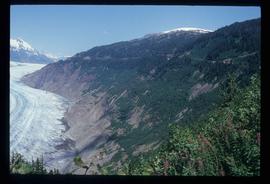
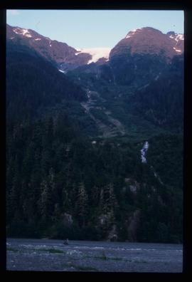
Image depicts a small section of the Bear Glacier.
Image depicts what is possibly Bear River in the Bear Glacier Provincial Park.
Image depicts what is possibly Bear River, flowing out from an opening in the Bear Glacier.
Image depicts a mountain somewhere in Bear Glacier Provincial Park.
Image depicts what is possibly Bear River flowing past what is likely a section of the Bear Glacier.
Image depicts the Bear Glacier stretching through a mountain range.
Image depicts a totem pole at an uncertain location, possibly in Gitwinksihlkw, B.C.
Mylar map is a plot map of a research plot at the Aleza Lake Research Forest. Provides date the plot was established, the harvest history, the silviculture history, remeasurement history, and information about individual trees.
Annotation on slide: "BC[?] advance regen. releasing in logged cedar block, ICHwk3"
Image depicts a few unidentified individuals fishing in a river at an uncertain location.
Image depicts the North end of Portage Lake.
Image depicts two individuals and two dogs standing by a stream at an uncertain location, possibly somewhere in Bear Glacier Provincial Park. The woman in purple is possibly Sue Sedgwick.
Image depicts Sue and Kent Sedgwick with two dogs, standing with the Bear Glacier in the background.
Image depicts what is possibly Bear River in the Bear Glacier Provincial Park.
Image depicts a close-up of a cave-like opening in the Bear Glacier.
Mylar map is a plot map of a research plot at the Aleza Lake Research Forest. Provides date the plot was established, the harvest history, the silviculture history, remeasurement history, and information about individual trees.
Image depicts a narrow footbridge suspended over a river at an uncertain location.
Image depicts what is possibly the Nass River.
Image depicts what is possibly Hospital Beach in Kitimat, B.C. The facility in the background is possibly the Alcan smelter.
Image depicts a view of the Fraser Lake.
Image depicts a downhill stream somewhere in the area surrounding Stewart, B.C.
Image depicts Bear Glacier in the foreground and a mountain in the background, somewhere in Bear Glacier Provincial Park.
Image depicts three individuals and three dogs standing by a stream at an uncertain location, possibly somewhere in Bear Glacier Provincial Park. The woman in purple is possibly Sue Sedgwick.
Image depicts what is possibly Bear River in the Bear Glacier Provincial Park.
Image depicts the Bear Glacier with a cave-like opening.
Image depicts the Bear Glacier stretching through a mountain range.
Image depicts a mountain with a thin line of what appears to be a road visible on the side, with the Bear Glacier located on the left side of the image.
Image depicts the Gitwinksihlkw Elementary School in Gitwinksihlkw, B.C.
Image depicts a rock formation on a mountain side at an uncertain location.
Mylar map is a plot map of a research plot at the Aleza Lake Research Forest. Provides date the plot was established, the harvest history, the silviculture history, remeasurement history, and information about individual trees.
Annotation on slide: "Lucille Mt. from Mt. Teare, Susan Stevenson, July 1994"
Image depicts a view of Fraser Lake.
Mylar map is a plot map of a research plot at the Aleza Lake Research Forest. Provides date the plot was established, the harvest history, the silviculture history, remeasurement history, and information about individual trees.
Map depicts historical timber sales areas and permanent sample plots (PSPs) at the Aleza Lake Research Forest. This map may be a guide (or otherwise related) to maps 2006.18.5.43-59.
No annotation on slide.