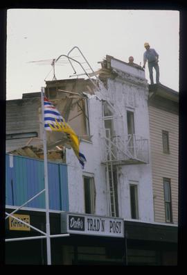
Showing 485 results

Archival description
434 results with digital objects Show results with digital objects
Sawmill - People and Logs
2012.13.1.122.22 · Item · June 1980
Part of J. Kent Sedgwick fonds

Image depicts numerous stripped logs and several unidentified individuals in hard hats at a saw mill somewhere in Prince George, B.C.

Sawmill - Interior
2012.13.1.122.24 · Item · June 1980
Part of J. Kent Sedgwick fonds

Image depicts logs being cut into planks in the interior of a saw mill somewhere in Prince George, B.C.

2012.13.1.135.01.05 · Item · [between 1980 and 2000]
Part of J. Kent Sedgwick fonds

Photograph depicts Rosel's restaurant at 1624 7th Avenue. Rosel's restaurant was owned and operated by Wilfred and Rosel Vogt from 1981 to 1997. The building was built in 1916 and was originally owned by Dr. Carl Ewart and later owned by Hubert King of Wilson, King and Company, the oldest law firm in Prince George, after 1946. The building is now a designated heritage building.

2012.13.1.135.01.11 · Item · [between 1980 and 2000]
Part of J. Kent Sedgwick fonds

Photograph depicts a residential building at 1612 12th Avenue, the building was used as "Prince Realty". Annotation on verso: "1612 - 12th Ave., NW corner of Vancouver."

Shearer building
2012.13.1.135.01.23 · Item · [between 1980 and 2000]
Part of J. Kent Sedgwick fonds

Photograph depicts the Shearer building in Prince George. Annotation on verso: "Shearer bldg".

Fort George Regional Museum
2012.13.1.3.071 · Item · Oct. 1983
Part of J. Kent Sedgwick fonds

Image depicts the Fort George Regional Museum (now known as The Exploration Place) in Prince George, B.C. Map coordinates 53°54'18.6"N 122°44'09.8"W

Prince George
2012.13.1.3.077 · Item · May 1984
Part of J. Kent Sedgwick fonds

Image depicts downtown Prince George looking northwest. Map coordinates 53°54'48.7"N 122°44'45.6"W

Prince George
2012.13.1.3.078 · Item · May 1984
Part of J. Kent Sedgwick fonds

Image depicts a view of Prince George from City Hall looking northeast along George Street. Map coordinates 53°54'46.3"N 122°44'41.9"W

Downtown Prince George
2012.13.1.3.082 · Item · May 1984
Part of J. Kent Sedgwick fonds

Image depicts downtown Prince George taken from City Hall looking north. Map coordinates 53°54'46.2"N 122°44'43.9"W

Downtown Prince George
2012.13.1.3.076 · Item · May 1984
Part of J. Kent Sedgwick fonds

Image depicts a view of Prince George from City Hall looking northeast with the pulp mills in the background. Map coordinates 53°54'46.3"N 122°44'41.9"W

Downtown Prince George
2012.13.1.3.080 · Item · May 1984
Part of J. Kent Sedgwick fonds

Image depicts downtown Prince George taken from City Hall looking north. Map coordinates 53°54'46.2"N 122°44'43.9"W

Downtown Prince George
2012.13.1.3.081 · Item · May 1984
Part of J. Kent Sedgwick fonds

Image depicts downtown Prince George taken from City Hall looking northwest. Map coordinates 53°54'46.2"N 122°44'43.9"W

Downtown Prince George
2012.13.1.3.079 · Item · May 1984
Part of J. Kent Sedgwick fonds

Image depicts downtown Prince George taken from City Hall looking northwest. Map coordinates 53°54'46.2"N 122°44'43.9"W

Log House
2012.13.1.3.083 · Item · July 1985
Part of J. Kent Sedgwick fonds

Image depicts the balcony of a log house, likely somewhere in or near Prince George B.C.

Handshake
2012.13.1.133.09 · Item · 1985
Part of J. Kent Sedgwick fonds

Image depicts a man and woman shaking hands in a building at an uncertain location, possibly in Cottonwood Park. The man standing behind the two is possibly Elmer Mercier, a former mayor of Prince George, B.C.

Woman with a Paper
2012.13.1.133.10 · Item · 1985
Part of J. Kent Sedgwick fonds

Image depicts a woman holding a sheet of paper in a room with numerous other unidentified individuals. The man standing behind her is possibly Elmer Mercier, a former Mayor of Prince George, B.C.

Map Board?
2012.13.1.133.11 · Item · 1985
Part of J. Kent Sedgwick fonds

Image depicts a man holding up a board which appears to have maps of the Cottonwood Park on it.