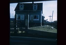
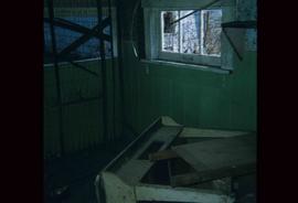
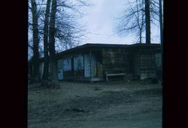
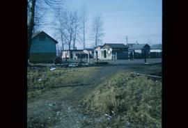
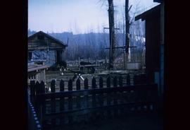
Image depicts a wood pile in Island Cache.
Image depicts the shore line and surrounding land of a lake or river at an airport, possibly in Prince George, B.C.
Image depicts a number of small houses at Island Cache.
Image depicts two unknown children in a house somewhere in Island Cache.
Image depicts several old, ruined cars and an unknown individual in Island Cache.
Image depicts a house in Island Cache.
Image depicts what appears to be an animal pen in Island Cache. There is a goat and numerous chickens in the image, as well as a pile of miscellaneous material.
Image depicts a few houses in Island Cache. There are two unknown individuals present.
Image depicts a damaged, upturned car in Island Cache.
Image depicts a view of Tabor Mountain in Prince George, B.C.
Image depicts some fallen trees at Island Cache.
Image depicts two dogs and numerous chickens in a yard at Island Cache.
Image depicts the bank of the Nechako River at Island Cache.
Image depicts a few houses and a dog on a porch at Island Cache.
Image depicts a body of water in Island Cache. It is possibly a small section of the Nechako River.
Image depicts what appears to be an animal pen in Island Cache. There are two horses and a chicken in the enclosure, and a rundown building.
Image depicts a backyard filled with various items piled against a shed in Island Cache.
Image depicts a house in Island Cache.
Image depicts a house in disrepair, and possibly abandoned, in Island Cache.
Image depicts the interior of a house that appears to be abandoned and in disrepair in Island Cache.
Forest cover map showing a crossing area of the McGregor River is annotated with a road and ferry crossing.
Item is a photograph of Mr. Williston (Minister of Lands, Forests & water Resources), Pat Jordan (Minister without Portfolio), Prince George Mayor Harold Moffat, Grace McCarthy (Minister without Portfolio) and Premier W.A.C. Bennett.
Image depicts a number of small houses at Island Cache.
Image depicts a stand of trees and a shed at Island Cache.
Image depicts what is likely an outhouse at Island Cache.
Image depicts a clearing at Island Cache.
Image depicts a grocery store at Island Cache.
Image depicts a house in Island Cache. There are several cars parked outside it.
Image depicts a boarded up building in Island Cache.
Image depicts two children standing near an old car in Island Cache.
Image depicts a number of sheds in Island Cache.
Map reproduction of the Aleza Lake Research Forest depicts timber sale areas, forest cover, and other details.
Image depicts the slopes of Tabor Mountain in Prince George, B.C.
Map reproduction of the Sinclair Spruce Lumber Co. Ltd. T.S.H.L. A01848 C.P. 310 cutting area, likely in the Aleza Lake Research Forest.
Image depicts numerous skiers standing near a finish line somewhere on Tabor Mountain in Prince George, B.C.
Image depicts a view of Prince George from the cutbanks.
Image depicts a cutbank on the Nechako River in Prince George, B.C.
Image depicts the Fraser River from the vantage point of the cutbanks in Prince George, B.C.
Image depicts a view of Prince George from the cutbanks on the Nechako river.
Image depicts part of the McMillan Creek Trail in the McMillan Regional Park in Prince George, B.C.
Image depicts part of the McMillan Regional Park in Prince George, B.C.
Image depicts the McMillan Creek from Northwood Pulpmill Road, in Prince George, B.C.
Image depicts a farmhouse on Old Summit Road in Prince George, B.C.
Image depicts a view of the Fraser-Nechako confluence from the Prince George cutbanks.
Image depicts a small slope on Carney Hill in Prince George, B.C.
Image depicts Cottonwood Island.
Image depicts a small stream somewhere on Cottonwood Island.
Image depicts two youths fishing from the bank of the Nechako River on Cottonwood Island.
Image depicts what is possibly a small section of the Nechako River on Cottonwood Island.