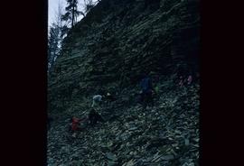
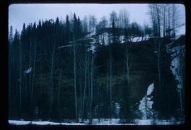
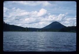
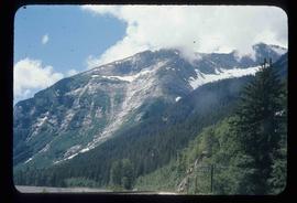
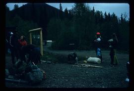
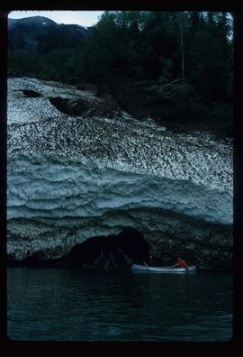
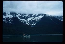
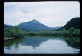
Image depicts an esker at Bednesti Lake, B.C.
Image depicts a crevasse filling ridge somewhere in the Bulkley Valley, B.C.
File consists of a pamphlet titled "The Quesnel-Lillooet Bulletin Area" prepared by the Department of Lands, Forests, and Water Resources from the Province of British Columbia. The pamphlet is a revised 2nd edition published in 1973, the original was published in 1968.
Image depicts numerous unknown individuals searching through a fossil bed, possibly in the Bulkley Valley.
Image depicts a fossil bed, possibly somewhere in the Bulkley Valley.
Image depicts an individual opening the gate at Nautley in Fort Fraser, B.C.
Image depicts Burns Lake, B.C.
Image depicts numerous unknown individuals standing by the Bulkley River near Moricetown, B.C.
Image depicts a group of people at a mine somewhere near Hazelton, B.C.
Item is an original 1972 map depicting the Nass River in British Columbia, published by the Department of Lands, Forests and Waster Resources of British Columbia.
Item is an original 1972 map depicting Punchaw Lake in British Columbia, published by the Department of Energy, Mines & Resources in Ottawa. The map includes pen markings.
Image depicts a group of unidentified individuals walking along a crevasse filled ridge somewhere in the vicinity of Smithers, B.C. The slide also labels it as a "drift ridge."
Map depicts the city of Prince George Boundary expansions since 1913.
Map depicts the city of Prince George boundary expansions from 1913 to 1974.
Image depicts the slopes of Tabor Mountain in Prince George, B.C.
File contains slides depicting places in the Lillooet area.
Image depicts the Fraser River in the Lillooet, B.C.
Image depicts the canoe group portaging to Indianpoint Lake.
Image depicts Indianpoint Lake.
Image depicts the foot of Indianpoint Lake.
Image depicts the sunset over Isaac Lake from the Betty Wendle campsite.
Image depicts a camp at the foot of Isaac Lake.
Image depicts the Cariboo Falls.
Image depicts the lower end of the river channel leading to the Spectacle Lakes.
Image depicts a few unknown individuals canoeing in a slough area while on approach to Bowron Lake.
Image depicts a slough area while on approach to Bowron Lake.
Image depicts the river channel leading to the Spectacle Lakes.
Image depicts Spectacle Lake.
Image depicts two unknown individuals canoeing on the lower part of Spectacle Lake.
Image depicts the Bulkley River near Moricetown, B.C.
Image depicts a mountain range located somewhere along the Skeena River.
Image depicts a road leading to Prince Rupert, B.C.
Image depicts the Skeena River.
Item is an original 1971 map depicting Vancouver Island, British Columbia, published by the Department of Lands, Forests and Water Resources of British Columbia.
Image depicts the Fraser River somewhere in the Lillooet area.
File contains slides depicting the Bowron Lake Provincial Park.
Image depicts a group of people preparing to portage their canoe equipment in Bowron Lake Provincial Park.
Image depicts the canoe group around a campfire at the head of Indianpoint Lake.
Image depicts a pair of Rainbow trout from Indianpoint Lake.
Image depicts an unknown individual in a canoe on Indianpoint Lake.
Image depicts Indianpoint Lake.
Image depicts Isaac Lake from the Betty Wendle campsite.
Image depicts the Isaac Falls.
Image depicts four individuals canoeing on Lanezi Lake.
Image depicts the snow still remaining from an avalanche at Lanezi Lake. Two people are also seen canoeing on the lake.
Image depicts a cirque in the mountains surrounding Lanezi Lake. Two individuals can also be seen canoeing on the lake.
Image depicts a mountain in the distance, and the river channel leading to the Spectacle Lakes.
File contains slides depicting places along the Skeena River on the way to Prince Rupert, B.C.
Image depicts the Skeena River alongside Highway 16 en route to Prince Rupert, B.C.
Image depicts a mountain located somewhere along the Skeena River, and a road alongside it.