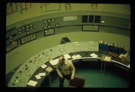
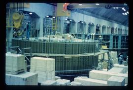
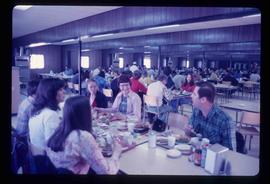
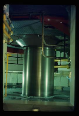
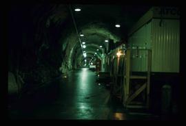
Image depicts a tunnel, possibly located somewhere in Fort St. John, B.C.
Image depicts what appears to be a computer room at an uncertain location, possibly in Fort St. John, B.C.
Image depicts what is possibly the Peace River running parallel to a road, possibly Highway 29.
Image depicts what appears to be a Fire Hall in Hudson's Hope, B.C.
Image depicts two houses in Hudson's Hope, B.C.
Image depicts a street with a building which is labelled "MacKeigan Enterprises Ltd." in Hudson's Hope, B.C.
Image depicts a view of numerous houses and a ballpark at an uncertain location. It is possibly located somewhere in the Peace River Region.
Image depicts the Peace River.
Image depicts a view of a saw mill in Chetwynd, B.C.
Image depicts a view of a train passing through an area of Chetwynd, B.C.
Image depicts a large group of unidentified individuals sitting on a hill; what is possibly the Peace River is visible in the background.
Image depicts a turbine on a large industrial vehicle somewhere in or near Fort St. John, B.C.
Image depicts a group of unidentified individuals in a greenhouse, possibly somewhere in Fort St. John, B.C.
Image depicts numerous wood crates and large pieces of machinery in an unknown concrete structure, possibly somewhere in Fort St. John, B.C.
Image depicts a group of unidentified individuals wearing hard hats inside an unknown concrete structure, possibly located in Fort St. John, B.C.
Image depicts a piece of machinery shaped like a large metal cylinder. It is possibly located somewhere in Fort St. John, B.C.
Image depicts a dam on what is possibly the Peace River.
Image depicts a stretch of highway, possibly Highway 29 or 97.
Image depicts the Clayhurst Ferry on the Peace River.
Image depicts what appears to be a motel in Hudson's Hope, B.C. The slide is labelled "camp HH."
Image depicts the Peace River, possibly near Hudson's Hope, B.C.
Image depicts an unidentified individual standing in front of a rock face with visible sediment layers. Located somewhere in the Peace River Region, possibly near Hudson's Hope.
Image depicts a wall of rock with visible sediment layers at an uncertain location in the Peace River Region, possibly near Hudson's Hope.
Image depicts the log building that acts as the public library in Hudson's Hope, B.C.
Image depicts the Peace River.
Image depicts a view of some farm land in Chetwynd, B.C.
Image depicts the Peace River and visible layers of sediment deposits in the surrounding cliffs.
Image depicts the interior of a store, possibly in Fort St. John, B.C.
Image depicts several unidentified individuals exiting a church made of logs, possibly in Fort St. John, B.C.
Image depicts a view of Fort St. John, B.C.
Image depicts the Peace River, possibly somewhere near Fort St. John, B.C.
Image depicts two unidentified individuals in hard hats leaning against the railing of a large, open space inside an unknown concrete structure. It is possibly located in Fort St. John, B.C.
Image depicts two individuals at work inside what appears to be a piece of machinery. It is possibly located somewhere in Fort St. John, B.C.
Image depicts an orange turbine in Fort St. John, B.C.
Item consists of transcript and tape summary of interview with Tom Waller who discusses fire protection and forest fires in the Prince George and Peace River region.
Sans titreImage depicts several houses in Chetwynd, B.C.
Image depicts a delta at Moberly Lake north of Chetwynd and south of Hudson's Hope, B.C.
Image depicts what is possibly the Peace River.
Image depicts a man in a yellow cap who appears to be blowing smoke into a bee colony at a bee farm. It appears to be an educational demonstration.
Image depicts a group of people throwing a frisbee in a parking lot at an uncertain location, likely in the Peace River Region.
Image depicts a river, possibly the Peace River.
Image depicts a group of individuals who appear to be examining a rock. It is possibly part of an educational trip.
Image depicts several unidentified individuals and a bridge behind them; it is possibly crossing the Peace River.
Image depicts a set of railway tracks and a long building located somewhere in the Peace River Region.
Image depicts a large group of people examining the sediment layers in a rock face.
Image depicts a crowded cafeteria, most likely somewhere in Hudson's Hope, B.C. The slide is labelled "Camp at H.H."
Image depicts a large group of people sitting and eating near a bridge at an uncertain location, though possibly near Hudson's Hope, B.C.