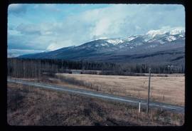
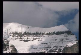
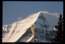
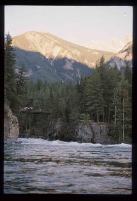
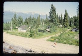
Image depicts a few unidentified individuals fishing in a river at an uncertain location.
Image depicts what is either the Rocky Mountains or possibly the Columbia Mountains, from McBride, B.C.
Image depicts a view of either the Rocky Mountains or possibly the Columbia Mountains near McBride, B.C.
Image depicts a view of what is either the Rocky Mountains or possibly the Columbia Mountains near McBride, B.C.
Image depicts a distant view of what appears to be a body of water, with numerous mountains in the background. The slide is labelled "Valemount reservoir."
Image depicts the peak of Mt. Robson.
Image depicts a river somewhere in Mt. Robson Provincial Park, with a bridge running over it. The slide itself is labelled "Robson station."
Image depicts Mt. Fitzwilliam.
Image depicts a heavily forested area located in the Rocky Mountain Trench, possibly near Dome Creek or Lamming Mills, B.C.
Image depicts a church school in the community of Crescent Spur, B.C.
Image depicts several buildings in the community of Loos, B.C.
Image depicts an old, boarded-up store/office in Lamming Mills, B.C.
Image depicts a small section of the area surrounding Lamming Mills, B.C.
Image depicts what appears to be a part of the old, abandoned mill in Lamming Mills, B.C.
Image depicts a log cabin somewhere in Dome Creek, B.C.
Image depicts an old, unused log cabin somewhere in Dome Creek, B.C.
Image depicts a beehive burner covered in snow in Sinclair Mills, B.C. Map coordinates 54°01'17.4"N 121°40'53.0"W
Image depicts railway tracks and buildings with a beehive burner on the left. The location is likely Sinclair Mills, B.C. Map coordinates 54°01'17.4"N 121°40'53.0"W
Image depicts two old houses surrounded by numerous trees at an uncertain location.
Image depicts a dilapidated house in Sinclair Mills, B.C.
Image depicts a field and a shack in the foreground and mountains in the background. The location is uncertain, likely Longworth, B.C.
Image depicts the Upper Fraser Road running through Upper Fraser, B.C. A beehive burner is seen in the background on the left and the mill office is seen on the right. Map coordinates 54°07'05.7"N 121°56'38.9"W
Image depicts entrance to mill yard for Upper Fraser mill in Upper Fraser, B.C. Map coordinates 54°07'10.8"N 121°56'51.7"W
Image depicts several houses, likely in Upper Fraser, B.C.
Image depicts Upper Fraser mill yard with log deck and beehive burner in silhouette across railroad tracks. Located in Upper Fraser, B.C. Map coordinates 54°07'01.5"N 121°56'29.6"W
Image depicts Upper Fraser residential area during demolition of town site. Map coordinates 54°06'51.6"N 121°56'26.3"W
Image depicts numerous piles of logs, and two unidentified individuals operating an excavator with a "thumb" attachment during the demolition of the Upper Fraser town site. Map coordinates 54°06'51.6"N 121°56'26.3"W
Image depicts numerous log decks at the Upper Fraser sawmill. Map coordinates 54°07'10.8"N 121°56'51.7"W
Image depicts an old house for sale surrounded by overgrown bushes in Upper Fraser, B.C. Map coordinates 54°07'15.0"N 121°57'02.0"W
Image depicts a field in Giscome, B.C. On the right side of the image, in the background, is a grey strip that appears to be a mine, possibly the quarry at Eaglet Lake in Giscome, B.C. Map coordinates 54°03'52.9"N 122°22'10.0"W
Previous site of sawmill in Giscome, B.C. looking northwest. Map coordinates 54°04'19.7"N 122°22'04.7"W
Image depicts the former location of the Giscome mill foreman's house on the hill with Eaglet Lake in the background. Map coordinates 54°04'28.0"N 122°22'05.8"W
Image depicts a snowy road at an uncertain location.
Image depicts a two-room schoolhouse in Penny, B.C.
Image depicts a house with ivy growing over it. The location is uncertain.
Image depicts an old house with a torn up roof. The location is uncertain.
Image depicts an old house in Penny and a woman, possibly Sue Sedgwick, standing in front of it. The location is uncertain.
Image depicts an aerial view of a lake, and what appears to be a set of railway tracks running towards the mountains in the distance. The location is uncertain.
Image depicts an aerial view of several lakes and their surrounding areas at an uncertain location.
Image depicts what appears to be a small, narrow river, and mounds of snow. The location is uncertain.
Image depicts the Giscome bunkhouse in Giscome, B.C. Map coordinates 54°04'17.6"N 122°22'06.1"W
Image depicts the Giscome Community Hall in Giscome, B.C. Map coordinates 54°04'18.5"N 122°21'57.7"W
Image depicts the Giscome mill foreman's house on the hill. Map coordinates 54°04'28.0"N 122°22'05.8"W
Image depicts the Giscome, B.C. mill site looking west. Map coordinates 54°04'18.5"N 122°21'57.7"W
Image depicts four unidentified individuals standing on the bank of a river, possibly the Fraser, somewhere in or near Penny, B.C.
Image depicts a river, possibly the Fraser, near Penny, B.C.
Image depicts Kent Sedgwick sitting on the bank of a river. An old beehive burner is visible in the background. Located somewhere in or near Penny, B.C.
Image depicts what is possibly the community of Newlands, B.C.
Image depicts a barn full of hay and several cows, possibly near Newlands, B.C.