This photograph album consists of photographs of remote police barracks at Mile 47 and Mile 29; early settlements and/or mercantile stores at Tete Jaune Cache, McBride, Sand Creek, Fort George and South Fort George; Grand Trunk Pacific Railway forestry and railway camps; scows and paddlewheel conveyors on the Fraser River; automobiles; community leisure activities; as well as, images of the Bourchier family. The following South Fort George establishments are identifiable within these photographs: Empress Hotel, Ah Yee General Merchant, German Bakery, Northern Hotel, South Fort George Drug Store & Post Office, St. Michael’s Church, Prince George Hotel, Ford Monarch dealership, Astoria Hotel, and King George V Elementary School. Identified geographic locations featured in these photographs include: Tete Jaune, Upper Fraser, Mile 47, Mile 29, Fraser River, Mt. Robson, McBride, Sand Creek, Glacier Mountain, Moose River, Giscome Portage, Pott Falls, Red Deer River, Grand Canyon, Summit Lake, Canoe Pass, Connaught Hill, Nechako Bridge, and Island Cache.
Bourchier, Alan K.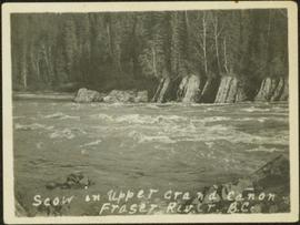
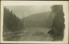
Photograph depicts men on river scow in distance. Rocks in foreground, trees and cliffs on opposite shore in background. Handwritten annotation on verso of photograph: "Scow in Upper Grand Canon. Fraser River. B.C.."

Stern wheeler passing through rapids. Printed annotation on recto reads: “The B.C. Express passing through the Grand Canyon B.C.” Handwritten annotation in red ink on recto adds: “1913”
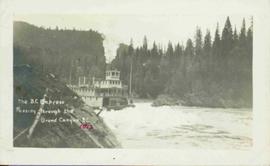
Photograph depicts sternwheeler passing through rapids of the Fraser River, B.C. Printed annotation on recto reads: “The B.C. Express Passing through the Grand Canyon B.C.”, handwritten in red ink: “1913”.

Image depicts a wooden structure at Gang Ranch. It is possibility an elevated water trough.

Image depicts a view of the property of the Gang Ranch.

Image depicts the Fraser River in the upper Fraser Canyon.

Image depicts an unknown woman on a road in the upper Fraser Canyon.

Image depicts the grave of W.L. Meason in the upper Fraser Canyon.

Image depicts Gang Ranch, with a sign warning that the area is patrolled by Range and Logging Patrols, in the Upper Fraser Canyon.

Image depicts Gang Ranch in the Upper Fraser Canyon.

Image depicts Gang Ranch in the Upper Fraser Canyon.

Image depicts a couple of old buildings, and a field full of tree trunks and dead wood. Located somewhere in or around the Upper Fraser Canyon.

Image depicts a view of the Upper Fraser Canyon. The Fraser River is visible.

Image depicts the Fraser River running through the Upper Fraser Canyon.
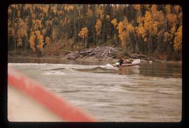
Image depicts a group of people in boats on the Fraser River in the Grand Canyon, B.C.

Image depicts the Fraser River in the Grand Canyon, B.C.
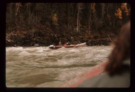
Image depicts a group of people in boats on the Fraser River in the Grand Canyon, B.C.
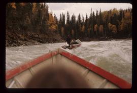
Image depicts a group of people in boats on the Fraser River in the Grand Canyon, B.C.
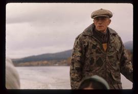
Image depicts Ray Mueller steering a boat on the Fraser River in the Grand Canyon, B.C.
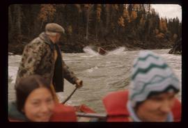
Image depicts a group of people in boats, with Ray Mueller steering one of them, on the Fraser River in the Grand Canyon, B.C.
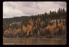
Image depicts a view of the ridge above the Fraser River which forms the Grand Canyon, B.C.
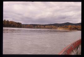
Image depicts the Fraser River in the Grand Canyon, B.C.
River in foreground, trees and rocky shore in background.

Photograph depicts men on river scow, large rock island or peninsula protruding into river behind them. Trees on opposite shore in background, large rock in foreground. Handwritten annotation on verso of photograph: "Grand Canyon. Fraser River. Big Rock.", on recto of copy print: "1911."
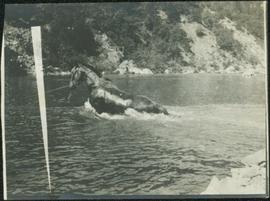
Photograph depicts horse and rope in Fraser River. Hill on opposite shore in background.
File contains slides depicting places in the area around Williams Lake, Clinton, and the Fraser Canyon.
File contains slides depicting images of the Fraser Canyon from somewhere around 1975.
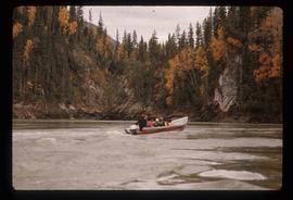
Image depicts a group of people in boats on the Fraser River in the Grand Canyon, B.C.
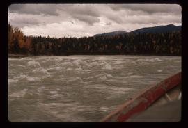
Image depicts the Fraser River in the Grand Canyon, B.C.
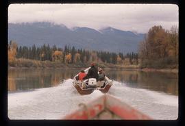
Image depicts a group of people in boats on the Fraser River in the Grand Canyon, B.C.
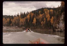
Image depicts a group of people in boats on the Fraser River in the Grand Canyon, B.C.
Image depicts the Fraser River in the Grand Canyon, B.C.
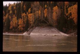
Image depicts a very small island in the middle of the Fraser River in the Grand Canyon, B.C.

Image depicts the house of the owner of Gang Ranch.

Image depicts the Fraser River in the upper Fraser Canyon.

Image depicts an unknown woman taking pictures. Nearby are the skeletal remains of an unknown animal. The location is somewhere near the upper Fraser Canyon.
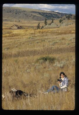
Image depicts an unknown woman with a camera. Nearby are the skeletal remains of an unknown animal. The location is the upper Fraser Canyon.

Image depicts a view of the upper Fraser Canyon. The Fraser River is visible on the left side of the image.

Image depicts a view of the upper Fraser Canyon. The Fraser River is visible on the left side of the image.

Image depicts a view of the upper Fraser Canyon.

Image depicts a road somewhere in the Upper Fraser Canyon, and a view of the hills and trees.
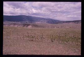
Image depicts the Upper Fraser Canyon.
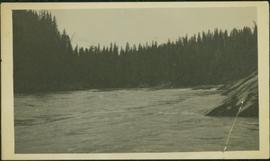
River in foreground, trees and cliffs in background.

Image depicts a view of the eastern part of the upper Fraser Canyon.

Image depicts the Fraser River passing through the upper Fraser Canyon.

Image depicts the Upper Fraser Canyon from what appears to be the entrance to Gang Ranch.

Image depicts a road near or on Gang Ranch in the Upper Fraser Canyon.

Image depicts the Fraser River near Gang Ranch in the Upper Fraser Canyon.

Image depicts a bridge over the Fraser River in the Upper Fraser Canyon; possibly near Gang Ranch.