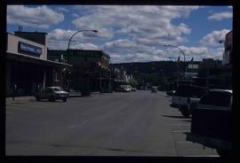
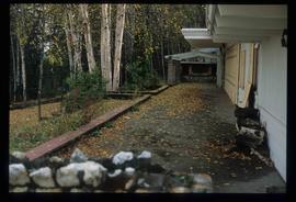
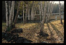
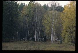
Image depicts a neighbourhood on North Meadows Road in Prince George, B.C.
Image depicts Parkside Intermediate Care Home on Ospika Boulevard in Prince George. Map coordinates 53°55'02.6"N 122°47'41.6"W
Image depicts the Fort George Regional Museum in Prince George, B.C. Map coordinates 53°54'18.6"N 122°44'09.8"W
Image depicts 3rd Ave at Victoria St. Map coordinates 53°55'03.9"N 122°44'54.8"W
Image depicts the Salvation Army on Ospika Boulevard in Prince George, B.C. Map coordinates 53°55'02.6"N 122°47'41.6"W
Image depicts a view of Prince George.
Image depicts the Lakeland Sawmill in Prince George, B.C, identified by the beehive burners; the one with white smoke belonged to Pas Lumber Co. which was bought out by Lakeland in 1987.
Image depicts the Lakeland Sawmill in Prince George, B.C.
Image depicts Prince George, B.C.
Image depicts a snow sculpture of a man with a shovel, possibly during the Winter City Conference, in Prince George, B.C. Taken at the Prince George Civic Center. Map coordinates 53°54'45.6"N 122°44'59.6"W
Image depicts the Northwood Bridge in Prince George, B.C.
Image depicts Prince George Sawmill taken from across the Nechako River looking southwest. Map coordinates 53°56'00.0"N 122°44'29.7"W
Image depicts an aerial view of what is possibly an outlying area of Prince George, B.C.
Image depicts the Royal Canadian Legion building on 7th Ave and the Inn of the North Coast Hotel in the background. Map coordinates 53°54'50.6"N 122°44'56.1"W
Image depicts two mills; the Intercontinental Pulpmill is on the left side of the tracks in the image and the Prince George Pulp and Paper Mill is located on the right side in Prince George, B.C. The Northwood Pulp Mill can be seen in the distance.
Image depicts Prince George from University Way, with the P.G.I. Pulp Mill in the distance.
Image depicts a sawmill in the Danson Industrial Park in Prince George, B.C.
Image depicts an aerial view of downtown Prince George, B.C.
Image depicts an aerial view of the BC Rail, in Prince George, B.C. It is now known as CN Rail.
Image depicts the Aquatic Centre in Prince George, B.C.
Image depicts the Prince George Civic Centre.
Image depicts the Prince George Public Library.
Image depicts a house on Blackwater Road.
Image depicts the interior of an abandoned, deteriorating cabin on Blackwater Road.
Image depicts an abandoned, deteriorating cabin on Blackwater Road.
Image depicts an abandoned cabin and shed on Blackwater Road.
Image depicts the north side of 3rd Ave in Prince George, B.C.
Image depicts a powerhouse in Prince George, B.C.
Image depicts a train carrying logs somewhere in Prince George, B.c.
Image depicts numerous logs that have been stripped of their bark at a saw mill in Prince George, B.C.
Image depicts machinery stripping a log of its bark in a saw mill somewhere in Prince George, B.C.
Image depicts an unidentified individual examining a piece of heavy machinery used in the forestry industry. It is located in Prince George, B.C.
Image depicts a group of individuals on the sidewalk outside Spee-Dee Printers on Brunswick Street in Prince George, B.C.
Image depicts a woman, wearing clothes reminiscent of traditional First Nations, who appears to be dancing in the street outside of a Native Friendship Centre in Prince George, B.C. A large crowd is looking on.
Image depicts numerous skiers standing near a finish line somewhere on Tabor Mountain in Prince George, B.C.
Image depicts a the Cottonwood Island Nature Park sign and map in Prince George, B.C.
Image depicts a section of the Heritage Trail on Cottonwood Island in Prince George, B.C.
Image depicts a woman holding a sheet of paper in a room with numerous other unidentified individuals. The man standing behind her is possibly Elmer Mercier, a former Mayor of Prince George, B.C.
Image depicts the demolition of the Europe Hotel in Prince George, B.C.
Image depicts an uncertain street in Prince George, B.C.
Image depicts the Lheidli T'enneh Burial Grounds in Fort George Park.
Image depicts an unknown building under construction at the corner of 6th Avenue and Dominion Street in Prince George, B.C.
Image depicts a view of 3rd Avenue with the Columbus Hotel prior to the fire that destroyed it in 2008.
Image depicts the Exhibition Sports Centre, which used to be a drill hall army base, on Keller Street in Prince George, B.C.
Image depicts the Ginter House in Prince George, B.C.
Image depicts the interior of the Ginter House in Prince George, B.C.
Image depicts the Ginter House in Prince George, B.C.