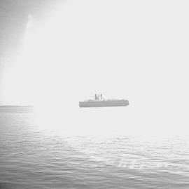
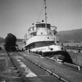
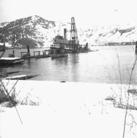
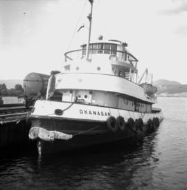
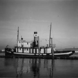
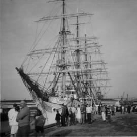
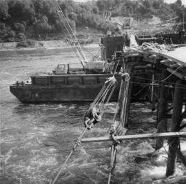
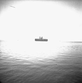
Photograph depicts "Canora," a CNR rail ferry.
Photograph depicts a CPR tug called the"Okanagan," at the CPR slip in Kelowna. It had recently been fueled from a tank car that is visible on the left. It was was built in Seattle and assembled at Okanagan Landing.
Photograph depicts a CPR steam tug called the "Naramata." It was built in 1913, retired to standby in 1967, and then sold in 1970.
Photograph depicts a CPR tug called the "Okanagan," located at the Kelowna slip. It was tied to the rail barge wih a steam up.
Photograph depicts a steam tug called "R.F.M". It was believed to not be in steaming condition.
Photograph depicts a replica of the "SS Beaver." It was built by the RCN in Esquimalt and was open for inspection in Vancouver.
Photograph depicts "SS Sir James Douglas," a Coastguard supply vessel, built in 1956. Astem from her is "Camsell," a full ice breaker, built in 1959. Out-of-service is CNR "SS Canora" is found in the background.
Photograph depicts "Skeena Prince." The iron chute projecting from the land beyond the steam of a coaster belongs to a long defunct coal mine which ran back horizontally into the hill side.
Photograph depicts a Japanese cadet sailing ship called "Kaiuo Maru" at Centennial Pier, Vancouver. Its visit was part of 1966 Vancouver Sea Festival and the ship was open to the public for inspection.
Photograph depicts the last lighthouse on the mainlain about a mile south of Ucuelet. It was believed to be the Amphitrite Point Light House.
Photograph depicts an old anchor that had been fished out of Coal Habour, Vancouver. One flulke was bent in towards the shank. Image captured outside the office of Kanata Marine Ways Ltd. (1965).
Photo depocts a road bridge in the Inner Harbour of Victoria.
Photograph depicts a bridge near the beginning of the Seton Portage to D'Arcy dirt road over the Portage River. The road was a one and half of a mile connection between the Anderson (upper) and Seton (lower) lakes.
Photograph depicts a bridge over Lardeau River. Survey stakes at the point where the photograph was taken suggested that a new bridge would be built within the next 2 or 3 years.
Photograph depicts the entrance to Kispiox Village, over the Kispiox River.
Photograph depicts Hazelton Bridge that was believed to be built in 1930. Crossing the Skeena River.
Photograph depicts a road bridge in Quesnel.
Photo depiicts a bridge over the Fraser River, south of Williams Lake. It was in poor condition, but was being prepared by the Department of Highways. The bridge was taken on the Gang Ranch public road, and led to the ranch and its uninhabited hinterland.
Photograph depicts Moha Bridge which crosses the Yalakon River. Taken at the side of a derelict mining village.
Photograph depicts a road bridge that led from Fort Langley to a ferry slip on an island.
Photograph depicts Alexandra Bridge that crossed the Fraser Canyon.
Photograph depicts Cisco Bridge, that crossed the Fraser River in Fraser Canyon. Looking upstream with CPR track in the lower right of the photo. 200 yards behind this photo, the CPR tack crossed the Fraser River to the west bank.
Photograph depicts a bridge over the Similkameen River. When track ran to Hedley, there were 3 of these bridges. All stood still at the time the photograph was captured. The other were on the lifted Keremeos to Hedley section.
Photograph depicts a PGE crossing over the Fraser River.
Photograph depicts work in progress on a new CNR lifting span bridge. Immediately in front of it was a coffer dam for a pier. Tidal conditions were a problem.
Photograph depicts the Federal Railway Bridge in New Westminster. Its span had been knocked down by an unmanned scow. New span was to be floated in on by April 22, 1976.
Photograph depicts an abandoned ranch house, southeast of Rock Creek, north of an abandoned GNR grade, and about a mile north of an international boundary.
Photograph depicts a house that had been pushed on its side by a bulldozer.
Photograph depicts a house that provided an example of the few surviving homes left on Beach Ave.
Photograph depicts one of the surviving houses on Beach Ave, Vancouver, between Gilford and Chilco.
Photograph depicts a house that had a "sold" notice on it and was partly demolished. Up to the date the photograph was captured, this block on Beach Ave. was the sole remaining one to have only houses on it, as opposed to a mixture of houses and apartment blocks, or blocks only.
Photograph depicts a house that was probably built in 1890-1900. It had just been demolished.
Photograph depicts a house on the southern edge of Chinatown.
Photograph depicts a two story log house located on Fiva Creek, beside east Kettle River.
Photograph depicts the Great Northern Railway station on Main Street, Vancouver being demolished.
Photograph depicts the Wrinch Memorial Hospital. It held 54 beds and was founded by Dr. Winch for the benefit of the local First Nations population.
Photograph depicts Vancouver City College, formerly King Edward Secondary School.
Photograph depicts a church on River Road, Whonnock, Maple Ridge.
Photograph depicts an Indian Roman Catholic church at the mouth of Anderson Lake. No services were held anymore. It was externally restored in 1968 by the white people of the village, while the Natives did the interior. Unfortunatley, there was no work done on the interior as of the date the photograph was captured.
Photograph depicts a Ukranian Greek Orthodox church on the outskirts of Mission.
Photograph depicts the completely rebuilt drug store in Barkerville based on historical sketches and photos.
Photograph depicts a building that was believed to have had many usess, its last being a fish store.
Photograph depicts the one and only service station that was in Trout Lake City. It had manual pumps as there was no distributed electricity in the village.
Photograph taken in the ghost town of Ferguson. About 8 deserted buildings remained, of which two appeared to be used as summer cabins. This building was the Lardeau Hotel.
Photograph depicts the Deroche post office that was well patronised for mail and newspaper distribution.
Photograph depicts a Canadian Customs House. The border crossing was only open between 8:00 a.m. and 5:00 p.m. daily.
Photograph depicts one of various old lead and zinc mine buildings. Behind this building, on the foreshore, were a few men working on the reclamation of tailings and waste from the mine that was dumped in Kootenay Lake.
Photograph depicts a Public Weigh Scale that was operated in Vancouver, on Main Street, opposite the CN Depot.
Photograph depicts Pioneer Sash and Door Company Ltd. Davies suggests that it may have been the same as S.C. Smith Ltd., which commenced operating in Vernon in 1883. In the early days, products were verandah posters, balusters, and fancy trim. Most products were sent to the U.S. Most of the fancy trim in early north Okanagan homes came from this plant. In 1972, its main output was cedar panelling for Florida.