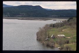
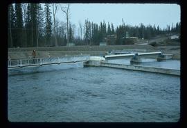
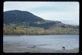
Image depicts numerous unknown individuals standing by the Bulkley River near Moricetown, B.C.
Image depicts a group of people in the historical village of 'Ksan near Hazelton, B.C.
Image depicts a group of people at a mine somewhere near Hazelton, B.C.
Image depicts a couple of old, collapsing buildings at the Nautley site in Fort Fraser, B.C.
Image depicts numerous totem poles in Kispiox, B.C.
Image depicts the Skeena River at Hazelton, B.C.
Image depicts the Fulton River.
Image depicts a small group of people standing near the Bulkley River at Moricetown, B.C.
Image depicts a view of the scenery between Smithers and Telkwa, B.C.
Image depicts the Bulkley River running through Moricetown Canyon.
Image depicts Noralee, B.C.
Image depicts a view of the Fraser Lake skyline.
Image depicts the Endako Hotel in Endako, B.C.
Image depicts a group of children playing a yard in Fraser Lake, B.C.
Image depicts a view of the Fraser Lake from the Fraser Lake campsite.
Image depicts the public library in Hazelton, B.C.
Image depicts the ferry in Isle Pierre, B.C.
Image depicts a lake at an uncertain location.
Image depicts the Nadina Delta at Francois Lake.
Image depicts a view of the forest surrounding Francois Lake.
Image depicts the old community hall located somewhere in the Wistaria Provincial Park.
Image depicts a river, possibly somewhere in the Wistaria Provincial Park.
Image depicts Southbank, B.C.
Image depicts Burns Lake, B.C.
Image depicts two bridges in Telkwa, B.C. One is for trains.
Image depicts a street in Telkwa, B.C.
Image depicts a view of Fraser Lake.
Image depicts Nautley and the Nautley River near Fraser Lake, B.C.
Image depicts a stretch of land; the photo was taken from the top of Kenny Dam, south of Francois Lake.
Image depicts a bridge in Prince George, B.C.
Image depicts a house on the corner of 7th Ave and Vancouver Street in Prince George, B.C.
Image depicts a house in the process of being demolished in Prince George, B.C.
Image depicts Prince George with numerous trees obscuring most of the view.
Image depicts Prince George.
Image depicts the Fraser River at Paddlewheel park, with a train on the other side of the river, in Prince George B.C.
Image depicts a view of Prince George.
Image depicts the King George V School in Prince George, which was demolished sometime around 2006 and Duchess Park Secondary School was built in its place.
Image depicts an old Swedish style house somewhere in the Pineview subdivision in Prince George, B.C.
Image depicts an old barn somewhere in the Pineview subdivision in Prince George, B.C.
Image depicts a building which is a part of the Studio 2880 Arts Complex on 15th Avenue in Prince George, B.C.
Image depicts a house somewhere in Prince George, B.C.
Image depicts an old telegraph cabin at Cheslatta, B.C.
Image depicts the Kenney Dam near Cheslatta, B.C.
Image depicts the Cheslatta River.
Image depicts the Cheslatta Falls.
Image depicts the train tracks at the old Dunster Station in Dunster, B.C.