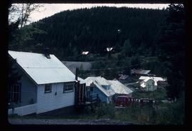
Showing 2097 results

Archival description
Atlin Road?
2012.13.1.98.43 · Item · 1999
Part of J. Kent Sedgwick fonds

Image depicts what is possibly Atlin Road. Numerous mountains are visible in the distance.

Miles Canyon? - Trees
2012.13.1.98.57 · Item · 1999
Part of J. Kent Sedgwick fonds

Image depicts numerous trees on the bank of a river, possibly in Miles Canyon near Whitehorse, Y.T. The slide is labelled "canyon city."

Miles Canyon - the Schwatka
2012.13.1.98.61 · Item · 1999
Part of J. Kent Sedgwick fonds

Image depicts numerous unidentified individuals getting off a boat which bears the name "Schwatka." It is located somewhere in Miles Canyon.

Highway and Mountains
2012.13.1.98.68 · Item · 1999
Part of J. Kent Sedgwick fonds

Image depicts a van on a highway with mountains in the distance; the location is uncertain, though it is possibly along the Alaska Highway.

Highway and Mountains
2012.13.1.98.70 · Item · 1999
Part of J. Kent Sedgwick fonds

Image depicts a van on a highway with mountains in the distance; the location is uncertain, though it is possibly along the Alaska Highway.

White Pass - Mountain Side
2012.13.1.100.11 · Item · 1999
Part of J. Kent Sedgwick fonds

Image depicts a mountain side somewhere along the White Pass railway. The thin ridge along the mountain side is possibly either a highway or part of the railway.

Old Trestle
2012.13.1.100.22 · Item · 1999
Part of J. Kent Sedgwick fonds

Image depicts an old trestle along the White Pass railway, and the White pass Train on the left of the image.

Snow Sounding
2012.13.1.121.02 · Item · 1967
Part of J. Kent Sedgwick fonds

Image depicts an unidentified individual setting up some sort of pole in the snow for a process the slide labels as "snow sounding." The location is uncertain.

2012.13.1.121.07 · Item · July 1970
Part of J. Kent Sedgwick fonds

Image depicts an atmometer. According to the slide, it is being used for measuring the rate of water evaporation "from carborundum stone." The location is uncertain.

2012.13.1.122.34 · Item · July 1982
Part of J. Kent Sedgwick fonds

Image depicts a man attaching a logging trailer to a crane on a wooden structure to stack the trailer on the truck. A Crestbrook Forest Industries sawmill is located in the background.

Intrusion
2012.13.1.124.01 · Item · 1970
Part of J. Kent Sedgwick fonds

Image depicts what is possibly an intrusive volcanic landform somewhere near Miworth, B.C.

2012.13.1.124.06 · Item · 1972
Part of J. Kent Sedgwick fonds

Image depicts a group of unidentified individuals walking along a crevasse filled ridge somewhere in the vicinity of Smithers, B.C. The slide also labels it as a "drift ridge."

Varves
2012.13.1.124.15 · Item · Oct. 1975
Part of J. Kent Sedgwick fonds

Image depicts an example of varves, an annual layer of sediment or rock, possibly located at the airport in Prince George, B.C.

Gravel
2012.13.1.124.19 · Item · Oct. 1975
Part of J. Kent Sedgwick fonds

Image depicts layers of gravel at the BCR site in Prince George, B.C.

Cottonwood House
2012.13.1.126.49 · Item · [1990?]
Part of J. Kent Sedgwick fonds

Image depicts the Cottonwood House Historic Site along Barkerville Highway, east of Quesnel, B.C. A sign posted by the fence reads: "For over half a century the Boyd family operated this haven for man and beast. Here weary travellers found lodging, food, and drink. Here fresh horses were hitched to stage-coaches and miners bought supplies. This historic road-house, built in 1864, stood as an oasis of civilization on the frontier of a rich new land."

Start of Birchleg
2012.13.1.129.04 · Item · 1975
Part of J. Kent Sedgwick fonds

Image depicts a long line of people cross country skiing along the Birchleg route on Tabor Mountain in Prince George, B.C.

Skiing through Trees
2012.13.1.129.08 · Item · 1975
Part of J. Kent Sedgwick fonds

Image depicts numerous skiers cross-country skiing on a trail through trees on the Birchleg Ski route on Tabor Mountain in Prince George, B.C.

Troll Lake Cabin
2012.13.1.129.12 · Item · 1975
Part of J. Kent Sedgwick fonds

Image depicts numerous skiers at the cabin located at Troll Lake on Tabor Mountain in Prince George, B.C.

2012.13.1.133.04 · Item · 1985
Part of J. Kent Sedgwick fonds

Image depicts a group of trees in the Cottonwood Park, with a sign which reads: "This is the primary plantation for the 'Forest for the World' project. These trees were planted on August 5, 1985, commemorating Prince George's 70th birthday by the citizens of Prince George & Expo 86'."

House 40
2012.13.1.84.46 · Item · 1994
Part of J. Kent Sedgwick fonds

Image depicts a house with a vehicle in a garage and the number 40 on it; location is uncertain.