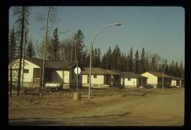
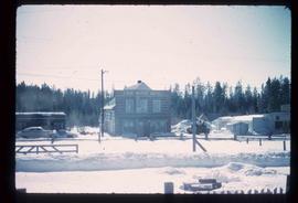
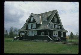
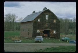
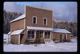
Image depicts an old, boarded up school, possibly the Central Fort George Traditional School in Prince George, B.C.
Image depicts a bridge over Telegraph Creek.
Image depicts numerous campers and other vehicles in Tumbler Ridge, B.C.
Image depicts a row of houses in Tumbler Ridge, B.C.
Image depicts a bridge under construction in Tumbler Ridge, B.C.
Image depicts a cabin somewhere in Mud River, B.C.
Image depicts what is likely the Dunkley Lumber Mill in Strathnaver, B.C.
Image depicts the Lone Butte Hotel in Lone Butte, B.C.
Image depicts an old log cabin with the sign "Robin Hood Flour" on it at an uncertain location. It is possibly at the 153 Mile House.
Image depicts the cemetery in Soda Creek, B.C.
Image depicts a rail road bridge, possibly the Cottonwood Bridge, at an uncertain location.
Image depicts the Cottonwood Bridge.
Image depicts a sawmill somewhere in Quesnel, B.C.
Image depicts the train station in Quesnel, B.C.
Image depicts a sawmill somewhere in Quesnel, B.C.
Image depicts what appears to be a farm at an uncertain location.
Image depicts numerous buildings in Hendrix Lake, B.C.
Image depicts the old community hall in Soda Creek, B.C.
Image depicts a house in Soda Creek, B.C.
Image depicts the old BX Sternwheeler office building in Soda Creek, B.C.
Image depicts an old building located somewhere are the Pickard farm north of Soda Creek, B.C.
Image depicts the old RCMP barn at 150 Mile House, B.C.
Image depicts the Watson Mansion at the 108 Mile Ranch. It burned down due to a chimney fire in 1983.
Image depicts the Flying U Ranch at 70 Mile House, B.C.
Image depicts a church located near Mapes, B.C.
Image depicts the historical village of 'Ksan near Hazelton, B.C.
Image depicts two totem poles in Skeena Crossing, B.C.
Image depicts the Bulkley River running through Moricetown Canyon.
Image depicts a few buildings in Fraser Lake, B.C.
Image depicts an old house in Kispiox, B.C.
Image depicts numerous totem poles in Kispiox, B.C.
Image depicts the dock for ferries in Isle Pierre, B.C.
Image depicts Grassy Plains, B.C.
Image depicts Danskin, B.C.
Image depicts a street in Burns Lake, B.C.
Image depicts the cemetery in Hazelton, B.C.
Image depicts a tombstone in the cemetery in Hazelton, B.C.
Image depicts Hazelton, B.C.
Image depicts the Telkwa river in Telkwa, B.C.
Image depicts an old, boarded up store in Isle Pierre, B.C.
Image depicts a boat on the Nechako Reservoir at Kenny Dam.
Image depicts a boat dock on the Nechako Reservoir at Kenny Dam.