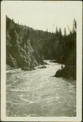
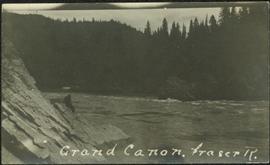
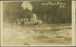
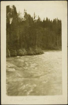
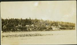
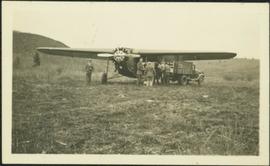
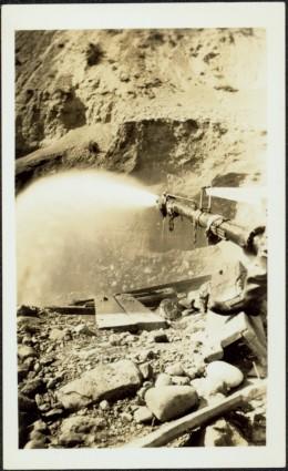
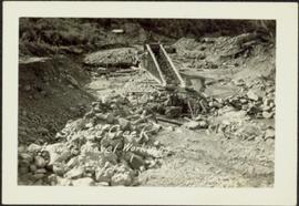
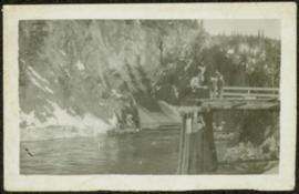
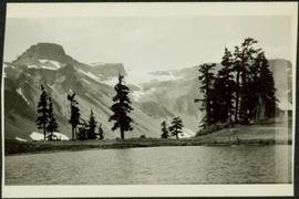
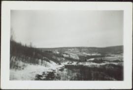
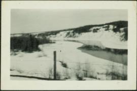
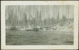
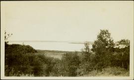
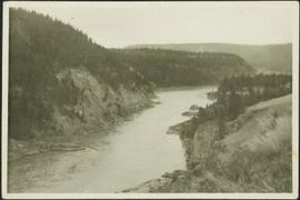
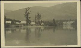
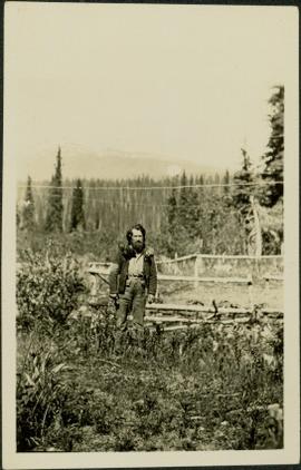
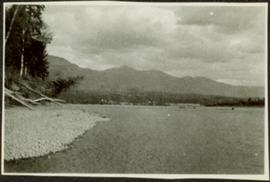
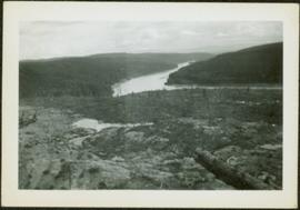
Photograph depicts river winding through hills, cleared area in foreground. Handwritten annotation on recto of photograph: "slid".
Photograph depicts unknown river winding through steep cliffs, trees on either side.
Photograph depicts trees standing in foreground, river and hills visible in distance.
Photograph depicts unidentified river flowing through hills, trees in foreground, mountains in background.
Photograph depicts unidentified river or lake. Bushes in foreground, hills in distance.
Photograph depicts a river or lake, trees on shore in foreground.
Photograph depicts river winding through steep hills.
Sarah sits between four men on large tree trunk suspended over canyon in unidentified area, cliffs and hill in background. Man holing Sarah's hand on her left is believed to be a Mr. Murray, also featured in item 2009.5.2.175.
Sarah Glassey stands looking down into what appears to be a camera, forest on hillside in background.
Photograph depicts mountains in background behind forest trees. River barely visible behind bushes at bottom of photo. Handwritten photo caption on verso and recto of this photograph reads: "On the Clearwater."
Photograph depicts winding river from above, tall trees on either side and mountains in background. Handwritten photo caption on verso and recto of this photograph reads: "Top of Grand Canyon from Portage trail".
Photograph depicts a line of men standing on opposite shore and holding a long rope between them, while men on scow float close to shore in distance. River water in foreground, trees on shore in background. Handwritten photo caption on verso and recto of this photograph reads: "In the Grand Canyon."
Photograph depicts a crew of 13 men on a scow believed to be maneuvering through the Upper Fraser River at Scow's Last Lap (Scow Rapids), downriver from the Grand Canyon of the Fraser. Trees on opposite shore in background, rocky shore in foreground. Handwritten annotation on recto of photograph reads: "the last lap".
Photograph depicts the Giscome Rapids. Opposite shore in background, rocky beach in foreground. Handwritten photo caption on verso and recto of this photo reads: "Point where G.T.P. [Grand Trunk Pacific] canoe capsized at Giscome Rapids & where 3 men were drowned."
Photograph depicts the early settlement of Fort George. The buildings to the left of the fence are believed to be owned by the Hudson's Bay Company. The land to the right of the fence belonged to the Fort George Reserve, the home of today's Lheidli T'enneh Band who relocated to a reserve at Shelley when this reserve was sold in 1912. Handwritten annotation on verso and recto of this photograph reads: "Fort George from opposite side of Fraser River".
Photograph depicts one man seated in rear of canoe on still water. Trees on opposite shore in background. This man is believed to be a member of the Bourchier forestry crew.
Photograph depicts group of men seated on scow carrying unidentified material. One man stands on rocky shore in left foreground, leaning on plank attached to scow. A second scow can be seen behind men. Tree-covered hills on opposite shore in background.
Photograph depicts four men on conveyor, and clear view of paddle wheel. A small boat is docked to the conveyor with men and equipment. Crowd of men on shore in foreground on right, trees on opposite shore in background. Mountains visible in distance. Handwritten annotation on verso of photograph reads: "Str. Conveyor".
Photograph depicts street in McBride, wood buildings and tent buildings on either side. Small businesses and restaurants line the left side of the street. Forest slash stands in newly cleared area in foreground. Railway tracks cross right foreground, hills visible in background. Annotation on verso of photograph reads: "MC.Bride, B.C.", handwritten on recto: "1914 [Bourchier?]"
Photograph depicts log buildings and tents on left shore. Fraser river in foreground, forest and hillside in background.
Photograph depicts small log buildings and loaded wagons in cleared dirt area. Building on far left has the sign "POOL HALL" posted on front . Treetops, lumber piles, and hills in background. Mountains can be seen in distance. Handwritten annotation on verso of photograph reads: "Sand Creek. B.C."
Photograph depicts bridge over Nechako River. Sloped cutbanks on opposite shore in background. Buildings and railroad tracks can be seen on town shore in right foreground.
Photograph depicts crowd of people in foreground near log fence. More crowds can be seen in distance at base of ski jump on either sides of the run. Jump visible at top of tree-covered hill in background. It is believed that this photograph was taken near the current location of City Hall.
Photograph depicts the major buildings and streets of the town. Sloped cutbank visible across the Nechako River in background. It is believed that this photograph was taken from Connaught Hill. Handwritten annotation on verso of photograph reads: "PRINCE GEORGE, B.C."
Photograph depicts an unidentified person seated on rocks in foreground. River crosses midground, cliffs and trees on opposite shore in background. Unidentified structures believed to be buildings can be seen on opposite shore. Handwritten annotation on verso of photograph: "Grand Canyon. fraser R."
Handwritten annotation on verso of photograph: "Grand Canyon, Nechaco, B.C.", on recto: "Steamer Nechacco in the Grand Canyon 1909." River rapids in foreground, opposite shore in background.
River in foreground, trees on shore in background. Handwritten annotation on verso of photograph: "Grand Canyon Fraser R."
Photograph depicts many buildings among forest trees on hillside of opposite shore. River in foreground.
Handwritten annotation on verso of photograph: "HOCKEY - HAZELTON. VS G.T.P.R [Grand Truck Pacific Railway] FEB. 20/11" Twelve players can be seen skating on ice, surrounded by large crowd of people standing on either side of the game. Referees dressed in suits stand around players, and a dog can also be seen in crowd. Snow pile in foreground; river banks, forest, and mountains in background.
Photograph depicts bridge built with wooden planks and poles, braced from below, with triangles built into its frame. The bridge crosses Hagwilget Canyon on the Bulkley River, five kilometres from its confluence with the Skeena River. This is one of the many bridge structures that have crossed this location since at least 1859.
Handwritten annotation on recto of photograph: "old bridge at the Bulkley River."
Photograph depicts the Grand Trunk Pacific Railway Bridge crossing the Bulkley River. A smaller bridge speculated to be used by pedestrians stands below and parallel to the railway bridge. Photo was taken from shore, with opposite shore crossing midground. Trees in foreground, mountains in background. A small building can be seen at opposite end of bridge. Other sections of railway can be seen on hill in background. Handwritten annotation on verso of photograph: "HAZELTON BULKLEY BRIDGE."
Grass area in foreground, forest and hills in background.
Man standing on far left believed to be H.F. Glassey. One mam stands in military uniform. Hauling truck parked close behind plane, hill in left background.
Photograph depicts a miner spraying enclosed area of river bed with water at high velocity. Cliffs in background.
Photograph depicts water being sprayed from a pipe at high velocity over edge in mining area. Man's leg in foreground, cliffs in background.
Photograph depicts water being sprayed from pipes at high velocity in mining area. Unidentified man in midground, cliffs in background.
Photograph depicts a large structure in center of mining area in riverbed, equipment and supplies scattered throughout. Buildings and forest in background. Handwritten annotation on verso of photograph: "Spruce Creek, Lower Shovel Workings 6/25/39.", on recto: "Atlin".
Photograph depicts two unidentified men standing on wood walkway extended high above water. Cliffs in background. Photograph speculated to have been taken at Sayer Creek, B.C.
Photograph depicts river and shore in foreground, hills on opposite shore in background. Handwritten annotation on recto of photograph: "Finlay Forks."
Photograph depicts two log buildings in fenced area on lake shore, forest trees in background. A man can be seen standing near docking area and small boat pier extending into water in foreground. Handwritten annotation on recto of photograph: "Fur Farm Red Rock Lake". This location is believed to at mile 27, north of Summit Lake.
Photograph depicts a team of dogs pulling a sled and an unidentified person across a very flat area under heavy clouds. Mountains in background. Handwritten annotations on verso of photograph: "Unbroken Trails", "Taylor". Photograph speculated to have been taken near Atlin, B.C.
Photograph depicts aerial view of unknown river winding through forest.
Photograph depicts Pine Creek winding through forest and hills. Altin Lake and mountains in background. Handwritten annotation on recto of photograph: "Atlin: Looking down lower Pine Ck, westerly towards Atlin, Atlin Lk, & the Atlin Mts. (part of Coast Range)."
Photograph depicts trees on water shore, lake in foreground, mountain in background. See also item 2009.5.2.80.
Photograph depicts trees on water shore, lake in foreground, mountain in background. See also item 2009.5.2.79.
Photograph depicts men and haul trucks visible in distance on snowy road in tree-covered hills.
Photograph depicts an unidentified river flowing through snowy area, trees on left, hill on right. Barbed wire fence crosses foreground.
Photograph depicts river in foreground, trees on opposite shore in background. Photo also appears to depict two unidentified individuals on small boat or canoe.
Photograph depicts thick forest in foreground, cliffs in distance.
Photograph depicts unidentified river flowing through hills, trees in foreground, mountains in background.