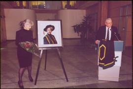
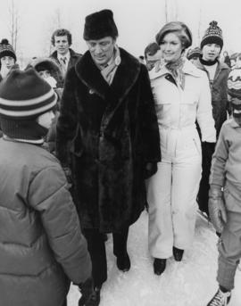
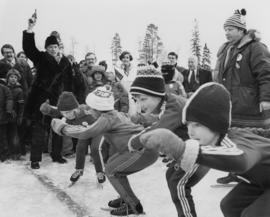
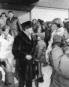
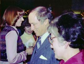
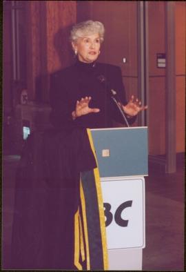
Showing 887 results

Archival description
2009.6.1.592 · Item · 17 August 2004
Part of The Honourable Iona Campagnolo fonds

Photograph taken in front of the 'icebergs' at the University of Northern British Columbia in Prince George, B.C. Campagnolo stands in middle row, third from right.

Card accompanying photograph reads: “UNBC’s 10th Anniversary, 08/17/04, With the compliments of Charles J. Jago, President and Vice-Chancellor”.

2011.3.2.10 · Item · [ca. 1910]
Part of North Coast & Central BC Postcard Collection

Street scene showing people, dog, team of horses & wagon. Signage reads: “Beds; Mecca Café; Hardware.” Printed annotation on recto reads: “Hamilton Avenue, South Fort George, B. C. No. 110.” Verso displays cancelled 1 cent Canadian Postage Stamp and handwritten message in ink is addressed to Mr. Eathan Villard Burt Mish, U.S.A.

2011.3.2.17 · Item · 1921
Part of North Coast & Central BC Postcard Collection

Photograph of George Street in Prince George B.C. Cars, people, and signage are visible. Printed annotation on recto reads: “George St. Prince George B.C. 1921 R7 by Moore” There is an “X” in ink over the fire hall. Handwritten annotation in ink on verso reads: “This view is also looking north and where I have put the X is the one and only fire hall and you can see the fire engine in the street. This is the main street.”

Prince George to Tete Jaune
2011.3.4.14 · Item · [ca. 1901-1915]
Part of North Coast & Central BC Postcard Collection

Stern wheeler in river. Handwritten annotation in pencil on verso reads: “Prince George to Tete Jaune” Hand written message in ink on verso is addressed to “Mademoiselle Elisabeth Joliet, Terrguy – Les Dijore Cote a Or France”

2011.12.02 · Item · ca. 1950
Part of Giscome, BC Historical Photograph collection

Photo depicts a street perspective of George St., in Prince George, BC, ca. 1950. Annotation recto reads: "George St. Prince George BC Photo by J Wrathall." Handwritten annotation in pen on verso of postcard reads: “This is the Hastings Street of Prince George. This & 3rd Streets are the main thoroughfares.”

CNR Prince George
2013.6.36.1.039.02 · Item · 1966
Part of David Davies Railway Collection

Photograph depicts a rail bridge over the Fraser River. Canter levelled on both sides were vehicle roadways which ceased to be used in 1987 when a new road bridge was supposed to be completed. The right lane took cars into the city of Prince George.

Highway 97
2012.13.1.3.022 · Item · Oct. 1975
Part of J. Kent Sedgwick fonds

Image depicts Highway 97 at 15th Ave. looking north. Map coordinates 53°54'42.1"N 122°46'53.1"W

Trailers for Sale
2012.13.1.3.027 · Item · Oct. 1975
Part of J. Kent Sedgwick fonds

Image depicts mobile homes for sale on Cowart Road looking northeast with Simon Fraser Bridge in background. Map coordinates 53°52'39.3"N 122°46'13.1"W

Woodwards
2012.13.1.3.029 · Item · Oct. 1975
Part of J. Kent Sedgwick fonds

Image depicts Parkwood Place taken from Connaught Hill looking west with the hospital in the background. Map coordinates 53°54'39.9"N 122°45'02.5"W

Prince George
2012.13.1.3.042 · Item · Nov. 1977
Part of J. Kent Sedgwick fonds

Image depicts downtown Prince George looking northwest across Dominion Street. Map coordinates 53°54'48.7"N 122°44'45.6"W

View from City Hall
2012.13.1.3.045 · Item · Jan. 1978
Part of J. Kent Sedgwick fonds

Image depicts a view of Prince George from City Hall looking northeast with the pulp mills in the background. Map coordinates 53°54'46.3"N 122°44'41.9"W

View from Gunn Point
2012.13.1.3.058 · Item · Nov. 1979
Part of J. Kent Sedgwick fonds

Image depicts a view of Prince George from Gunn Point in the L.C. Gunn Park looking north. Map coordinates 53°54'26.2"N 122°43'35.8"W.

View from Gunn Point
2012.13.1.3.062 · Item · Nov. 1979
Part of J. Kent Sedgwick fonds

Image depicts a view of Prince George from Gunn Point in the L.C. Gunn Park looking north. Map coordinates 53°54'26.2"N 122°43'35.8"W.

View from Gunn Point
2012.13.1.3.063 · Item · Nov. 1979
Part of J. Kent Sedgwick fonds

Image depicts a view of Prince George from Gunn Point in the L.C. Gunn Park looking north. Map coordinates 53°54'26.2"N 122°43'35.8"W.

View from Gunn Point
2012.13.1.3.066 · Item · Nov. 1979
Part of J. Kent Sedgwick fonds

Image depicts a view of Prince George from Gunn Point in the L.C. Gunn Park looking north. Map coordinates 53°54'26.2"N 122°43'35.8"W.