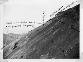
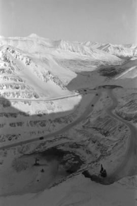
2000.1.1.3.13.12
·
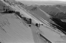
Item
·
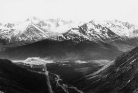
25 October 1965
Part of Cassiar Asbestos Corporation Ltd. fonds
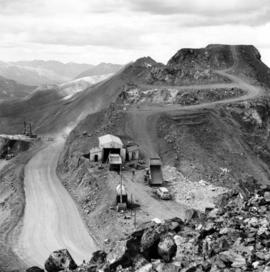
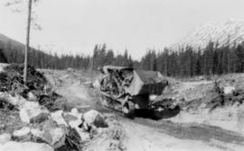
Photograph depicts large swath of dark waste down mountainside to right of valley. The waste dump is believed to be visible at top of swath on right of image. Bench mining visible on the North and South peak in background. Handwritten annotation on recto of photograph: "Oct. 25 / 65 4:25 PM."