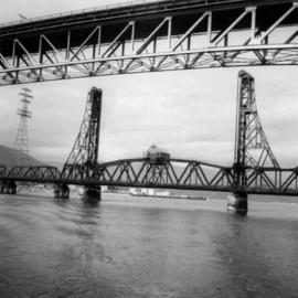
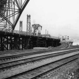
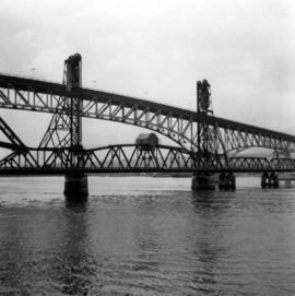
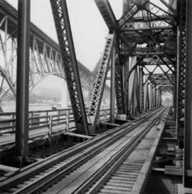
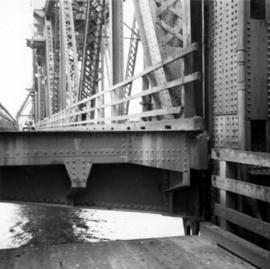
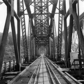
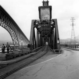
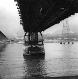
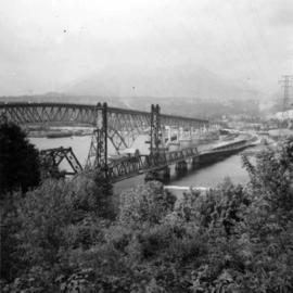
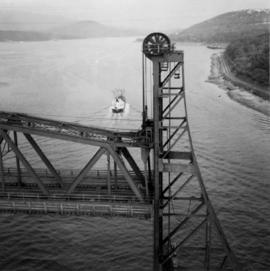
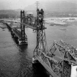
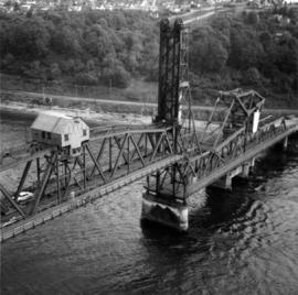
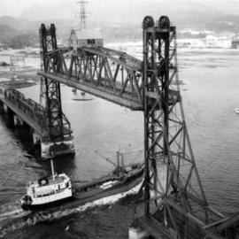
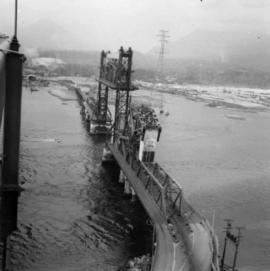
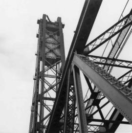
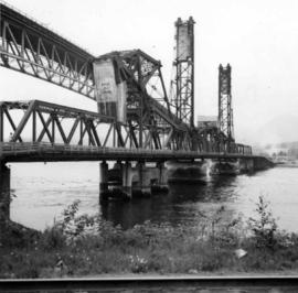
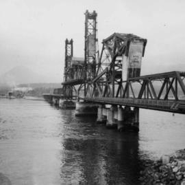
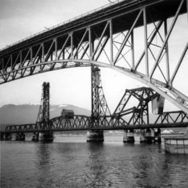
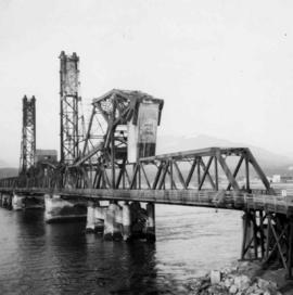
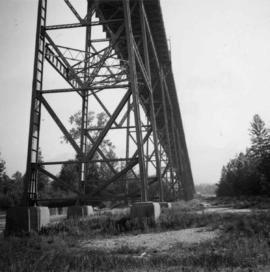
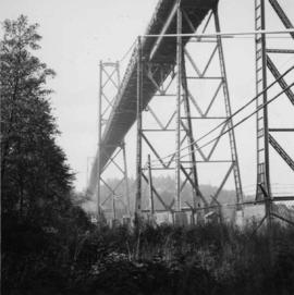
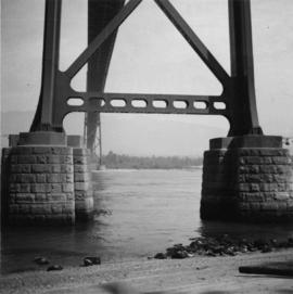
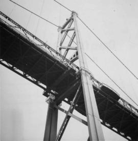
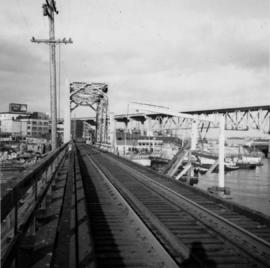
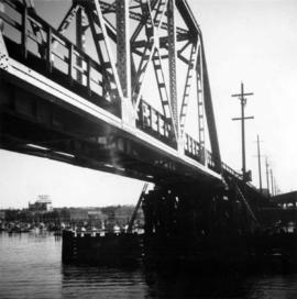
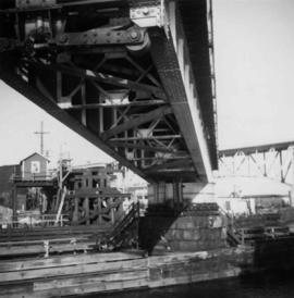
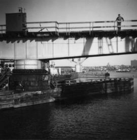
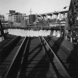
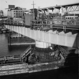
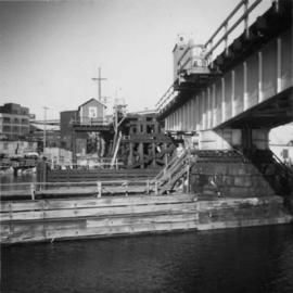
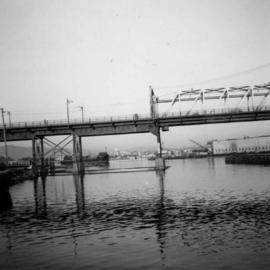
Photograph depicts the Cambie St. Bridge in Vancouver, BC, looking east and showing the north fixed span of the bridge.
Photograph depicts a wooden arch supporting the sagging Georgia Viaduct in Vancouver, BCThe road in the foreground is Taylor Way.
Photograph depicts the Fraser St. road bridge over the north section of the north arm of the Fraser River, looking north from Mitchell Island to Vancouver, BC
Photograph depicts the road bridge crossing the south section of the north arm of the Fraser River at Fraser St. The view is from the north bank of Lulu Island.
Photograph depicts the Fraser St. road bridge over the north section of the north arm of the Fraser River (ie. between Vancouver and Mitchell Island). Shot is looking northeast.
Photograph depicts a trestle bridge for road traffic leading to the Second Narrows Bridge in Vancouver, BCThe shot is taken from the south bank.
Photograph depicts the Second Narrows Railway Bridge, looking east.
Photograph depicts the rail approach to the Second Narrows Railway Bridge in Vancouver, BCThe shot taken on CPR trackage and from underneath the road bridge on the south bank.
Photograph depicts the Second Narrows Railway Bridge in Vancouver, BCfrom the south east shore.
Photograph depicts the Second Narrows Railway Bridge in Vancouver, BC, from a view on the lifting span looking north.
Photograph depicts the lifting span of the Second Narrows Bridge with a motor car on the west roadway, as the span is about to close to its normal, flush position.
Photograph depicts the Second Narrows Railway Bridge in Vancouver, BC; view from the lifting span looking south.
Photograph depicts the Second Narrows Bridge from the south end, showing the railway in the center and the south and north bound road traffic ways on either side. The latter is disused.
Photograph depicts the underside of the lifting span of the Second Narrows Railway Bridge in Vancouver, BCView is from the south, fixed side.
Photograph depicts the road and rail bridges at Second Narrows, Vancouver B.C. The photograph was taken from Boundary Rd. looking north.
Photograph depicts the Second Narrows Railway Bridge in Vancouver, BC, as the lifting span is starting to drop. The view is looking east towards Capitol Hill and Berry Point.
Photograph depicts the Second Narrows Railway Bridge in Vancouver, BCwith the lifting span up.
Photograph depicts the Second Narrows Railway Bridge in Vancouver, BCas the lifting span is being lowered. The span lifts about every 1 to 2 hours.
Photograph depicts the Second Narrows Railway Bridge in Vancouver, BC, as a coastal tanker going upstream to a refinery passes beneath it.
Photograph depicts the Second Narrows railway bridge in Vancouver, BCfrom the south end of the road bridge with the lifting span up.
Photograph depicts the north side lifting tower of the Second Narrows railway bridge in Vancouver, BC
Photograph depicts the Second Narrows railway bridge in Vancouver from the south bank. The bascule does not move.
Photograph depicts the span of the Second Narrows bridge lifting from the southwest bank of Vancouver, BC
Photograph depicts a plaque attached to the east side girder of bascule section of the Second Narrows railway bridge in Vancouver, BC
Photograph depicts the Second Narrows railway bridge in Vancouver, BC
Photograph depicts the south tower of the Lions Gate Bridge looking east with the SS Prince George in the background.
Photograph depicts the Lions Gate Bridge on west side looking south from the shore of North Vancouver, BC
Photograph depicts the piers of the south tower on the Lions Gate Bridge in Vancouver, BC
Photograph depicts the decking and piers of the northern section of the Lions Gate Bridge, looking north from the shore of North Vancouver, BC
Photograph depicts the Lions Gate Bridge on the east side looking south from the shore of North Vancouver, BC
Photograph depicts the southern granite piers of the Lions Gate Bridge in Vancouver, BC
Photograph depicts the south tower and a segment of decking of the Lions Gate Bridge in Vancouver, BCPhotograph taken from the east side.
Photograph depicts the Lions Gate Bridge in Vancouver, BCfrom the southeast side.
Photograph depicts the False Creek Trestle bridge open and the Granville Bridge looking east.
Photograph depicts the B.C. Electric Railway trestle bridge over False Creek looking north at the fixed span. The fixed span can be removed by floating it onto a scow on rising tide to allow large and newly launched ships to get out to sea.
Photograph depicts the fixed span of the B.C. Electric Railway swing bridge at False Creek looking south.
Photograph depicts the under face of the B.C. Electric Railway swing bridge at False Creek looking north.
Photograph depicts the B.C. Electric Railway swing bridge at False Creek on the west side looking east as it is about to swing open.
Photograph depicts the B.C. Electric Railway trestle bridge swinging span at False Creek.
Photograph depicts the B.C. Electric Railway swing bridge at False Creek.
Photograph depicts the B.C. Electric Railway swing bridge at False Creek on the west side looking north.
Plan depicts Granville Island industrial sites in False Creek, Vancouver. Shows revised trackage from 1955 annotated in colour by Davies.
Map depicts the city of Vancouver and its railways.
Map depicts annotations of the freight-way routes throughout British Columbia. These routes include: the Garnet Enterprise Truck Haul from Vancouver to Terrace, the Canadian Freightways from Vancouver to Edmonton to Alaska; the Lindsay Transfer from Terrace to Dease Lake and Telegraph Creek; and the Northland Navigation roll-on and roll-off service.
Map depicts annotations marking the major freight-ways: Garnet Ent. Truck Haul from Vancouver to Terrace, Canada Freightways Lyndon Trucking from Vancouver-Edmonton-Alaska Highway, Lindsays Transfer from Terrace to Dease Lake and Telegraph Creek, and the Northland Navigation roll-on and roll-off service. The cities and towns of Vancouver, Prince George, Dawson Creek, Terrace, Kitimat and Whitehorse are noted.
The pair walks on sidewalk, wearing hats and long coats, Glassey on right. Crowd of walking people and tall buildings in background. Photograph taken by street photographer. Stamped annotation on recto of photograph: "SOUVENIR SNAPS 401 W. HASTINGS ST. VANCOUVER, B.C. EXTRA COPIES BY NUMBER."
The pair walks on sidewalk, wearing hats and fur lined coats, Glassey on left. Car, power lines, and tall buildings stand in background. Photograph believed to have been taken by street photographer.
Photograph depicts Sarah walking amongst people on sidewalk lined with cars and tall buildings. Power lines cross midground. Photograph believed to have been taken by street photographer. Handwritten annotation on recto of photograph: "Sarah Glassey."
Typed on verso of ticket: "CANADIAN NATIONAL RAILWAYS WESTERN REGION" "EMPLOYES TRIP PASS - FIRST CLASS" "SUBJECT TO CONDITIONS ON BACK" "PASS (1) Miss V. B. Taylor, ACCOUNT Stenographer -- C.N.R. TO Vancouver, B.C. FROM Prince Rupert, B.C. via Jasper, Alta." "DATE ISSUED} June 14th/27. EXPIRES END OF} July. 1927" "ADDRESS Prince Rupert. REQD BY V.B.T." "HONORED ON TRAIN NO. [6]". Verso has been signed by the conductor (illegible) and dated "Jun 18".
Typed on recto of ticket: "PASS ONE WAY ONLY TW IN ACCORDANCE WITH ACCOMPANYING PASS, BUT IN OPPOSITE DIRECTION" "VOID IF DETACHED" "143518". Stamped annotation on recto: "[ISSUED BY] W. H. TOBEY". Handwritten annotation on recto: "OFF SNOWSHOED NO 5 JULY 13 [WM?]". Ticket has been punched with four different shapes.