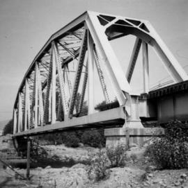
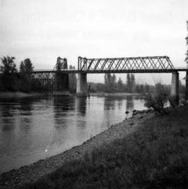
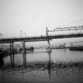
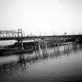
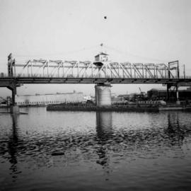
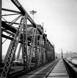
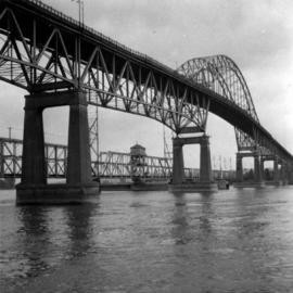
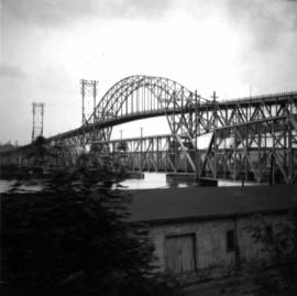
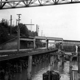
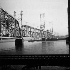
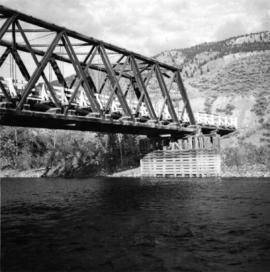
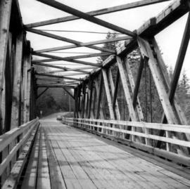
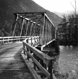
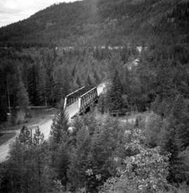
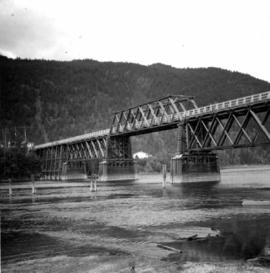
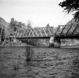
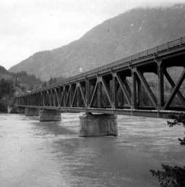
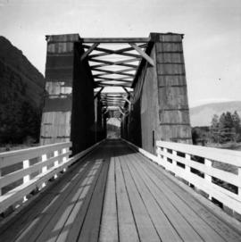
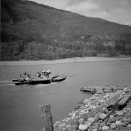
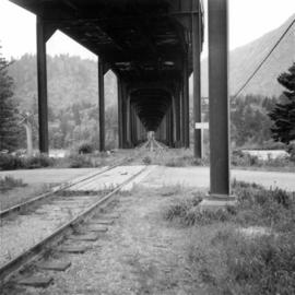
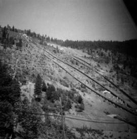
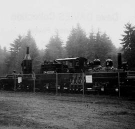
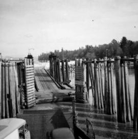
Photograph depicts the swing span of the road and rail bridge at Mission City, looking upstream from the south bank.
Photograph depicts a Pacific Great Eastern rail bridge to crossing the Capilano River in west Vancouver. Photo is taken from the east shore looking west.
Photograph depicts a bridge over the south Thompson River at the west end of Shuswap Lake at Squilax. The left or northern span used to be a lifting span for sternwheelers (pre 1920s?).
Photograph depicts the Alexandra Bridge in the Fraser Canyon, about 20 miles north of Hope. Photo looks to east bank.
Photograph depicts the Alexandra Bridge in the Fraser Canyon. It is closed to wheeled traffic and has a grid iron deck. Photo looks east.
Photograph depicts the Alexandra Bridge in the Fraser Canyon. It is closed to traffic but is possible to drive a vehicle across but the road is blocked on the east bank. The bridge is in good condition. Photo looks east.
Photograph depicts the Alexandra Bridge in the Fraser Canyon. The view is looking northeast and depicts the Fraser River running downstream to the right of the photo. There is First Nations salmon net pole in the bottom left-hand corner.
Photograph depicts the Cambie St. Bridge in Vancouver, BC, looking east and showing the north fixed span of the bridge.
Photograph depicts the Cambie St. Bridge in Vancouver, BC, looking southeast and showing the southern fixed span on the bridge.
Photograph depicts the Cambie St. Bridge in Vancouver, BC, looking east and showing the central swing span.
Photograph depicts the Cambie St. Bridge in Vancouver, BC, showing the west side and view facing south.
Photograph depicts the Patullo Bridge in New Westminster, looking east with the rail bridge in the background.
Photograph depicts the rail connections below the north bank of the Patullo Bridge in New Westminster. The track in the foreground belongs to C.N. and the flyover foreground rail bridge belongs to the B.C. Electric Railway. The flyover background rail bridge is shared by the Great Northern Rail and C.N. Rail.
Photograph depicts the road and rail bridges at New Westminster, BCView is from the north and facing upstream.
Photograph depicts the railway bridge at New Westminster, looking towards the south bank. The bridge is used by C.N., BCHydro, and the Great Northern Railway.
Photograph depicts the road bridge crossing over the Kootenay River at Fort Steele, 10 miles northwest of Cranbrook, looking downstream. Two piers of a new bridge can be seen behind the present one. The railway is from Golden to Fernie and built in approximately 1913.
Photograph depicts the road bridge over Toby Creek, just north of Invermere or 75 miles north of Cranbrook, looking at upstream piers.
Photograph depicts the bridge over the Nicola River at Spences Bridge in the north Fraser Canyon, looking downstream.
Photograph depicts the bridge over the north Thompson River at Barriere, 40 miles north of Kamloops. View is looking towards the east bank. A new bridge is being built half a mile upstream and just awaiting decking.
Photograph depicts a bridge on the Upper Clearwater Rd., 10 miles north of Clearwater. The town is 70 miles north of Kamloops. The road leads north (to left side of photo) to the entrance of Wells Gray Provincial Park.
Photograph depicts a bridge over Powell Lake, directly behind Powell River town. The bridge is in poor condition and being replaced by steel bridge at right (just off the picture).
Photograph depicts truss bridge over Lois River looking north. Bridge is about 2-4 miles north of Saltery Bay, leading to Powell River.
Photograph depicts bridge over the Similkameen River between Hedley and Keremeos. The bridge leads to Ashnola and the photograph taken from the northwest looking south.
Photograph depicts a bridge over Scotch Creek on the north shore of Shuswap Lake about 10 miles northeast of Squilax.
Photograph depicts the bridge over the south Thompson River at Squilax where the road connects Squilax Village with a First Nations reservation on the north bank (photo background). The overhead truss in the center span was created to give clearance to paddle sternwheelers.
Photograph depicts bridge over the Similkameen River between Hedley and Keremeos. The bridge leads to Ashnola and the photograph taken from the south bank.
Photograph depicts Spences Bridge on the Thompson River and the only surviving pier of the earlier Spences' Bridge. View looking at east bank.
Photograph depicts a former Great Northern Railway bridge, which carried the line over the Similkameen River between Keremeos and Hedley. The bridge is about 2-3 miles west of Keremeos.
Photograph depicts the North Bend Ferry (Aerial Cage) at Boston Bar in the Fraser Canyon. The capacity of the aerial cage is 1 car or truck, or 40 passengers. Vehicle height clearance: 12 feet. Load-limit: 3 tons gross. Schedule: On call 24 hours. Rates: Car with driver, 25 cents; truck with driver, 50 cents; passenger, 5 cents.
Photograph depicts a double-use bridge across the Fraser River at Hope, BCon the north side of the village. The upper deck carries road traffic and the lower deck the C.P.R. rail line. View looking north.
Photograph depicts a former Great Northern Railway bridge carrying a single track over the Similkameen River, between Keremeos and Hedley. The bridge is about 2-3 miles west of Keremeos.
Photograph depicts a reaction ferry over the Fraser River, located just north of Lytton. The east bank leads to the Lytton-Lillooet road, while the west bank is a dead-end road 20 miles long along the river shelf.
Photograph depicts a double-use bridge across the Fraser River at Hope, BCon the north side of the village. The upper deck carries road traffic and the lower deck the C.P.R. rail line leading to the Kettle Valley Line. View looking north.
Photograph depicts a rail bridge carrying the C.N.R. track over the Thompson River at Lytton, BCThe bridge is at the confluence of Fraser River and Thompson River. View looking north.
Photograph depicts a car parked on Hurricane Ridge in Olympic National Park, south of Port Angeles, Washington.
Photograph depicts a car parked on the road between Kaslo and New Denver, on the site of a former railway right-of-way.
Photograph depicts a float plane landing at Gold River on west Vancouver Island.
Photograph depicts telephone fittings on Vancouver Island.
Photograph depicts the entrance to False Creek in Vancouver, B.C. The wooden navigation marker has since been removed. The photo is taken from 1053 Beach Ave.
Photograph depicts the ferry from Campbell River approaching the Quathiaski Cove slip on Quadra Island.
Photograph depicts a reaction ferry at Blackpool, near Clearwater on the north Thompson River, about 60 miles north of Kamloops. The car is being loaded on the east bank.
Photograph depicts a 1953 Vauxhall Velox parked at 925 Cadero St. in Vancouver, B.C. It is a blue, 6 cylinder, and has had three owners to date.
Photograph depicts a reaction ferry at Blackpool, near Clearwater on the north Thompson River, about 65 miles north of Kamloops. At least 3 such ferries exist north of Kamloops. In freshet the trip takes 1 minute, in low water 15-20 minutes. The other two ferries are equipped with outboard motors in 1964. The ferry broke loose in flood water in approximately 1960.
Photograph depicts block ships sunk to protect booming grounds at Powell River. The ships were former wartime naval vessels.
Photograph depicts a view from the ship the Queen of Powell River, en route from Earl Cove to Saltery Bay.
Photograph depicts a view of the Fraser River from the Albion Ferry from Haney to Fort Langley. The ferry is approaching the south bank of Fort Langley. Gulls sat on logs floating downstream; too heavy to rise after eating candlefish.
Photograph depicts the B.C. Hydro station at Shalalth, 15 miles southeast of Lillooet on Seton Lake. Photograph shows penstocks carrying water from Bridge River to the powerhouse.
Photograph depicts the Albion Ferry on the Fraser River, as it approaches a ferry slip at Fort Langley.
Photograph depicts an early type of spool donkey circa 1890-1900, on display at Promised Land Park on the Olympia Peninsula in Washington state.