2009.7.1.130
·
Item
·
[ca. 1878 - ca. 1920]
Parte de Archdeacon W. H. Collison fonds
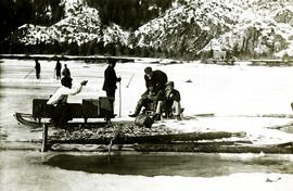
Photograph depicts two men standing beside beds of fish laid out to dry. More oolichan fish hang on tall structures in background.
Handwritten annotation on verso reads: "'Food for winter' Oolichans drying at Fishing Bay, Nass River".