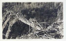
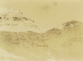
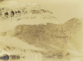
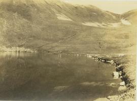
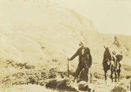
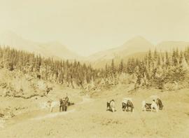
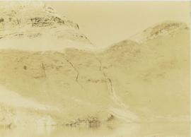
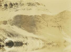
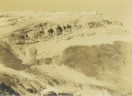
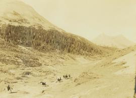
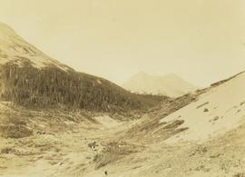
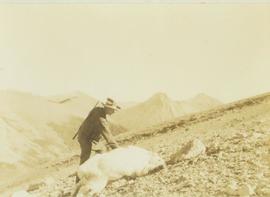
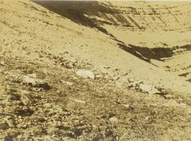
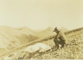
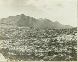
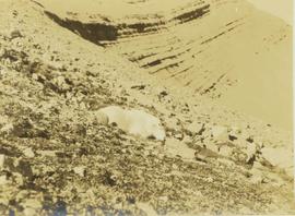
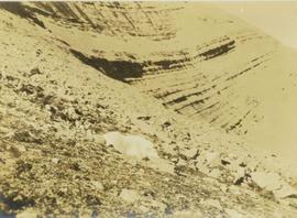
Image depicts the north aspect of Oscar Peak overlooking Lava Lake in the Nass Valley.
Slide depicts a close up of a llama eating hay. The photograph was taken in Kaleden, BC. Original slide index description: "Llama, Kaleden."
Slide depicts a close up of a lion lying on wood shavings in an enclosed area. The photograph was taken in Kaleden, BC. Original slide index description: "lion, Kaleden."
Slide depicts a mixture of bighorn sheep and fallow deer around a trough. The photograph was taken in Kaleden, BC. Original slide index description: "illegible sheep & fallow deer, Kaleden."
Slide depicts two eagles in an enclosure. The photograph was taken in Kaleden, BC. Original slide index description: "Eagles, Kaleden."
Slide depicts a close up of a camel behind a fence. The photograph was taken in Kaleden, BC. Original slide index description: "Camel, Kaleden."
Slide depicts a camel and two llamas in an enclosed pasture. The photograph was taken in Kaleden, BC. Original slide index description: "Camel & Llamas in pasture, Kaleden."
Slide depicts Kelowna and Casa Loma photographed during the day from across the Okanagan Lake in the Lakeview Heights area. Original slide index description: "Kel & Casa Loma from Lakeview Hts."
Slide depicts a tree with apple blossoms in a backyard of a brown house. The yard is surrounded by a wooden fence. The neighbor's white house can be seen next door. Photographed in Kelowna, BC. Original slide description: "Apple Blossom bkyd. Kel."
File consists of the following items:
- "Mac" by D.L. Surveyor
- "Knox (Mac) McCusker: Dominion Land Surveyor" by E.L. Rutherford, V.C. Brink, R.S. Silver and M.Z. (Smokey) Neighbour
- Excerpts from Men and Meridians by Don W. Thomson
- Article re: Knox McCusker written on the occasion of his death (April 14, 1955)
- "McKusker (sic) to open up Blueberry Mountain Area" (Alaska Highway News, June 8, 1950)
- "McCusker was surveyor, big game guide….also rancher and trail blazer"
- "Knox Freeman McCusker" written on the occasion of his death (The Canadian Surveyor, July 1955)
- "Veteran Surveyor - Alaska Highway Stories"
- Memories of Knox McCusker by his oldest niece Betty (McCusker) Rutherford
- "Veteran Surveyor prefers horses for long bush treks" by Eric Young (Edmonton Journal)
- Eulogy for Knox McCusker read by Stanley D. Seif at Burch Presbyterian Church in Fort St. John, B.C.
- Eulogy for Gwendolyn Dorothy McCusker (July 1997)
- "Tropical Valley No Myth: amazing story of woman who lived there" by Thomas A. Wayling (Vancouver Sun)
- Photocopy of section of map: "Topographical sketch map showing route traversed by the Bedaux Sub-Arctic Expedition 1934 through the Rocky Mountains" (by Frank Swannell, March 27, 1935)
- Memories of Knox McCusker by Bill McCusker, his oldest nephew
- "There is always a reason; destiny made it a date. The corridor of the Alcan didn’t just happen" (Fort St. John publication)
- Article on Knox McCusker (ALS News, Winter 1983)
File consists of photocopies of various report front covers and references to Knox McCusker from 1926-1931.
Item is an original BC Parks report entitled "Preservation and Management of the Grizzly Bear in B.C. Provincial Parks: The Urgent Challenge".
Photograph depicts three men standing in dirt area near fire wood. Tent building semi-visible on left, forest trees behind snow pile in background. Handwritten annotation on recto of photograph: "Relief camp at Penny. 100 men - A.K. Bourchier Foreman - Dixon Taylor timekeeper. [Ted Nevan?] purchasing agent - hungry thirties. Construction days. Mile 29 - A.K. Bourchier J.P." Man in middle is believed to be A.K. Bourchier.
Image depicts numerous wood piles near the sawmill somewhere in Quesnel, B.C.
Image depicts a sawmill somewhere in Quesnel, B.C.
This remote-sensing aerial photograph was taken by Lockwood Survey Corporation Ltd. under contract for the B.C. Forest Service. This historically important aerial photograph depicts the headwaters of Williston Reservoir soon after its creation in 1968 with the building of the W.A.C. Bennett Dam on the Peace River.
The identification coding on these photographs can be interpreted as follows:
- The largest number on the leftmost side is the frame number for the photograph.
- The following code to the right in the format B) 69-53 is currently unknown, but may refer to an internal project number for the Lockwood Survey Corporation.
- The 6" may refer to the camera's focal length in inches.
- Next is "17,150 ASL" which is 17,150 feet Above Sea Level.
- Following is "152.52" which refers to the camera's focal length in millimeters, which equals 6 inches.
- The "W1307" may refer to the reel, but that is unconfirmed.
- "8 SEP 69" is the date the photo was taken.
This remote-sensing aerial photograph was taken by Lockwood Survey Corporation Ltd. under contract for the B.C. Forest Service. This historically important aerial photograph depicts the W.A.C. Bennett Dam and Williston Reservoir soon after its flooding in 1968.
The identification coding on these photographs can be interpreted as follows:
- The largest number on the leftmost side is the frame number for the photograph.
- The following code to the right in the format B) 69-53 is currently unknown, but may refer to an internal project number for the Lockwood Survey Corporation.
- The 6" may refer to the camera's focal length in inches.
- Next is "17,150 ASL" which is 17,150 feet Above Sea Level.
- Following is "152.52" which refers to the camera's focal length in millimeters, which equals 6 inches.
- The "W1307" may refer to the reel, but that is unconfirmed.
- "8 SEP 69" is the date the photo was taken.
Photograph of a long bridge spanning two rock faces. A small settlement is visible on the lower right.
Hand coloured photograph of the surrounding lands and many residential buildings encompassing the Tsimshian village of Lax Kw'alaams (previously called Port Simpson). Printed annotation on recto reads: "Indian Village, Port Simpson, B.C."
Photograph depicts the wooden Hagwilget Bridge spanning a rocky gorge over the Bulkley River. Forested area visible in the background. Annotation on recto of photograph states: "W.W.W. Old Indian Bridge, Bulkley River"
Photograph depicts a mountain ridge rising our of an alpine lake that is visible in the foreground. The photograph location is the Mt. Petrie area from the north and northwest.
Photograph depicts a mountain ridge rising out of an alpine lake. The photograph location is the Mt. Petrie area from the north and northwest.
Photograph depicts the top of a mountain ridge situated next to an alpine lake. The photograph location is the Mt. Petrie area from the north and northwest.
Photograph depicts the craggy top of a mountain peak situated above an alpine lake. The location of the photograph is the Mt. Petrie area from the north and northwest.
Photograph depicts a mountain peak rising above an alpine lake. The photograph location is the Mt. Petrie area from the north and northwest.
Photograph depicts pack horses and crewmen walking along the shore of an alpine lake with a hillside rising up in the background. The location is the Mt. Petrie area from the north and northwest.
Photograph depicts a man, probably Prentiss Gray, standing over three felled grizzly bears while holding the reins of his horse and a rifle. In the background a mountain side rises up in the distance.
Photograph depicts a man who is probably Prentiss Gray standing over three felled grizzly bears. The man is holding the reins of a horse while a mountain rises in the distance.
Photograph depicts a man who is probably Prentiss Gray standing over three felled grizzly bears. The man is holding onto the reins of a horse and a rifle while a mountain range rises up in the background.
Photograph depicts a pack horse train in the foreground walking through a mountain valley. In the background forested foothills are visible with a mountain peak rising from the background.
Photograph depicts a pack horse train walking through a mountain valley. In the background forested foothills are visible with a mountain peak rising in the distance.
Photograph depicts seven pack horses grazing in grass by a stream. In the background the tree line of a forest is visible with mountain peaks rising in the distance.
Photograph depicts a distance perspective of a herd of mountain goats grazing across a rocky mountain slope.
Photograph depicts a distant perspective of a herd of mountain goats grazing across a rocky mountain slope.
Photograph depicts a distance perspective of a herd of mountain goats grazing across a rocky mountain slope.
Photograph depicts a herd of mountain goats grazing across a rocky mountain slope with the ridge of the mountain visible in the background.
Photograph depicts Prentiss Gray reaching out to a felled mountain goat lying on a rocky slope. In the background a mountain range is visible.
Photograph depicts a mountain goat lying on a rocky mountain slope. In the background a steep mountain area is visible.
Photograph depicts Prentiss Gray standing beside a felled mountain goat on a rocky slope. In the background a mountain range is visible.
Photograph depicts a young caribou visible in the distance standing on a rocky mountain slope. In the background a mountain range is visible.
Photograph depicts a mountain goat lying on a rocky mountain slope.
Photograph depicts a mountain goat lying on a rocky mountain slope. In the background a steep, striated mountain side is visible.
Photograph depicts a mountain goat lying on a rocky section of a mountain with a steep, striated mountain slope in the background.