File consists of notes, clippings, and reproductions relating to Father Adrien Morice. Father Adrien Morice was a missionary and was ordained as a priest who came to British Columbia in 1880 to complete his ecclesiastical studies. After completing his schooling he was signed to the Williams Lake Mission where he worked closely with the Chilcotin peoples, learning their language and ministering. He continued to learn Chinook before moving to work at Stuart Lake with the Na'Kaztl'Tenneh Band in 1885, working with four divisions of the Carrier Tribes, the Alexandria, Quesnel, Blackwater, and Lhuskuz. Morice continued to use the Cree language and eventually published a monthly newspaper between 1881 and 1884 called "Tsettes Nahivelnik" (meaning "storyteller") using the Cree language. File primarily consists of handwritten notes by Kent Sedgwick regarding Father Adrien Morice and his work.

Image depicts the Catholic Church in Penny, B.C.

Image depicts the Oblates of Mary Immaculate Catholic Church in Aleza Lake, B.C. Map coordinates 54°07'08.2"N 122°02'00.0"W

Image depicts the Oblates of Mary Immaculate Catholic Church in Aleza Lake, B.C. Map coordinates 54°07'08.2"N 122°02'00.0"W

Image depicts the Oblates of Mary Immaculate Catholic Church in Aleza Lake, B.C. Map coordinates 54°07'08.2"N 122°02'00.0"W

Image depicts the Oblates of Mary Immaculate Catholic Church in Aleza Lake, B.C. Map coordinates 54°07'08.2"N 122°02'00.0"W

Image depicts the Oblates of Mary Immaculate Catholic Church in Aleza Lake, B.C. Map coordinates 54°07'08.2"N 122°02'00.0"W
Image depicts the Oblates of Mary Immaculate Catholic Church in Aleza Lake, B.C. Map coordinates 54°07'08.2"N 122°02'00.0"W

Image depicts the Oblates of Mary Immaculate Catholic Church in Aleza Lake, B.C. Map coordinates 54°07'08.2"N 122°02'00.0"W

Image depicts the Oblates of Mary Immaculate Catholic Church in Aleza Lake, B.C. Map coordinates 54°07'08.2"N 122°02'00.0"W

Image depicts a Catholic church in Giscome, B.C. Map coordinates 54°04'15.5"N 122°21'52.1"W

Image depicts a Catholic church in Giscome, B.C. Map coordinates 54°04'15.5"N 122°21'52.1"W

Image depicts a Catholic church in Giscome, B.C. Map coordinates 54°04'15.5"N 122°21'52.1"W

Image depicts a Catholic church in Giscome, B.C. Map coordinates 54°04'15.5"N 122°21'52.1"W

Image depicts a Catholic church in Giscome, B.C. Map coordinates 54°04'15.5"N 122°21'52.1"W

Image depicts the Oblates of Mary Immaculate Catholic Church in Aleza Lake, B.C. Map coordinates 54°07'08.2"N 122°02'00.0"W

Image depicts a church in Giscome, B.C. Map coordinates 54°04'16.2"N 122°21'54.3"W

Image depicts an open field and numerous buildings, including a church in Giscome, B.C. Map coordinates 54°04'03.2"N 122°22'04.6"W
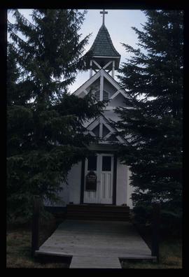
Image depicts St. Mark's Anglican Church in Woodpecker, B.C.
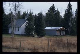
Image depicts the St. Mark's Anglican Church and a small house in Woodpecker, B.C.
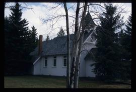
Image depicts St. Mark's Anglican Church in Woodpecker, B.C.
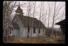
Image depicts St. Mark's Anglican Church in Woodpecker, B.C.
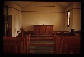
Image depicts the interior of a church, most likely St. Mark's Anglican Church in Woodpecker, B.C.
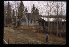
Image depicts the St. Mark's Anglican Church and a small house in Woodpecker, B.C. There is an unknown individual present.
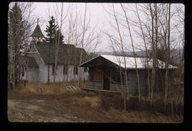
Image depicts the St. Mark's Anglican Church and a small house in Woodpecker, B.C.
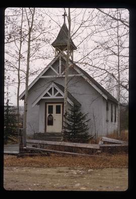
Image depicts St. Mark's Anglican Church in Woodpecker, B.C.
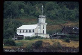
Image depicts an Anglican church in Old Aiyansh.

Image depicts a Catholic church at an unknown location.
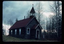
Image depicts an old Catholic church in Salmon Valley.
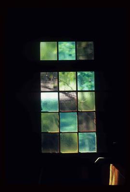
Image depicts a stained glass window from the interior of an Anglican Church in Woodpecker, B.C.
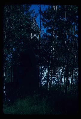
Image depicts a church in Woodpecker, B.C.
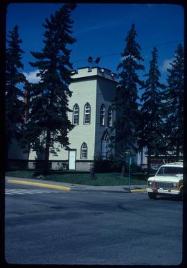
Image depicts a Knox United Church at an uncertain location, though possibly in either Hixon or Woodpecker, B.C.
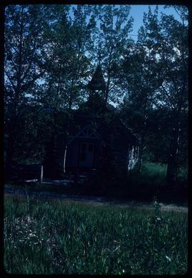
Image depicts a church in Woodpecker, B.C.
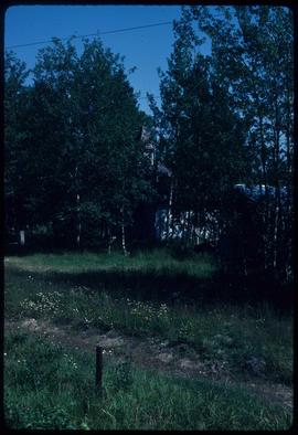
Image depicts a church in Woodpecker, B.C.

Image depicts a church in Fort St. James, B.C.
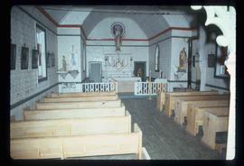
Image depicts the interior of a church, likely in Fort St. James, B.C.
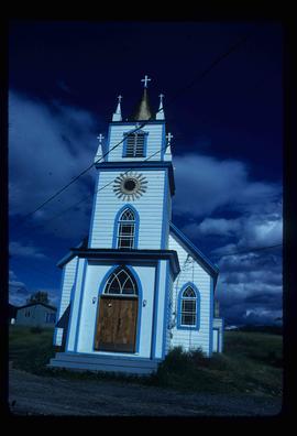
Image depicts a church, somewhere between Hazelton and Hagwilget, B.C.
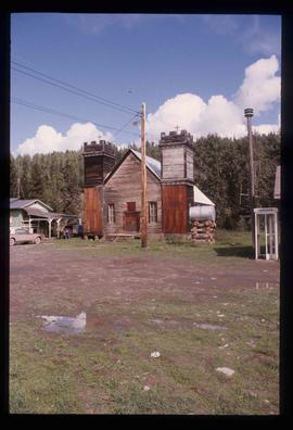
Image depicts an Anglican church in Kitwancool Lake, B.C.
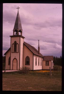
Image depicts a Catholic Church on Stoney Creek Road in Vanderhoof, B.C.
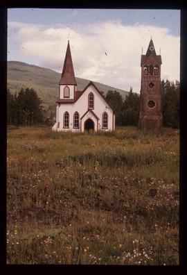
Image depicts an Anglican church and a bell tower in Kitwanga.
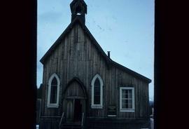
Image depicts an old Anglican Church in Barkerville, B.C.

Image depicts the interior of a church, possibly one in or near Barkerville, B.C.
File contains slides depicting St. Marie, Ontario.
File contains slides depicting a church in Shelley B.C.

Image depicts a church somewhere in McBride, B.C. The sign in front possibly reads "St. Patrick's Church."
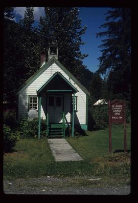
Image depicts the St. Marks Community Church in Stewart, B.C.

Image depicts an old, abandoned church located somewhere in Seton Portage, B.C.
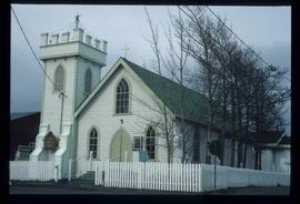
Image depicts an Anglican Church at the Atlin Museum.

Image depicts several unidentified individuals exiting a church made of logs, possibly in Fort St. John, B.C.
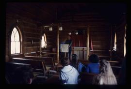
Image depicts several unidentified individuals inside of a church made from logs, possibly located in Fort St. John, B.C.