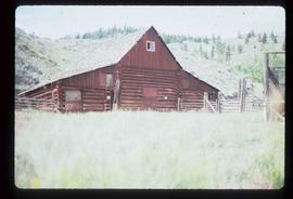
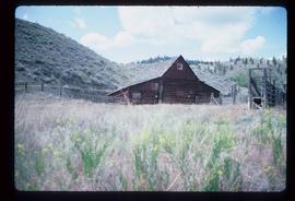
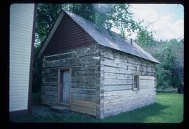
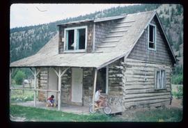
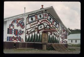
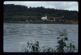
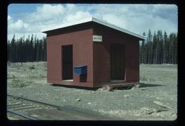
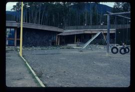
Image depicts the BCR station in Leo Creek, B.C.
Image depicts a few piles of culverts in Leo Creek, B.C.
Image depicts two cabins on the shore near the lodge at Takla Lake.
Image depicts a cabin on the "west arm" of Takla Lake.
Image depicts a lake viewed "south-east from lodge;" it is possibly Takla Lake.
Image depicts a number of identical buildings and vehicles at "Driftwood Creek" in the Driftwood Canyon Provincial Park.
Image depicts the Driftwood BCR station, possibly located near Driftwood Creek in the Driftwood Canyon Provincial Park east of Smithers, B.C.
Image depicts a group of people preparing to depart on a trip. Location is uncertain, though it is possibly in Prince George, B.C.
Image depicts an area of Barlone, B.C. surrounded by trees.
Image depicts a row of houses in Bralorne, B.C.
Image depicts the old sales office of Bralorne Pioneer Mines Ltd. which is now the Bralorne Pioneer Museum.
Image depicts a few boarded-up buildings in Bralorne, B.C.
Image depicts a church and a row of houses in Bralorne, B.C.
Image depicts a row of houses in Bralorne, B.C.
Image depicts what is possibly an old, rundown mill in Bralorne, B.C.
Image depicts several houses in Bralorne, B.C.
Image depicts what is possibly an old, rundown mill in Bralorne, B.C.
Image depicts Bralorne, B.C.
Image depicts what appears to be a motel somewhere near Bralorne, B.C.
Image depicts a hotel in what appears to be a small community, possibly an outlying area of Bralorne, B.C.
Image depicts what appears to be a mud house with grass and weeds growing on the roof at an uncertain location. An unknown woman is sitting on a bench outside of it.
Image depicts the welcome sign of the historic Hat Creek Ranch site north of Ashcroft, B.C.
Image depicts a "box barn" on the historic Hat Creek Ranch site north of Ashcroft, B.C.
Image depicts the front of the ranch house on the historic Hat Creek Ranch site north of Ashcroft, B.C.
Image depicts the road leading to the historic Hat Creek Ranch site north of Ashcroft, B.C. Several individuals are sitting on the front porch of the Ranch house.
Image depicts several individuals sitting on the front porch of the Ranch house on the historic Hat Creek Ranch site north of Ashcroft, B.C.
Image depicts numerous individuals standing near the Ranch house and McLean Cabin on the historic Hat Creek Ranch site north of Ashcroft, B.C.
Image depicts an old barn on the historic Hat Creek Ranch site north of Ashcroft, B.C.
Image depicts the Ranch house on the historic Hat Creek Ranch site north of Ashcroft, B.C.
Image depicts the McLean Cabin, built in 1861, which belonged to a retired Hudson's Bay Chief trader named Donald McLean, who was shot and killed while part of a posse that was searching for the murderers of a survey party. It is located at the historic Hat Creek Ranch site north of Ashcroft, B.C.
Image depicts a church in Deadman Creek, west of Kamloops, B.C.
Image depicts two children in front of an old log building on the Deadman Creek reserve, located west of Kamloops, B.C.
Image depicts the corner of an old log building in Deadman Creek, near Kamloops, B.C.
Image depicts several children and numerous adults inside a church in Deadman Creek, near Kamloops, B.C.
Image depicts a school and playground, possibly in New Aiyansh, B.C.
Image depicts a building painted with First Nations art in New Aiyansh.
Image depicts New Aiyansh.
Image depicts a view of Old Aiyansh.
Image depicts the McBride Hotel near the Mt. Robson Provincial Park.
Image depicts a rail road bridge over the Fraser River, possibly somewhere in the Lillooet area.
Image depicts the grave of W.L. Meason in the upper Fraser Canyon.
Image depicts the sign to Gang Ranch, located in the Upper Fraser Canyon, with graffiti on it.
Image depicts a man, possibly Kent Sedgwick, standing next to a monument which states: "In honour of the pioneers of the Ootsa Lake Valley, first settled in 1905." Located somewhere in either the Francois Lake Provincial Park or the Wistaria Provincial Park.
Image depicts a church on a hill in Moricetown, B.C.
Image depicts the entrance to the historical village of 'Ksan in Hazelton, B.C.
Image depicts a totem pole beside the grave marker of the Chief Lu-dal-da-zuatz, in Kispiox, B.C.
Image depicts the Endako Hotel in Endako, B.C.