File consists of a transcript of an oral history interview with Jeanne Anderson.
File consists of a transcript of an oral history interview with Kate Anderson and Mae Romanin.
File consists of a transcript of an oral history interview with Buster Brown.
File consists of a transcript of an oral history interview with Walter Carlson.
File consists of a transcript of an oral history interview with Heather (Scott) Empey.
File consists of a transcript of an oral history interview with Arturo Garcia-Alonso.
File consists of a transcript of an oral history interview with Lea Gobbi and Kate Anderson.
File consists of a transcript of an oral history interview with Joe Rositano.
File consists of a transcript of an oral history interview with Joe Rositano.
File consists of a transcript of an oral history interview with Horst Sander. Also includes photocopies of Horst Sander's personal records, such as a tree farm license.
File consists of a transcript of an oral history interview with Carl Strom.
File consists of a transcript of an oral history interview with Ray Williston.
File consists of a transcript of an oral history interview with Ken Sasaki.
File consists of an audio recording of an interview with Jeanne Anderson. Includes one copy of the original recorded audio cassette; the original recording is not held by the archives.
File consists of an audio recording of an interview with Kate Anderson and May Romanin. Includes one original recorded audio cassette and three copies.
File consists of an audio recording of an interview with Buster Brown. Includes two copies of the original recorded audio cassette; the original recording is not held by the archives
File consists of an audio recording of an interview with Walter Carlson. Includes one original recorded audio cassette and one copy.
File consists of an audio recording of an interview with Ruth Cunningham, Lillian Coulling, and Evelyn Rebman. Includes two original recorded audio cassettes and two copies.
File consists of an audio recording of an interview with Heather (Scott) Empey. Includes one original recorded audio cassette and one copy.
File consists of an audio recording of an interview with Arturo Garcia-Alonso. Includes two copies of the original recorded audio cassette; the original recording is not held by the archives.
File consists of an audio recording of an interview with Andre Laquerre. Includes one original recorded audio cassette.
File consists of an audio recording of an interview with Joe Rositano. Includes one original recorded audio cassette and one copy.
File consists of an audio recording of an interview with Joe Rositano. Includes one original recorded audio cassette and one copy.
File consists of an audio recording of an interview with Horst Sander. Includes two original recorded audio cassettes and two copies.
File consists of an audio recording of an interview with Ken Sasaki. Includes one original recorded audio cassette and three copies.
File consists of an audio recording of an interview with Carl Strom. Includes one original recorded audio cassette and one copy.
File consists of an audio recording of an interview with John and Bernice Trick. Includes one original recorded audio cassette and one copy.
File consists of an audio recording of an interview with Ray Williston. Includes three original recorded audio cassettes and three copies.
File consists of a transcript of an oral history interview with Ruth Cunningham, Lillian Coulling, and Evelyn Rebman. Also includes photocopies of Ruth Cunningham's personal records, such as photographs and newspaper clippings.
File consists of a transcript of an oral history interview with Andre Laquerre.
The Upper Fraser Historical Geography Project was conducted by UNBC faculty and a team of researchers between 1999 and 2002. The lead researchers were Aileen Espritiu, Gail Fondahl, Greg Halseth, Debra Straussfogel, and Tracy Summerville. The project resulted in the creation of 93 oral history records and their transcripts. Participants included regional forest industry executives, politicians (including former MLA Ray Williston, local mayors and Fraser Fort George Regional District representatives), forest industry workers, and former and contemporary Upper Fraser community residents. The oral histories document the rise, consolidation and demise of the forestry-based settlements along the Upper Fraser River between 1915 and 2000.
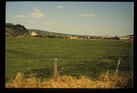
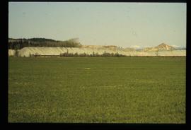
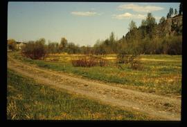
Image depicts a field in Giscome, B.C. On the right side of the image, in the background, is a grey strip that appears to be a mine, possibly the quarry at Eaglet Lake in Giscome, B.C. Map coordinates 54°03'52.9"N 122°22'10.0"W
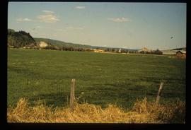
Image depicts a field in Giscome, B.C. On the right side of the image, in the background, is a grey strip that appears to be a mine, possibly the quarry at Eaglet Lake in Giscome, B.C. Map coordinates 54°03'52.9"N 122°22'10.0"W
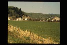
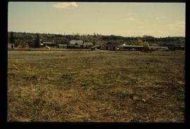
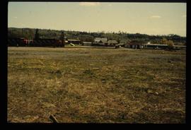
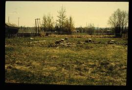
Image depicts an open field and numerous buildings, including a church in Giscome, B.C. Map coordinates 54°04'03.2"N 122°22'04.6"W
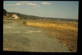
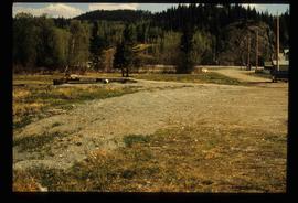
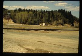
Image depicts an open area with Eaglet Lake in the background. It depicts the previous site of the mill at Giscome, B.C. Map coordinates 54°04'19.7"N 122°22'04.7"W
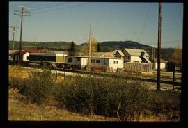
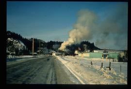
Image depicts the Giscome B.C. townsite from across the railroad tracks looking southeast. Map coordinates 54°04'19.7"N 122°22'04.7"W
Image depicts the Giscome B.C. townsite from across the railroad tracks looking southeast. Map coordinates 54°04'19.7"N 122°22'04.7"W
Image depicts what is possibly the quarry located at Eaglet Lake in Giscome, B.C.
Previous site of sawmill in Giscome, B.C. looking northwest. Map coordinates 54°04'19.7"N 122°22'04.7"W
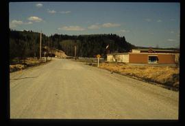
Image decpicts the old road to the townsite in Giscome, B.C. Map coordinates 54°04'19.7"N 122°22'04.7"W
Image depicts debris left in residential area on Giscome, B.C. townsite. Map coordinates 54°04'16.7"N 122°21'55.1"W
Image depicts the Giscome railway station and buildings remaining in townsite in Giscome, B.C. Map coordinates 54°04'18.0"N 122°22'04.7"W
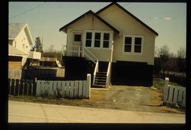
Image depicts a house with the main floor and entrance high off the ground. The location is uncertain, likely Giscome, B.C.
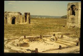
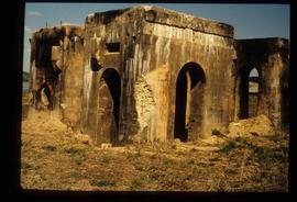
Image depicts several unidentified concrete structures that are badly damaged and cracking, located on old mill site in Giscome, B.C. Map coordinates 54°04'18.0"N 122°22'04.7"W
Image depicts several unidentified concrete structures that are badly damaged and cracking, located on old mill site in Giscome, B.C. Map coordinates 54°04'18.0"N 122°22'04.7"W
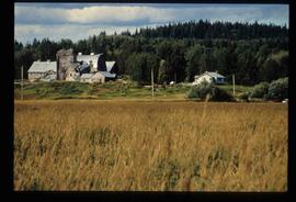
Image depicts a large, old and collapsing barn, as well as a nearby house of the dairy farm in Giscome, B.C. Map coordinates 54°03'53.3"N 122°21'22.6"W
Image depicts the Giscome mill site in Giscome, B.C. The bunkhouse is in the background on the left and the school is in the foreground on the right. Map coordinates 54°04'04.8"N 122°22'04.7"W
Image depicts the Giscome mill site in Giscome, B.C. The bunkhouse is no longer there and the school is in the foreground on the right. Map coordinates 54°04'04.8"N 122°22'04.7"W
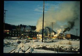
Image depicts the Giscome mill site in Giscome, B.C. The bunkhouse is the large building with many windows. A train and railroad tracks are in the foreground. Map coordinates 54°04'17.6"N 122°22'06.1"W
Image depicts the Giscome mill site in Giscome, B.C. The railroad tracks are in the foreground. Map coordinates 54°04'17.6"N 122°22'06.1"W
