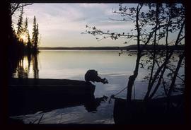
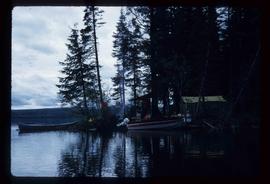
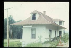
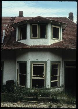
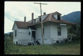
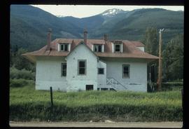
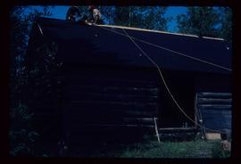
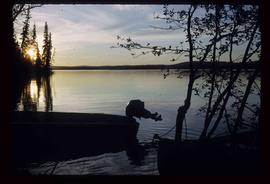
Image depicts two boats on the shore of Carp Lake.
Image depicts a man holding a chain of fish on the shore of Carp Lake.
Image depicts a campsite on the shore of Carp Lake.
Image depicts a green canoe sitting in the water on the shore of Carp Lake.
Image depicts a group of people preparing to depart on a trip. Location is uncertain, though it is possibly in Prince George, B.C.
Image depicts Bobtail Lake.
Image depicts a house which is possibly in Prince Rupert, B.C.
Image depicts a row of houses; it is possibly in Prince Rupert, B.C.
Image depicts an old building with a sign labelling it as a "Dining Lounge," it is possibly in Prince Rupert, B.C.
Image depicts a condominium, possibly in Prince Rupert, B.C.
Image depicts an old theatre owned by Paul Aivazoff in Prince Rupert, B.C. It opened in 1935 and was closed in 1981; it has since been renovated for retail use.
Image depicts a train track and several buildings in an unknown location.
Image depicts the rail yards in Prince Rupert.
Image depicts a shed in an unknown location.
Image depicts two rows of houses in an unknown location.
Image depicts several old log cabins, possibly at McLeod Lake.
Image depicts a log house at an uncertain location.
Image depicts the Alkali Lake Ranch in Akali Lake, B.C.
Image depicts the Harrison House in Kersley, B.C.
Image depicts an old log cabin at an uncertain location.
Image depicts the Tsek'enhe cemetery at McLeod Lake.
Image depicts McLeod lake.
Image depicts the Pack River outlet at McLeod Lake.
Image depicts the Kwinitsa CNR station, which is Prince Rupert's railway museum.
Image depicts the Kwinitsa CNR station in Kwinitsa, along the Skeena River.
Image depicts the McBride CNR station.
Image depicts an abandoned cabin and shed on Blackwater Road.
Image depicts an abandoned, deteriorating cabin on Blackwater Road.
Image depicts the interior of an abandoned, deteriorating cabin on Blackwater Road.
Image depicts a shed on Blackwater Road.
Image depicts an Anglican church in Old Aiyansh.
Image depicts a Catholic church at an unknown location.
Image depicts an old Catholic church in Salmon Valley.
Image depicts a house on Blackwater Road.
Image depicts an old log house with a collapsing roof in Salmon Valley.
Image depicts an old log cabin in Salmon Valley.
Image depicts a house in 127 Mile House, B.C.
Image depicts an old, rundown building at an uncertain location.
Image depicts the 132 Mile House Ranch.
Image depicts the 137 Mile House.
Image depicts an old government building, believed to have once housed the RCMP, in 150 Mile House, B.C.
Image depicts the Harrison House in Kersley, B.C.
Image depicts an old, rundown building in Dunster, B.C. Possibly a disused Rail Station.
Image depicts a log cabin, with a few unknown individuals working on the roof, in Woodpecker, B.C.