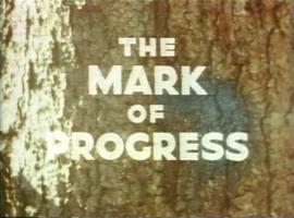
The research of Dr. Joselito Arocena was extensive and multi-disciplinary. The records contained within this series of research material provide only a small glimpse of the depth and breadth of his research portfolio. The majority of Dr. Arocena's research results were released in his 200+ academic publications over the course of his career. This series contains a selection of research records that were unpublished and cover research projects that relate to the health of BC indigenous communities, the McGregor Model Forest, and others.
File consists of selected personal records from Dr. Joselito Arocena's digital media. Includes 3 floppies and migrated data from hard drives.
File consists of Dr. Joselito Arocena's promotion package for rising to the rank of full professor at UNBC.
File consists of Dr. Joselito Arocena's annual reports and promotion records relating to his employment at UNBC.
File consists of administrative records relating to the academic accomplishments of Dr. Joselito Arocena. Includes merit awards, letters of congratulation, and acceptance correspondence.
File consists of records relating to the Arocena's application and offer of employment at UNBC as Assistant Professor in the Faculty of Natural Resources and Environmental Studies. His start date at UNBC was 1 July 1994.
File consists of photocopies of the academic degree diplomas of Dr. Joselito Arocena as well as documents relating to approvals from his PhD committee.
Series consists of Dr. Joselito Arocena's personal records that provide background context to his academic accomplishments, research, and professorial tenure at UNBC.
Fonds consists of the research and professorial records of Dr. Joselito Arocena, a founding faculty member of UNBC. Arocena was an internationally-recognized soil scientist and UNBC’s first Canada Research Chair. His records demonstrate his accomplishments as an academic and researcher, as well as his many and varied interdisciplinary research endeavours. Also included are selections from Arocena’s extensive photographic slide collection which illustrate his teaching, research projects, and personal interests.
Zonder titelFile consists of two signs:
- "Government of British Columbia Official Use Only"
- "British Columbia Forest Service Research Plot No Cutting or Disturbance".
File consists of a plaque dedicating a tree to Harry Coates for his work in the Prince George Forest Region (1957-1993).
File includes seven of awards and plaques as well as 3 pins awarded to Harry Coates through his years of service.
File consists of a forestry tool called a dibble and mile marker.
Series consists of tools and materials Harry Coates used during his work as a BC Forest Service Research Technician at Aleza Lake Research Forest. Series also includes awards Harry Coates received during his career.
Item is a map compiled and produced by Geographic Division, Surveys and Mapping Branch, Department of Lands, Forests, and Water Resources ; geological and physiographical data supplied by Dept. of Mines and Petroleum Resources, Victoria, B.C. (1964).
Item is a map of Aleza Lake Research Forest land management units and boundaries. By Madrone Consultants Ltd. May, 9, 1997.
Item is McBride, B.C. Sheet 93H and Part of 83E Second Status Edition (1971) from "Classification and Interpretation of some Ecosystems of the Rocky Mountain Trench, Prince George Forest Region, British Columbia: First Approximation" (1984).
Item is McNaughton Lake, B.C. Map 83D and Part of 83C Second Status Edition (1975) from "Classification and Interpretation of some Ecosystems of the Rocky Mountain Trench, Prince George Forest Region, British Columbia: First Approximation" (1984).
Item is a map of Prince George Wood Preserving Ltd. Development Plan Forest Licence A27771 for the period of January 1, 1986 to January 1, 1991: Fraser Operating Area. Geographic features include the Fraser River.
Item is a Forest Cover Map, 93J-7, annotation on the back reads Summit Lake. Geographical features include Summit Lake and Crooked River.
Item is a Forest Cover Map, 93J-10-d, annotation on the back reads Carpet Lake. Geographic features include Merton Lake and Peculiar Lake.
File consists of trail maps and recreation guides from various places in British Columbia, especially Northern British Columbia. Maps include:
- British Columbia Road Map and Parks Guide
- Northwood Pulp and Timber Limited Forest Operations Recreation Map
- Provincial Parks of Northern British Columbia
- Visitor's Guide: Mackenzie Woodlands
- Visitors Guide: Mackenzie Woodlands
- Mackenzie Forest District Recreation Map
- Dawson Creek Forest District Recreation Map
- Morice Forest District Recreation Map
- Fort St. James Forest District Recreation Map
- Lakes Forest District Recreation Map
- Cariboo Forest Region Recreation Map
- Lakes District Visitors Map
- Prince George Forest District Recreation Map
- Vanderhoof Forest District Recreation Map
- Fort St. John Forest District Recreation Map
- Cariboo Forest Region Recreation Map (East)
- Robson Valley Forest District Recreation Map
- Fort Nelson Forest District Recreation Map
- Forest Service Recreation Sites: Valemount - Blue River
- Forest Service Recreation Sites: McBride - Goat River
- Forest Service Recreation Sites: Prince George West
- Forest Service Recreation Sites: Moberly - Sukunka
- Forest Service Recreation Sites: Nation - Takla
- Forest Service Recreation Sites: Murrat - Kiskatinaw
- Recreation Road Map for the Prince George Forest Area (1987-1988)
- Recreation Road Map for the Prince George Forest Area (1997)
- The Bobtail Forest Service Road Tour
- Forest Recreation Map: Northwood Pulp and Timber Limited
- Forest Operations Recreation Map: Northwood pulp and timber limited
- Forest Service: Recreation Sites Williston/Mackenzie
- Forest Service Recreation Sites Prince George West
- The Official Prince George Tourist Street Map
- Ecological Reserves in British Columbia (July 1990)
- Prince George Forest District map (April 1990) with annotations regarding trials.
Series consists of maps, and road maps, and trail guides from various communities and regions in Northern and Central BC. Series includes Forest Cover Maps and maps related to BC forest and natural resource management.
Item is a photograph of a team of ten horses hauling logs.
Item is an aerial photograph of a research nursery at Red Rock in September 1972.
File consists of 17 slides of Aleza Lake Research Forest.
File consists of 26 photographs including: 10 images of Aleza Lake Research Forest aerial photos; 4 images of packed cones from Red Rock to Duncan 1970; 11 black and white forestry photographs; photo of J. Revel.
File consists of photographs of forestry related activities.
File consists of photographs mostly depicting trees, forests, and logs. Some photos include Harry Coates. One set of photographs shows Harry Coates accepting an award.
File consists of Air photos BC85019 no. 141-143, 197-198 and BC5249 no. 10, 12, and 29.
File consists of photographs of sapling measurements for experiment 713.
File consists of photographs of sapling measurements for experiment 697.
File consists of photographs of sapling measurements for experiment 646.1.
File consists of photographs of "partial willow kill - good Aspen + Fireweed control 147-009 85/87" largely depicting deforested land and young trees. Some photographs are aerial photographs.
File consists of photographs of trees and forests, some photographs include Harry Coates.
File consists of 47 photographs of Dawson Creek forestry activities.
File consists of 47 photographs of cleared forest with some regrowth. File includes images from Prince George West - Bill's Creek 104:814: 85/87 Unit 'A'; Red Rock seed orchard July 22, 1986 Permit no. 400-360: 86/87; Mackenzie Forsar Project 86-9-9 adjacent to velpar treatment; 147-005 84/86 TFL 30 CP 5 #26; 147-008 85/87 TFL 30 CP.5 Unit 1; Northwood TFL 30 CP 12E Unit 15, Pesticide use permit #147-012:85/87.
File consists of two sets of photographs. The first set consists of 19 photographs of a cleared site with evidence of former fire damage and new growth. The second set consists of 40 photographs from EP 668 from 1972 of seedling or [wildling] heights, this set of photographs are documented with notes.
Item is a photograph of Harry Coates surrounded by seedlings and sapling trees.
File consists of 35 photographs of trees, cleared forest land, experimental plots sites, plantations, equipment, and one photograph of Harry Coates.
- 8 photos in folder "FES [Forest Experiment Station] [Stem?] Mapping"; photos include pictures of the Aleza Lake Research Forest Sign, trees, 3 photos from CP 410 Oct. 1992, and photo of Aleza Lake E loop [trail?] 1992
- Black and white photo of a young Harry Coates
- 5 photos in folder "SHEEP July 1990" include 2 photos of cleared land (back of each photo reads "Sheep penny?") and 3 photos of a an unknown piece of forestry equipment
- 8 photos in folder "Fire" of various locations of fire damaged forests in 1992
- 13 photos in "More Planting" envelope; photos include 1 from Red Rock plantation in 1971; 2 from Cedar Plot in Valemont in Fall 1992; 2 from Cedar Goat R[oad] Fall 1992; 2 from [Compan Plantation?], Spittal Creek Fall 1992; Douglas Fir, Valemount - Cedar [Creal?]; Spaced Aspen Spittal Creek Fall 1992; 2 Cedar Plot, Spittal Creek, Fall 1992; Whit Pine Spittal Creek Fall 1992; Buckhorn B. Spruce 1978.
File consists of 10 air photos: BC85019 No. 111, 112, 140, 199 (CFS McGregor written on reverse), 200; BC77004 No. 199 (comment on reverse re location of tie point, 200; and 3 higher altitude air photos with no obvious label. Note that BC77004 No. 199 and 200 have MOF stamps on the reverse.
File consists of three copies of two photos of Harry Coates printed next to each other with the words "Genetic Variability of a White Spruce Seedlot".
File consists of 19 photographs depicting Harry Coates, experiments, landscapes, and air photos, including:
- Photo pf Harry Coates ca. 1958 at Aleza lake Experiment Station
- Photo of Lloyd Brothers at Cluculz Lake, Gordon Talbot
- 3 photos: including a photo of pine trees, a photo of Harry Coates with a damaged tree, and a photo of a damaged pine
- 1 photo of a young man in safety gear sitting in the back of a parked pickup struck, holding circular saw and smiling at the camera
- 3 photos of cleared forest in the winter
- 2 photos from EP 442 Wansa Lake, P. 60, 61 and 70
- 3 photos of Fire Study June 1984
- 1 photo of EP 657.03 Squirral Damage, June 1984
- 1 photo EP 868.07 McBride May 1984
- 3 photos of Bobtail Demo 660 in 1992, EP 657.03.
File consists of photocopied plot layouts from an unknown original source and 39 photographs taken during experiments.
File consists of 29 photographs of silviculture activities and equipment. Photographs include:
- 4 photos from Buckhorn EP [549.3] * 2 photos of a "bracke mounder" attachment
- 21 photos of mounding and herbicide trial(s)
- a large photo of a seedling
- a large photo of Harry Coates measuring a small tree.
File consists of 6 photographs depicting Spruce Plantation Spacing Trials in Anzac taken ca. 1980s.
Series consists of forestry photographs. Series includes photographs taken at experimental plots.
A VHS tape containing "The Mark of Progress" film created by the British Columbia Forest Service and first played for a live audience in 1959 in Prince George, BC.
File consists of two videos:
- A VHS video tape containing "Mark of Progress" promotional and possible training video for the BC forest industry in and around Prince George
- A VHS tape "Reforestation in British Columbia: A Growing Success" published by the Province of British Columbia Ministry of Forests.
File consists of pamphlets and brochures including:
- "The Ancient Forest: A Walk through British Columbia's Hidden Treasure"
- Northern Silviculture Committee "Research Using the Past to Step into the Future"
- "Jumpingpound Demonstration Forest: A Self-Guided 10 kilometer Discovery Trip"
- "Willow River Demonstration Forest"
- "Roads, Rivers and Trails of the Lower Blackwater River"
- Roads, Rivers and Trails of the Bella Coola Valley"
- "Teapot Mountain Hiking Trail"
- "Bobtail Bluff Hiking Trail"
- "Fort George Canyon: Hiking Trail"
- Northwood informational booklet.