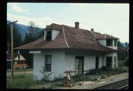
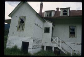
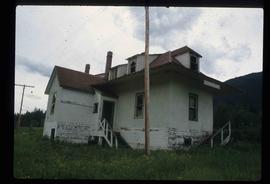
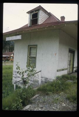
Image depicts an unidentified individual standing next to a marker and a stake at an uncertain location.
Image depicts an unidentified individual setting up some sort of pole in the snow for a process the slide labels as "snow sounding." The location is uncertain.
Image depicts a marker for aerial photography at an uncertain location. The slide labels it as "Elizabeth Station."
Image depicts a log house at an uncertain location.
Image depicts the corner of a log house at an unknown location.
Image depicts a fence, perhaps somewhere in the Chilcotin region.
Image depicts a fence somewhere in Anahim Lake, B.C.
Image depicts a fence in the Blackwater River area in the Chilcotin.
Image depicts a wooden Ranch House at an uncertain location.
Image depicts a shed somewhere in Kitwancool Lake, B.C.
Image depicts a wooden fence at somewhere in Meldrum Creek, B.C.
Image depicts a wooden fence at an uncertain location, perhaps somewhere in the Chilcotin region.
Image depicts a cabin at an unknown location.
Image depicts a cabin at Fraser Lake, B.C. which is labelled on the slide as an example of a "square log" dovetail joint.
Image depicts the corner of a log house, the slide itself labels the picture as being from Barkerville, B.C. and also indicates the corner is an example of a "round log" dovetail joint.
Image depicts the old Dunster Station in Dunster, B.C.
Image depicts the town of Dunster, B.C.
Image depicts the old Dunster Station in Dunster, B.C.
Image depicts the interior of the old Dunster Station in Dunster, B.C.
Image depicts the train tracks at the old Dunster Station in Dunster, B.C.
Image depicts the interior of the old Dunster Station in Dunster, B.C.
Image depicts the old Dunster Station in Dunster, B.C.
Image depicts a grave somewhere along the White Pass railway.
Image depicts a view over a forested, mountainous area and a river towards the vicinity of Skagway, Alaska.
Image depicts an old trestle along the White Pass railway, and the White pass Train on the left of the image.
Image depicts the White Pass Train crossing over a railway bridge at an uncertain location in the mountains.
Image depicts a patch of snow-covered ground with a sign that reads "Trail of 98," somewhere along the White Pass railway.
Image depicts two merging railway tracks, and what appears to be a frozen river, somewhere near the summit of a mountain.
Image depicts an old trestle along the White Pass railway.
Image depicts the White Pass Train entering a tunnel in the mountain side.
Image depicts another train on the White Pass railway along a forested mountain side.
Image depicts the White Pass Train crossing over a railway bridge at an uncertain location.
Image depicts a mountain side somewhere along the White Pass railway. The thin ridge along the mountain side is possibly either a highway or part of the railway.
Image depicts a forested mountain side somewhere along the White Pass railway. The thin ridge along the mountain side is possibly either a highway or part of the railway.