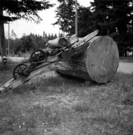
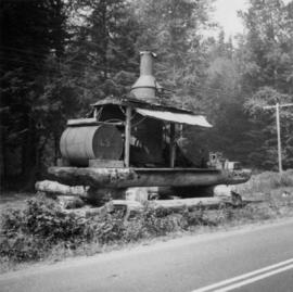
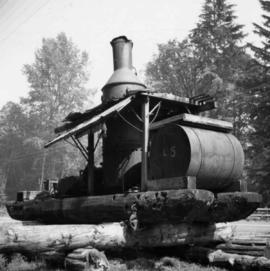
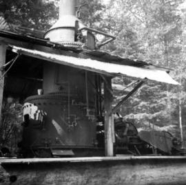
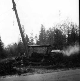
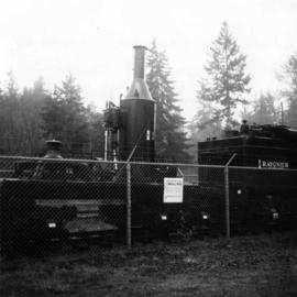
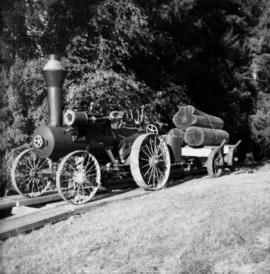
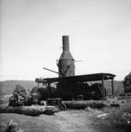
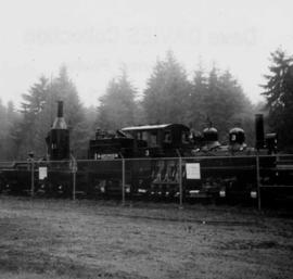
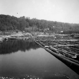
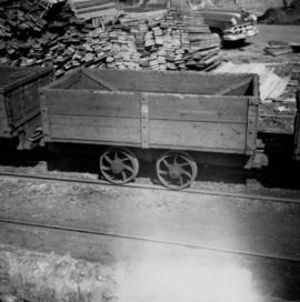
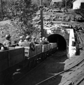
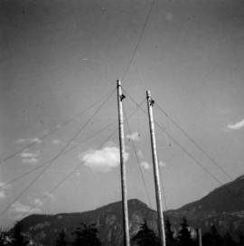
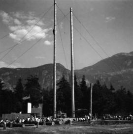
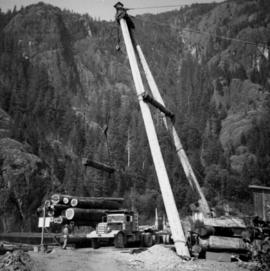
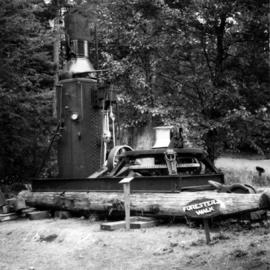
Photograph depicts an early spool donkey at the Cowichan Valley Forest Museum
Photograph depicts a saw on the outskirts of Courtenay on the road to Cumberland.
Photograph depicts a view of a steam donkey probably at Sayward near Kelsey Bay on North Vancouver Island.
Photograph depicts the reverse view of a steam donkey at Sayward near Kelsey Bay on North Vancouver Island.
Photograph depicts a Vancouver Iron Works built steam donkey in use until the early 1950s. It was purchased for $800 by an enthusiast in 1963 , set up beside home and roadside at Sayward near Kelsey Bay on North Vancouver Island.
Photograph depicts a steam donkey beside a mill pond of a shingle mill at Sappho or Tyee, on the Olympic Peninsula. It is steam fed from the main plant boiler.
Photograph depicts an early type of steam donkey mounted on a flatcar and attached to a Shay Tank. It is displayed on the roadside at Promised Land Park, probably near Forks, on the Olympic Peninsula in Washington state.
Photograph depicts a tractor owned by G. Wellburn at the Duncan Forest Museum.
Photograph depicts a steam donkey located in the Crown Zellerbach Museum at Ladysmith on Vancouver Island.
Photograph depicts an early type of spool donkey circa 1890-1900, on display at Promised Land Park on the Olympia Peninsula in Washington state.
Photograph depicts a logging museum in Ladysmith on Vancouver Island.
Photograph depicts pole climbing in logger sports probably at Squamish, B.C.
Photograph depicts logger sports at Squamish, B.C.
Photograph depicts a lumber mill probably in the Lower Mainland.
Photograph depicts pole climbing in logger sports probably at Squamish, B.C.
Photograph depicts a lumber mill probably in the Lower Mainland.
Photograph depicts a mill on the north stream of the north arm of the Fraser River, looking east from the Fraser St. bridge.
Photograph depicts a baby seal at C.N. log drop at Cowichan Lake on Vancouver Island.
Photograph depicts a lumber mill probably in the Lower Mainland.
Photograph depicts dumping logs at Gold River on the west coast of Vancouver Island.
Photograph depicts a log boom probably in the Lower Mainland or on Vancouver Island.
File consists of documentary photographs taken by David Davies of the forest and lumber industry in British Columbia.
Photograph depicts the newsprint plant of MacMillan, Bloedell, and Powell River Ltd. In Powell River, B.C. The view is looking northwards and shows that the plant is working on Easter Day/
Photograph depicts a general view, looking north, of Westview Harbour with the Powell River paper plant smoking in the background.
Photograph depicts a small coal tram at Tsable coal pit near Fanny Bay on Vancouver Island.
Photograph depicts the Tsable coal pit on Vancouver Island as the first coal of the afternoon shift being hauled up.
Photograph depicts coal miners near Buckley Bay. The afternoon shift (3 p.m.) is going down the Tsable drift mine, which is the only working coal pit on Vancouver Island in 1964 and has a total of 70 employees. It is run by the Comox Colliery Co. and has a daily production of 200-300 tons.
Subseries consists of prints and negatives depicting railways in British Columbia, as well as a small selection of other subjects such as historical ships, buildings, vehicles, and bridges. All photographs created by David Davies.
Series consists of graphic material depicting railways in British Columbia. Includes prints, negatives, and postcards.
Technical drawing depicts a condensed profile of the CN Albreda subdivision.
Map depicts the City of Squamish, Howe Sound, and the Britannia Mine.
Plan depicts the location of the Lyon Creek Bridge and borrow pit on the CNR Clearwater subdivision.
Plan depicts a section, profile, and contour plan of the fill of the Lyon Creek Trestle bridge in the Clearwater CNR subdivision.
Map depicts the Shuswap Lakes, Rogers Pass, Kamloops, Yellowhead Pass, Thompson Valley, and the Nicola Valley. Also includes the first clues to a treasure hunt.
Map depicts location of treasure hidden between Clearwater and Clemina, BC.
Contour plan shows layout of a water tunnel near Lyon's Creek in the CNR Clearwater subdivision.
Sign says "Pacific Great Eastern Railway Company - Explosives - Handle Carefully - Keep Fire Away - North Vancouver Station June 25 1969". Also includes condensed rules for handling cars with explosives.
Map depicts locations of all mining properties in British Columbia. Includes index with names of owners of properties.
Plan depicts Granville Island industrial sites in False Creek, Vancouver. Shows revised trackage from 1955 annotated in colour by Davies.
Plan depicts a proposed location for a CNR station and crossing in Kelowna.
Plan depicts the proposed location and layout for the Canadian Northern Pacific terminal at Kamloops on the Kamloops-Lumby branch.
Plan depicts "scheme B" of the proposed 6 stall addition to the roundhouse at Kamloops, BC.
Plan depicts sections, elevations, and floor plans for the addition to the Kamloops roundhouse.
Plan depicts architectural drawings of the Canadian National Railway station in Kamloops. Includes an elevation of the building and floor plans.
Plan depicts the Canadian Pacific Railway yards in Kamloops and the proposed connection between CPR and CNR. Includes a CPR track profile, profiles of street crossing, and enlargements.
Plan depicts the proposed CNR rail yard layout in Kelowna. A later plan, dated May 30th 1925, shows drastically reduced trackage and no barge slip.
Plan depicts the CNR rail yard in Kamloops. The plan was originally drafted on March 6, 1928 and updated to July 1937.
Plan depicts the location of buildings occupied by the Northern Construction Company on the old Kamloops Station ground.