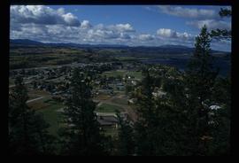
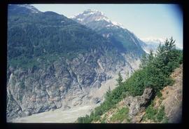
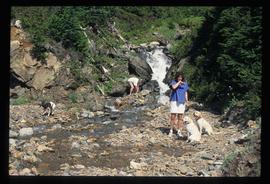
Image depicts numerous unknown individuals swimming in a lake or standing on a dock at an uncertain location.
The item is a photograph of the Prince George Federal Government Building, commonly referred to as the 'old post office.' The photograph depicts the exterior west wall of the building. Building was previously located at 1239 3rd Avenue, Prince George.
Item is an original 1994 map titled "Welcome to Prince George" that includes the Prince George Heritage River Trails. The map was published by the City of Prince George.
Image depicts a view of Fraser Lake.
The item is a photograph of the Prince George Federal Government Building, commonly referred to as the 'old post office.' The photograph depicts the exterior west wall of the building. Building was previously located at 1239 3rd Avenue, Prince George.
File contains slides depicting various places located across Canada.
Image depicts a marching band with numerous other unidentified individuals. One man is carrying a Canadian flag with the depiction of men in a boat and the words "Canada Sea-to-Sea" on it.
Image depicts a marching band with numerous other unidentified individuals. One man is carrying a Canadian flag with the depiction of men in a boat and the words "Canada Sea-to-Sea" on it, and there is a mascot beside him that appears to be a chipmunk in an RCMP uniform.
Image depicts a marching band with numerous other unidentified individuals. One man is carrying a Canadian flag with the depiction of men in a boat and the words "Canada Sea-to-Sea" on it.
Image depicts a group of individuals standing on the corner of 3rd Ave in Prince George, B.C.
File consists of notes, clippings, and reproductions relating to Tete Jaune.
File consists of notes, clippings, and reproductions relating to proposed heritage buildings in Prince George. Includes: "A heritage to remember" typescript document prepared by the Prince George Joint Heritage Advisory Committee (Dec. 1983); "Heritage aspects of 886 Vancouver Street" typescript letter sent to Alderman Monica Becott from Kent Sedgwick (2 May 1991); and "House at 1677 - 7th Ave". typed letter to Ed Chanter from Kent Sedgwick (9 Sept. 1994). Also includes photographs depicting houses at the addresses 1651 Fifth Avenue, 1085 Vancouver Street, 983 Vancouver Street, 1675 Fifth Avenue, 1643 Fifth Avenue, 886 Vancouver Street, 1734 Twelfth Avenue (1991).
The item is a photograph depicting the front and side view of a white coloured house at 1699 5th Avenue in Prince George. Annotation on reverse side of picture states, "1675 5th Sept 94."
The item is a photograph depicting the front view of a white coloured house at 1699 5th Avenue in Prince George. Annotation on reverse side of picture states, "1675 5th Sept 94."
Image depicts a dog on a road, and a view of the mountains in Bear Glacier Provincial Park.
Image depicts a house with a vehicle in a garage and the number 40 on it; location is uncertain.
File consists of notes, clippings, and reproductions relating to secondary sources of Prince George's development and historiography. Includes: "Ted Williams Slides" notes by Kent Sedgwick; "Nechako River cutbanks" card with a painting depicting the Nechako River cutbanks in Prince George; "Historic Timeline of Prince George" typed document created by Kent Sedgwick (2009); "Historiography of Northern British Columbia Project" typed document sent out to College Height Secondary School by Ted Renquist regarding a project to develop a historiography of Northern British Columbia (15 Apr. 1991); and "Canadian Encyclopedia" typed letter from Adriana Bryenton with the Canadian Encyclopedia requesting review of the Prince George article for the Canadian Encyclopedia (29 June 1994).
Image depicts a woman named "Gail" on a trail to Portage Lake.
Image depicts Divide Lake.
Image depicts two women sitting on a fallen tree on the shore of a lake, possibly Portage Lake; the woman in blue is "Gail," and the woman in red is Sue Sedgwick.
Image depicts Bear Glacier in the foreground and numerous mountain peaks in the background in Bear Glacier Provincial Park.
Image depicts two individuals and three dogs standing by a stream at an uncertain location, possibly somewhere in Bear Glacier Provincial Park. The woman in purple is possibly Sue Sedgwick.
Image depicts Sue and Kent Sedgwick with two dogs, standing with the Bear Glacier in the background.
Image depicts Sue Sedgwick with a dog, standing with the Bear Glacier in the background.
Image depicts numerous mountains surrounding the Bear Glacier.
Image depicts several unidentified individuals inside a building, one of which is carving a totem pole. The location is uncertain.
Image depicts several unidentified individuals standing outside a building, and holding intricately painted drums; the woman on the right is Sue Sedgwick. The location is uncertain.
Image depicts an intricately painted drum. The location is uncertain.
Image depicts Sue Sedgwick seated in a lawn chair near a campfire and several other unidentified individuals, as well as three dogs. The location is uncertain.
Image depicts a cookhouse at Sinclair Mills, B.C.
Image depicts a snow-covered road with vehicle tracks, and several houses. The location is uncertain.
Image depicts a dilapidated house in Sinclair Mills, B.C.
Image depicts a small house with brightly coloured door and window frames in Penny, B.C.
Image depicts mountains in the background and two unidentified individuals standing on a dirt road in the bottom left corner. The location is uncertain, likely Longworth, B.C.
Image depicts a house surrounded by trees and a mountain in the background; it is most likely located somewhere in or near Longworth, B.C.
Image depicts a riverboat on the Fraser River, possibly in Longworth, B.C.
Image depicts what appears to be a teepee at an uncertain location.
Image depicts a road covered in snow running through the woods at an uncertain location.
Image depicts a dirt road and a possibly abandoned building at an uncertain location.
Image depicts an older building with numerous vehicles parked out front in Upper Fraser, B.C. Map coordinates 54°07'03.5"N 121°56'34.4"W
Image depicts a row of houses in Upper Fraser, B.C. Map coordinates 54°06'51.6"N 121°56'26.3"W
Image depicts a field in Giscome, B.C. On the right side of the image, in the background, is a grey strip that appears to be a mine, possibly the quarry at Eaglet Lake in Giscome, B.C. Map coordinates 54°03'52.9"N 122°22'10.0"W
Image depicts the Giscome B.C. townsite from across the railroad tracks looking southeast. Map coordinates 54°04'19.7"N 122°22'04.7"W
Image decpicts the old road to the townsite in Giscome, B.C. Map coordinates 54°04'19.7"N 122°22'04.7"W
Image depicts a house with the main floor and entrance high off the ground. The location is uncertain, likely Giscome, B.C.
Image depicts a large, old and collapsing barn, as well as a nearby house of the dairy farm in Giscome, B.C. Map coordinates 54°03'53.3"N 122°21'22.6"W
Image depicts the former location of employee houses on mill site in Giscome, B.C. Map coordinates 54°04'23.4"N 122°22'16.9"W
Image depicts several old buildings in a field, one of which has a caved-in roof, in Newlands, B.C. Map coordinates 54°06'28.2"N 122°12'01.0"W
Image depicts three people standing at the front door of a house at an uncertain location.
Image depicts a grave-marker with several names, it reads: "In Memory of Edith Golder, Winnifred Golder, Baby Pelton, Mrs. Nazarek, Baby Nazarek, Baby Wazylyk 1915 - 1929." It is located in the Willow River Cemetery.