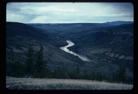
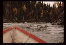
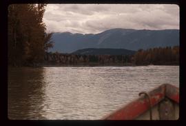
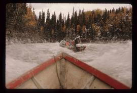
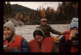
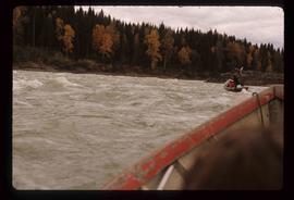
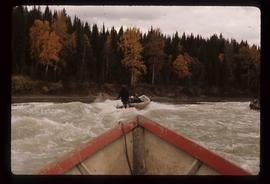
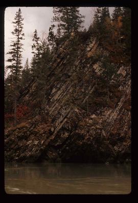
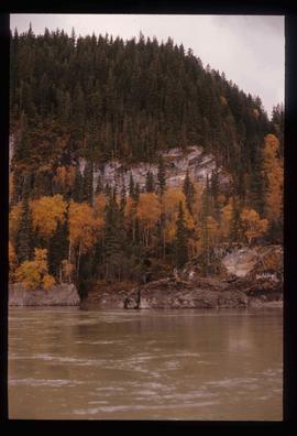
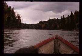
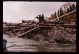
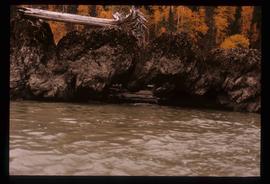
Image depicts a view of the Fraser River in Lillooet, B.C.
Image depicts a view of the mountains surrounding Lillooet, B.C.
Image depicts some farmland in Lillooet, B.C.
Image depicts the Bridge River near Lillooet, B.C.
Image depicts a section of river located somewhere near Barriere, B.C.
Image depicts a Beehive Burner along the Nechako on River Road. Map coordinates 53°55'34.1"N 122°44'58.0"W
Image depicts an aerial view of a grooved region of land at an uncertain location.
Image depicts an example of varves, an annual layer of sediment or rock, with a pipe used for reference size. It is possibly located at the airport in Prince George, B.C.
Image depicts sand beds with a shovel present for size reference. The slide places it at the "BCR site," possibly in Prince George, B.C.
Image depicts numerous skiers on the Birchleg Ski route on Tabor Mountain in Prince George, B.C.
Image depicts numerous skiers cross-country skiing on a trail through trees on the Birchleg Ski route on Tabor Mountain in Prince George, B.C.
Image depicts a view of the area around Tabor Mountain in Prince George, B.C.
Image depicts numerous skiers and skis that are standing upright in in the snow on Tabor Mountain in Prince George, B.C.
Image depicts the Fraser River running through the Moran Canyon near Lillooet, B.C.
Image depicts an area around Lillooet, B.C. It is possibly the Fraser River running through the Moran Canyon.
Image depicts a view of the Fraser River, as well as a road and railroad, near the Moran Canyon.
Image depicts a group of people hiking, possibly somewhere near Riske Creek, B.C.
Image depicts what is possibly either the Fraser or Chilcotin River.
Image depicts four hikers putting on rain parkas.
Image depicts what is possibly the Chilcotin River.
Image depicts the BCR tracks passing through a mill somewhere near the 100 Mile.
Image depicts an aerial view of Williams Lake, B.C.
Image depicts an aerial view of the Gibraltar mine site's pits and waste dumps, north of Williams Lake, B.C.
Image depicts the Stellako River.
Image depicts a view of the Fraser Lake from Lejac, B.C.
Image depicts the Rocky Mountain Trench from McBride, B.C.
Image depicts a heavily forested area located in the Rocky Mountain Trench, possibly near Dome Creek or Lamming Mills, B.C.
Image depicts a Yellowhead Realty sign in Lamming Mills, B.C. It reads: "For Sale, entire community, 50 buildings, 60 acres."
Image depicts a beehive burner in the community of Crescent Spur, B.C.
Image depicts a red boat on a river, possibly the Fraser, near Penny, B.C.
Image depicts an old building that was possibly once a gas station in the community of Newlands, B.C.
Image depicts a cliff side on the bank of the Fraser River in the Grand Canyon, B.C.
Image depicts a group of people in boats on the Fraser River in the Grand Canyon, B.C.
Image depicts Ray Mueller steering a boat on the Fraser River in the Grand Canyon, B.C.
Image depicts a group of people in boats on the Fraser River in the Grand Canyon, B.C.
Image depicts a rocky section of the bank of the Fraser River in the Grand Canyon, B.C.
Image depicts the bank of the Fraser River in the Grand Canyon, B.C.
Image depicts the Fraser River in the Grand Canyon, B.C.
Image depicts numerous logs piled up on rocks in the Fraser River.
Image depicts a formation of rocks in the Fraser River, with a dead tree stuck on top of them.
Image depicts an aerial view of a plateau near the Fraser River.
Image depicts an aerial view of a section of land, likely near the Fraser River, that is possibly either a slump or part of a mining operation. The slide is labelled "slump or mining."
Image depicts an aerial view of the land near the Fraser River. The Fraser River is barely visible on the right side of the image.