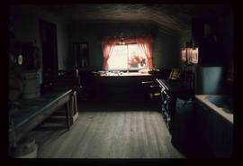
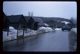
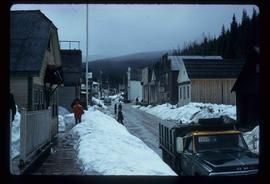
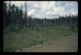
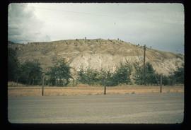
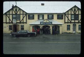
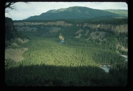
Image depicts a view of the Fraser River and the mountains surrounding Lillooet, B.C.
Image depicts three unknown individuals in a kitchen somewhere in Lillooet, B.C. They are possibly archaeology students.
Image depicts the Fraser River near Lillooet, B.C.
Image depicts Riske Creek, B.C. The brown building on the left is the local school.
Image depicts a snow-covered hill in Barkerville, B.C.
Image depicts a street in Barkerville, B.C.
Image depicts an old Anglican Church in Barkerville, B.C.
Image depicts the kitchen area of the interior of the Cottonwood House.
Image depicts the interior of a church, possibly one in or near Barkerville, B.C.
Image depicts the old, grown-over Cariboo Road at an uncertain location.
Image possibly depicts the Fraser River from Highway 97 near Quesnel, B.C.
Image depicts a stretch of land from Highway 97 near Williams Lake, B.C.
Image depicts a number of buildings at an uncertain location; the slide labels the older building in the image as potentially being the "original road house."
Image depicts the Gibraltar mine site north of Williams Lake, B.C.
Image depicts a number of workers putting in blasting powder at the Gibraltar mine site north of Williams Lake, B.C.
Image depicts an aerial view of some scenery near Williams Lake, B.C. The highway and BCR tracks are visible among the trees.
Image depicts an aerial view of the Fraser River near Soda Creek, B.C.
Image depicts a street in Wells, B.C.
File consists of notes and reproductions relating to an Environmental Studies Diploma offered at the College of New Caledonia.
File consists of a bound book titled "Indian Issues, Yesterday and Today", prepared as a school unit by the Human Rights Commission summer program. Includes handwritten annotations by Kent Sedgwick.
Item is an original 1974 map depicting Isle Pierre, published by the Department of Energy, Mines and Resources in Ottawa. Map includes pen markings.
Image depicts the Cottonwood House at the Historic Site located in Barkerville, B.C.
Image depicts the living area of the interior of the Cottonwood House.
Image depicts the old, grown-over Cariboo Road at an uncertain location.
Image depicts a gathering of people for an uncertain event at an uncertain location, possibly in Lillooet, B.C. A few tents are set up in the picture.
Image depicts the Fraser River near Lillooet, B.C.
Image depicts a view of Williams Lake, B.C.
Image depicts several unknown individuals present as a piece of machinery is used to assist in the mining of gold at Mosquito Creek in Wells, B.C.
Image depicts a man using a piece of machinery for the mining of gold at Mosquito Creek in Wells, B.C.
Image depicts the Helmcken Falls in Wells Gray Provincial Park.
Image depicts the drainage area for the Helmcken Falls in Wells Gray Provincial Park.
Image possibly depicts the Fraser River from Highway 97 near Quesnel, B.C.
Image depicts some farmland near Alexandria, B.C.
Image depicts the property of an old ranch at Mile 108 of Highway 97.
Image depicts an area of forests and fields somewhere near Fort St. John, B.C.
Image depicts a street in Barkerville, B.C.
Image depicts the Cariboo Road south of Williams Lake.
Image depicts the picnic site of the Cottonwood House Historic Site, located on the Barkerville Highway, east of Quesnel, B.C.
Image depicts the original main street of Quesnel, B.C.
Image depicts a stretch of land from Highway 97 near 100 Mile House, B.C.
Image depicts a section of land from Highway 97 near Cache Creek, B.C.
Image depicts a rail road construct from Highway 97 at Mile 126; the slide is also labelled "McAlister."
Image depicts a stretch of land from Highway 97 at Mile 231, possibly near Clinton, B.C.
Image depicts some cacti somewhere near Soda Creek, B.C.
Image depicts a loading truck at the Gibraltar mine site north of Williams Lake, B.C.
Image depicts an aerial view of Strathnaver, B.C.
Image depicts the Wells Hotel in Wells, B.C.
Image depicts a hallway in an unknown building somewhere in Wells, B.C.