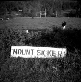
Photograph depicts a sign board that reads "Mount Sicker." Siding was located about 1 mile south of where this photograph was taken at Westholme Depot. The sign was sighted 5 miles north of Duncan, Vancouver Island. "MS" siding appeared to be taken out. This board was found in a freight shed.
File consists of research material regarding railway signs, which predominantly consist of photocopy reproductions, excerpts from books, and clippings from periodicals. Includes information on "tell-tales" that mark restricted clearances, blue flags, mileposts, metal crossing signs, culvert markers, speed signs, whistle posts, flanger signs, and other trackside signs.
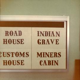
Photograph depicts four signs on a board that read, "Road House," "Indian Grave," "Customs House," and "Miners Cabin."
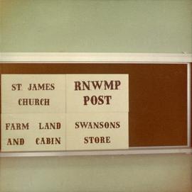
Photograph depicts four signs on a board that read, "St James Church," "Farm Land and Cabin," Swanson's Store," and "RNWMP Post."
File contents relate to: Engineering. Document type(s) include: notices, signs.
File consists of notes and reproductions relating to sign technology and placement. Includes: "RE: Information on Plaques" from Kent Sedgwick to Trelle Morrow (16 Mar. 1990); "Interpretive signs for heritage river trails" typescript letter from Kent Sedgwick to Mike Maguire (4 May 1988).
File consists of two signs:
- "Government of British Columbia Official Use Only"
- "British Columbia Forest Service Research Plot No Cutting or Disturbance".
File contents relate to: Engineering. Document type(s) include: correspondence, drawings.
Titles - General.
Photograph depicts a billboard size sign on the side of a building in Grand Forks BC.
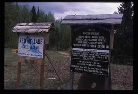
Image depicts two signs for hiking trails in Penny, B.C. One reads: "Hiking trail to Red Mt. Lake (Grizzly Bear Mt.) expect to meet wild animals."
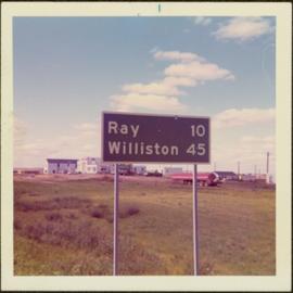
Item is a photograph of a road sign in North Dakota stating the distance to Ray and Williston.
Photograph depicts Iona Campagnolo standing outside the school and signing an autograph for an unidentified female student during Campagnolo's Skeena Riding Tour of Haida Gwaii, BC.
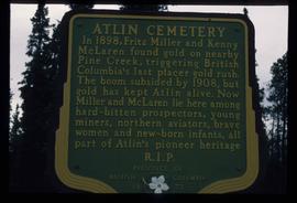
Image depicts a sign in the Atlin Cemetery, it reads: "In 1898, Fritz Miller and Kenny McLaren found gold on nearby Pine Creek, triggering British Columbia's last placer gold rush. The boom subsided by 1908, but gold has kept Atlin alive. Now Miller and McLaren lie here among hard-bitten prospectors, young miners, northern aviators, brave women and new-born infants, all part of Atlin's pioneer heritage R.I.P."
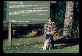
Image depicts Kent Sedgwick standing in front of a sign with a dog in Quesnelle Forks, B.C. The sign describes the history of the site, which began as a mining camp in 1859, but was later completely abandoned after a fire in 1866. It is now managed as a Forest Service Recreation Project.
Image depicts a the Cottonwood Island Nature Park sign and map in Prince George, B.C.
Image depicts a the Cottonwood Island Nature Park sign and map in Prince George, B.C.
Photograph depicts "Managed Forest" sign.
Photograph depicts Sign on bar door.
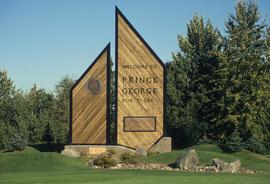
Image depicts the Prince George welcome and population sign, with a population of 71,086. Map coordinates 53°53'52.0"N 122°46'08.7"W
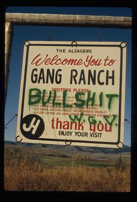
Image depicts the sign to Gang Ranch, located in the Upper Fraser Canyon, with graffiti on it.
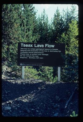
Image depicts a sign at the Tseax Lava Flow asking people to not remove lava from the site.
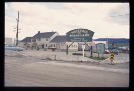
Image depicts the welcome sign in Burns Lake, B.C.
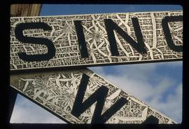
Image depicts a railway crossing sign with peeling and cracked paint somewhere in or near Penny, B.C.
File consists of notes and reproductions relating to a heritage interpretative sign for the Millar Addition in Prince George. Includes: "RE: Millar Addition Sign" letter from the Borealis Creative Productions to Kent Sedgwick (28 June 1995). File also includes photographs depicting Fort George Park, a street view, and houses in the Millar Addition of Prince George (1995).
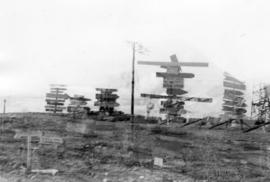
Photograph depicts numerous illegible sign posts on dirt road.
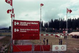
Photograph depicts a Health and Welfare Canada sign in front of outdoor sports activity stations as part of a Recreation Canada event in Kitimat, B.C. The photograph was taken while on Iona Campagnolo's Skeena riding tour.
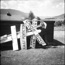
Photograph depicts a sign reading "Penticton East" beside a hut in the Penticton CPR depot yard.
File consists of photographs of the Unveiling of the UNBC Entrance sign .
Photograph depicts outdoor sign on side of building: "LIONS POOL".
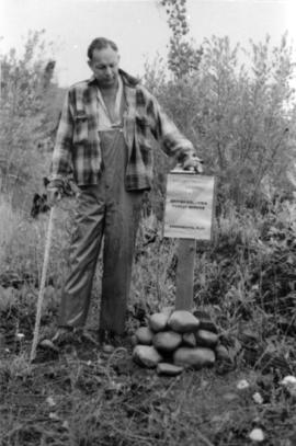
Caption describing photograph: "Research Division Experimental Plot sign". Harry Coates stands beside the sign for scale.
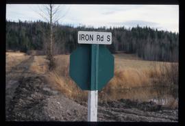
Image depicts the street sign for Iron Road South, which is located north of Woodpecker, B.C.
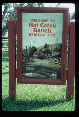
Image depicts the welcome sign of the historic Hat Creek Ranch site north of Ashcroft, B.C.
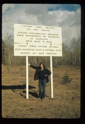
Image depicts an unknown individual leaning against a sign at the Stewart Access Road which warns travellers to pack several days of food. Located in Hazelton, B.C.
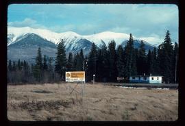
Image depicts a Yellowhead Realty sign in Lamming Mills, B.C. It reads: "For Sale, entire community, 50 buildings, 60 acres."
Photograph depicts New Forest Planted 1985 sign.
The item is a photograph depicting John Backhouse and another man unveiling a sign with information on L. C. Gunn.
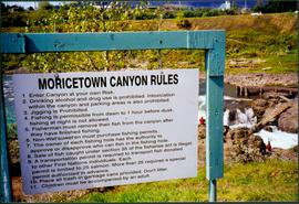
Photograph depicts sign in foreground outlining rules and restrictions for behaviour at Moricetown Canyon. Traditional fishing territory visible behind sign at waterfall in the Bulkley River, B.C. Highway and buildings can be seen in background.
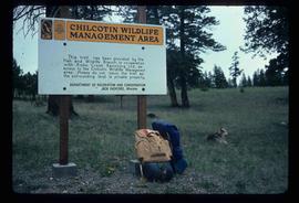
Image depicts a sign titled "Chilcotin Wildlife Management Area" somewhere near Riske Creek, B.C. It reads: "This trail has been provided by the Fish and Wildlife Branch in co-operation with Riske Creek Ranching Ltd., as access to the Chilcotin Wildlife Management Area. Please do not leave the the trail as the surrounding land is private property."
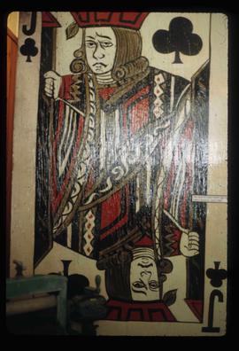
Image depicts the old Jack O' Clubs Hotel Sign in Wells, B.C. A small label on it reads "The Jack O' Clubs Hotel sign was taken down in April," it is uncertain if the following year listed is 1960 or 1980. The hotel itself burned down on February 14th in 1994.
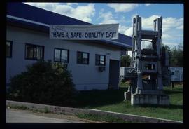
Image depicts the office at the Northwood Upper Fraser Saw Mill and a sign which reads "Have a safe, quality day." Map coordinates 54.117916, -121.943351
