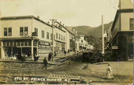
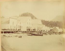
Mostrar 66 resultados

Archival description
58 resultados com objetos digitais Mostrar resultados com objetos digitais
Millar Addition heritage sign
2012.13.2.14.14 · Dossiê/Processo · 1993-1996
Parte de J. Kent Sedgwick fonds

File consists of notes and reproductions relating to a heritage interpretative sign for the Millar Addition in Prince George. Includes: "RE: Millar Addition Sign" letter from the Borealis Creative Productions to Kent Sedgwick (28 June 1995). File also includes photographs depicting Fort George Park, a street view, and houses in the Millar Addition of Prince George (1995).

Gang Ranch Sign
2012.13.1.52.04 · Item · 1980
Parte de J. Kent Sedgwick fonds

Image depicts the sign to Gang Ranch, located in the Upper Fraser Canyon, with graffiti on it.

Sign Featuring Moricetown Canyon Rules
2008.3.1.22.36 · Item · [ca. 1995]
Parte de Bridget Moran fonds

Photograph depicts sign in foreground outlining rules and restrictions for behaviour at Moricetown Canyon. Traditional fishing territory visible behind sign at waterfall in the Bulkley River, B.C. Highway and buildings can be seen in background.

Chilcotin Wildlife Management Area Sign
2012.13.1.65.07 · Item · May 1975
Parte de J. Kent Sedgwick fonds

Image depicts a sign titled "Chilcotin Wildlife Management Area" somewhere near Riske Creek, B.C. It reads: "This trail has been provided by the Fish and Wildlife Branch in co-operation with Riske Creek Ranching Ltd., as access to the Chilcotin Wildlife Management Area. Please do not leave the the trail as the surrounding land is private property."

Stewart Access Road - Warning Sign
2012.13.1.51.037 · Item · May 1973
Parte de J. Kent Sedgwick fonds

Image depicts an unknown individual leaning against a sign at the Stewart Access Road which warns travellers to pack several days of food. Located in Hazelton, B.C.

Northwood Upper Fraser Sawmill Sign
2012.13.1.89.161 · Item · 1999
Parte de J. Kent Sedgwick fonds

Image depicts the office at the Northwood Upper Fraser Saw Mill and a sign which reads "Have a safe, quality day." Map coordinates 54.117916, -121.943351

McBride - Church
2012.13.1.85.62 · Item · [2004?]
Parte de J. Kent Sedgwick fonds

Image depicts a church somewhere in McBride, B.C. The sign in front possibly reads "St. Patrick's Church."

Trail of 98
2012.13.1.100.20 · Item · 1999
Parte de J. Kent Sedgwick fonds

Image depicts a patch of snow-covered ground with a sign that reads "Trail of 98," somewhere along the White Pass railway.

Boarded Up Builidng
2012.13.1.83.02 · Item · 1979
Parte de J. Kent Sedgwick fonds

Image depicts a boarded up building in Stewart B.C. There is also a sign that reads: "No U Turns."

Robin Hood Flour
2012.13.1.50.068 · Item · [1978?]
Parte de J. Kent Sedgwick fonds

Image depicts an old log cabin with the sign "Robin Hood Flour" on it at an uncertain location. It is possibly at the 153 Mile House.

Upper Fraser General Store
2012.13.1.87.043 · Item · [between 1975 and 1995]
Parte de J. Kent Sedgwick fonds

Image depicts the Upper Fraser General Store in Upper Fraser, B.C. Two other signs indicate that it is also a post office and a place that offers propane refills. Map coordinates 54°07'10.8"N 121°56'51.7"W

Cross Country Ski Trails in Summer
2008.3.1.22.29 · Item · [ca. 1995]
Parte de Bridget Moran fonds

Photograph depicts landscape scene. Tree, bridge, and sign featuring cross country skier in foreground. Fence, hills, and forest in background.

Chetwynd - Motor Hotel and Esso
2012.13.1.91.40 · Item · 1979
Parte de J. Kent Sedgwick fonds

Image depicts several businesses in a small section of Chetwynd, B.C. There is a motor hotel and a half-visible sign for an Esso gas station.

To Raven Cabin
2012.13.1.79.12 · Item · Aug. 1977
Parte de J. Kent Sedgwick fonds

Image depicts a woman standing in a field, with a sign in a tree behind her pointing the way towards the Raven Cabin.

Unidentified Woman at Alaska Signage
2008.3.1.22.14 · Item · [ca. 1995]
Parte de Bridget Moran fonds

Woman stands in front of sign that reads "ALASKA / STEWART 237 km / HYDER AK. 240 km / BEAR GLAC. 201 km". Second sign in background indicates restaurant, convenience store, and service centre. Car, road, and highway can be seen in midground; mountains in background. (This woman is also featured in item 2008.3.1.22.13).

Gang Ranch - Fraser River
2012.13.1.52.34 · Item · [1980?]
Parte de J. Kent Sedgwick fonds

Image depicts the Fraser River, and a sign pointing towards Gang Ranch with an unknown individual hugging it, in the Upper Fraser Canyon.

Buildings in Upper Fraser, BC
2012.13.1.87.067 · Item · [between 1975 and 1995]
Parte de J. Kent Sedgwick fonds

Image depicts a row of buildings in Upper Fraser, B.C. with the store (titled "Paradise") with a Pepsi sign. Map coordinates 54°07'09.1"N 121°56'47.0"W

McBride - Engine Services
2012.13.1.85.59 · Item · [2004?]
Parte de J. Kent Sedgwick fonds

Image depicts a machine shop somewhere in McBride, B.C. The sign above the door reads "McBride Air Cooled Engine Services Ltd."

Giscome Sawmill
2012.13.1.87.171 · Item · [between 1975 and 1995]
Parte de J. Kent Sedgwick fonds

Image depicts the mill site at Giscome, B.C. A sign in the foreground reads "Maynard's Industrial Auctioneers." Map coordinates 54°04'19.7"N 122°22'04.7"W

Main Street, Quesnel
2014.10.1.040 · Item · 1909
Parte de Arthur Holland Land Surveying Collection
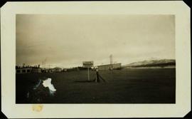
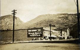
Photograph depicts a group of men standing near a building with the sign, "James Reid Ltd. General Merchants". There are a few fences and buildings in the background.

McGregor River - Bridge
2012.13.1.72.34 · Item · July 1981
Parte de J. Kent Sedgwick fonds

Image depicts a bridge over the McGregor River. A sign in the image reads: "Danger. The river is not navigable for any type of boat. Down stream falls and rapids impassible!"

Orchard Irrigation - Danger Keep Out
2012.13.1.82.28 · Item · 1981
Parte de J. Kent Sedgwick fonds

Image depicts water flowing through an irrigation channel in an orchard, somewhere in or near Seton Portage, B.C. There is a sign which reads: "Danger Keep out."

Nechako Cutbanks, Prince George
2012.13.2.14.15 · Dossiê/Processo · 1996
Parte de J. Kent Sedgwick fonds

File consists of notes and reproductions relating to the Nechako cutbanks in Prince George. Includes: "The Cutbanks" typed document by Kent Sedgwick (1 Feb. 1996). File also includes a photograph depicting heritage river trail signs erected at the cutbanks and describing the significance of the cutbanks in Prince George (1996).

Sixth Street, Prince Rupert, BC
2011.3.3.6 · Item · 1910
Parte de North Coast & Central BC Postcard Collection

People, boardwalks, and store signs visible in street scene. Printed annotation on recto reads: “6th St. Prince Rupert. B.C.” Handwritten message in ink on verso is addressed to: “Mrs. Loistram Halls Buildings Nicholas St Limerick Ireland”. Verso stamped "PRINCE RUPERT JUN 30 10".

Willow River Houses
2012.13.1.87.105 · Item · [between 1975 and 1995]
Parte de J. Kent Sedgwick fonds

Image depicts a snowy street in Willow River, B.C. with a row of houses. The white building on the end with the Pepsi sign is the Willow River General Store. Map coordinates 54°04'18.3"N 122°28'14.7"W

Keithley Creek - Road to Barkerville
2012.13.1.69.21 · Item · [1981?]
Parte de J. Kent Sedgwick fonds

Image depicts a sign on the dirt road leading to Barkerville from Keithley Creek. The sign reads: "Barkerville 40 (via Yanks Peak) Maximum elevation 6200 FT. Summer road only. Steep grades and switchbacks not recommended for other than 4-wheel drive vehicles. You are entering an isolated mountain area; you will be on your own."

Bridget Moran at Gitwinksihlkw Suspension Bridge
2008.3.1.22.35 · Item · [ca. 1995]
Parte de Bridget Moran fonds

Photograph depicts Moran standing in front of bridge featuring a sign reading "USE OF BRIDGE AT YOUR OWN RISK / GITWINKSIHLKW BAND COUNCIL". River below, hills on opposite shore in background.

Stewart Access Road
2012.13.1.51.036 · Item · May 1973
Parte de J. Kent Sedgwick fonds

Image depicts a man, possibly Kent Sedgwick, leaning against a sign forbidding public traffic on the Stewart Access Road from between 5 am to 8 pm. Located in Hazelton, B.C.

Forest for the World Plantation
2012.13.1.133.04 · Item · 1985
Parte de J. Kent Sedgwick fonds

Image depicts a group of trees in the Cottonwood Park, with a sign which reads: "This is the primary plantation for the 'Forest for the World' project. These trees were planted on August 5, 1985, commemorating Prince George's 70th birthday by the citizens of Prince George & Expo 86'."

House Raising and Moving in Upper Fraser
2012.13.1.87.050 · Item · [between 1975 and 1995]
Parte de J. Kent Sedgwick fonds

Image depicts a house being removed from Upper Fraser, B.C. during demolition of town site. A sign on the house reads: "Murray Blackwell House Raising & Moving." Map coordinates 54°06'51.6"N 121°56'26.3"W

Community Album - Town Office
2000.1.1.3.19.110 · Item · [ca. 1980]
Parte de Cassiar Asbestos Corporation Ltd. fonds

Photograph depicts unidentified man walking up front steps to building with the following sign: "TOWN ADMINISTRATION / MOTOR VEHICLE BRANCH / HCBC AGENCY / DISTRICT REGISTRAR / CDN CITIZENSHIP COURT / FISH & GAME LICENCES". Vehicles parked in foreground and behind at unknown building in midground. Power line and mountains in background.

Community Album - Fire Hall
2000.1.1.3.19.120 · Item · [ca. 1980]
Parte de Cassiar Asbestos Corporation Ltd. fonds

Photograph depicts two fire trucks semi-visible in garage with the sign "FIRE HALL". House and snowmobile can be seen in left midground, truck and power pole in right foreground. Mountains in background. Warning visible on front of trucks: "KEEP BACK 500m".

Shops along Shore at Port Essington, BC
2006.45.11 · Item · [ca. 1897]
Parte de Historical North Coast Photograph Album

Shops stand along riverside boardwalk. Storefront sign for R. Cunningham & Sons visible. Many people stand and sit on boardwalk, and canoes and small boats float in water in foreground.

Handwritten photo captions beside image read: "R. Cunningham & Sons - Probably Port Essington", "NW coast canoe".