Print preview Close

Showing 352 results

Archival description
317 results with digital objects Show results with digital objects
Daphne Baldwin Collection
2003.7 · Archief · 1942 - 1970s

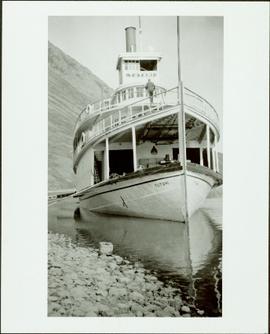
This collection consists of textual records related to the history of Northern B.C. and the community of Prince George. Series consist of : (1) Kiwanis Club of Prince George ; (2) Miscellaneous ; (3) Yukon/Alaska Ephemera ; and (4) Josephine Mitchell.

Miles Canyon - A River
2012.13.1.98.65 · Stuk · 1999
Part of J. Kent Sedgwick fonds

Image depicts a river in the Miles Canyon near Whitehorse Y.T. The Robert Lowe Bridge, built in 1922, can be seen over the canyon.

2023.2.2.6.1 · Bestanddeel · 1983
Part of Dr. Paul Sanborn fonds

During the 1980s, Agriculture Canada pedologists Scott Smith (retired from Summerland Research Station, formerly based in Whitehorse) and Charles Tarnocai (retired from Central Experimental Farm, Ottawa) had a large field program which addressed the trends in soil development in the central Yukon. Across this region, particularly between Whitehorse and Dawson City, the land surfaces and surficial deposits vary greatly in age due to the differing extents of glaciations over the past ~2 million years.

Tarnocai and Smith shared the unpublished data and soil samples from this work with Dr. Paul Sanborn, and this resulted in a student project published as:
Daviel, E., P. Sanborn, C. Tarnocai, and C.A.A. Smith. 2011. Clay mineralogy and chemical properties of argillic horizons in central Yukon paleosols. Canadian Journal of Soil Science 91: 83-93. https://doi.org/10.4141/cjss10067

This file consists of photocopies of 76 detailed soil description forms from the 1983 Yukon Paleosol Study by Tarnocai and Smith.

2023.2.2.7.1 · Bestanddeel · 1960, 1971, 1989
Part of Dr. Paul Sanborn fonds

In July 2009, Dr. Paul Sanborn undertook the first soils field research at the Fort Selkirk volcanic field in central Yukon, with helicopter support and funding from the Yukon Geological Survey. This file consists of prints of aerial photographs that depict the area accessed for the study, upstream from the confluence of the Yukon River and the Pelly River.

Air photographs include:
Flight line A17210, Photo Nos. 54-60 (taken 1960)
Flight line A22354, Photo Nos. 43-45, 47-48 (taken 1971)
Flight line A27516, Photo Nos. 48-52 (taken 1989)

2023.2.2.7.3 · Bestanddeel · 2009-2023, predominant 2009-2010
Part of Dr. Paul Sanborn fonds

In July 2009, Dr. Paul Sanborn undertook the first soils field research at the Fort Selkirk volcanic field in central Yukon, with helicopter support and funding from the Yukon Geological Survey. This file includes the following data sets gathered from the research:

  • Ft Selkirk 110114069.xls [particle size analysis data, CANTEST]
  • S1090final.xlsx [chemical analysis data, Ministry of Forests & Range, Analytical Chemistry Laboratory]
  • S1112final.xlsx [chemical analysis data, Ministry of Forests & Range, Analytical Chemistry Laboratory]
  • Ft Selkirk 2009 soils data (updated Sept 15, 2010 and April 10, 2023).xls [consolidated lab data for all 2009 samples]