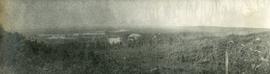
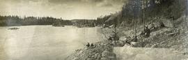
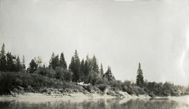
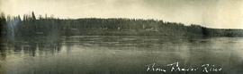
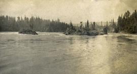
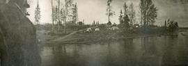
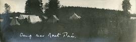
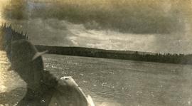
Photograph depicts two people and a dog team on a snowy river bank with a narrow passage of open water and a snowy bluff in the background.
Photograph depicts a four-dog team harnessed to a loaded sleigh. Two people stand near the loaded sleigh on a snowy forest path.
Photograph depicts a large white building surrounded by a fence.
Photograph depicts Lheidli T'enneh Nation burial grounds in foreground, Hudson Bay Company buildings in background.
Photograph depicts a cluster of wooden buildings including a flagpole and church spire at a Lheidli T'enneh village site. Original photo identified this image as "Indian Village, Fort George".
Photograph depicts view of the river from a boat. There is a silhouette of a person wearing a hat in the foreground.
Photograph depicts four men paddling a long canoe. The canoe is loaded with supplies and a dog, river and forest in the background.
Photograph depicts six men standing outside a small log building. A sawhorse in the foreground, a tall pole "cache" and forest in the background.
Photograph depicts one man standing on the bank of a river, forest in the background. The image is not in focus or possibly a double exposure.
Photograph depicts a small cluster of buildings near the river bank.
Photograph depicts four men pinning a "Union Jack" flag to the exterior of a building.
Photograph depicts several men standing on the river bank. Possibly A.H. Holland in center of photo.
Photograph depicts six adults and three or more children sitting on the ground with a log cabin in the background. Snow scatters the ground in small patches.
Photograph depicts twenty-eight or more people standing on the river's edge, a stack of wood is ready for loading on the steamer that is anchored near the shore.
Photograph depicts several people in a large field. There are buildings and trees in the background.
Photograph depicts a tarp spread out on the grass, two men sit nearby the tarp. There is a canvas tent in the background with a man standing beside it. Behind the tent is a low hill with a fence bordering the top of the hill. There are blankets drying on the fence.
Photograph depicts a view from a high hill, looking down on the Nechako river. There is forest and low rolling hills in the background.
Photograph depicts a view from a hill of a river winding through the forest with marshlands nearby.
Photograph depicts a view from a hill of a river winding through the forest with marshlands nearby. This may be a double exposure and there is an indiscernible image in the center of the photo.
Photograph depicts a man bathing himself while standing in a small metal tub. Photograph description in album notes this as "His 'Semi Annual'" [bath]. On the left is a log structure, presumably a cache building. A large clearing surrounds the building and bathing man. There is a forest and bluff in the background. Possibly located near Giscome Portage.
Photograph depicts four men pulling a long canoe across a clearing on a wheeled trailer.
Photograph depicts nine or more people watching a steamer navigate the rough waters of Fort George Canyon from the river shore.
Photograph depicts scattered buildings, an outhouse, and tents on a rough clearing. A river and its cutbacks are in the background.
Photograph depicts a view from the river looking at the river bank. There is a canvas tent with forest in the background.
Photograph depicts a wide expanse of river in the foreground looking across the water to a narrow clearing along the opposite riverbank. A few building are scattered across the clearing. There is forest in the background.
Photograph depicts eighteen or more canvas tents scattered on the river shore next to rough cabins and an outhouse.
Photograph depicts the rough waters and rocks at Fort George Canyon.
Photograph depicts a view of the river shore, a few scattered buildings and tents are near the shore. A footpath leads from the water's edge between the dwellings and through the newly cleared land.
Photograph depicts a view from a high hill looking down on the Nechako river. There is forest and low rolling hills in the background.
Photograph depicts a view of a lake from a row boat. The back of one male boat passenger and oars are in the foreground.
Photograph depicts several canvas tents set in lush vegetation near dusk.
Photograph depicts seven or more men relaxing near a canvas tent. Some of the men appear to be whittling wood. Long underwear dry on a tent rope and wood smoke drifts past the men and tent to the forest behind.
Original photographic print included in "Northern Interior Forest Experiment Station: Report of Preliminary Investigations" by Percy Barr.
A VHS tape containing "The Mark of Progress" film created by the British Columbia Forest Service and first played for a live audience in 1959 in Prince George, BC.
Slide depicts a black bear eating garbage by wooden outbuildings, possibly at the Aleza Lake Experiment Station.
Slide depicts a detonation in an area of cleared ground in a forested area, likely the Aleza Lake Experiment Station. Work may have been undertaken for roadbuilding activities at the Experiment Station.
Slide depicts a cleared area at the Aleza Lake Experiment Station with plant regeneration.
Slide depicts a heavily forested area with fallen logs, likely at the Aleza Lake Experiment Station.
Slide depicts the original wooden BC Forest Service sign for the Aleza Lake Forest Experiment Station.
Slide depicts a burning building at the Aleza Lake Experiment Station on the date it was shut down by the BC Forest Service.
Slide depicts a view of what is possibly the Upper Fraser River.
Slide depicts the Ranger Station at the Aleza Lake Experiment Station.
Slide depicts a man operating heavy equipment in a forest, likely at the Aleza Lake Experiment Station.
Slide depicts a sawmill in operation, likely located in the Upper Fraser area, with a pile of burning wood products and a beehive burner.
Slide depicts a bulldozer clearing ground, likely at the Aleza Lake Experiment Station.
Slide depicts a cleared area in a forest, likely at the Aleza Lake Experiment Station.
Slide depicts cleared ground and felled trees in a forested area, likely at the Aleza Lake Experiment Station.
Large-format map depicts the Monkman Public Sustained Yield Unit (PSYU) and Tree Farm Licence 30 east of Prince George.
File consists of:
- An original final draft of John Revel's problem analysis entitled "Silviculture in Spruce-Alpine Fir Types in the North Central Interior of British Columbia" for E.P. 639 with the Research Division of the BC Forest Service.