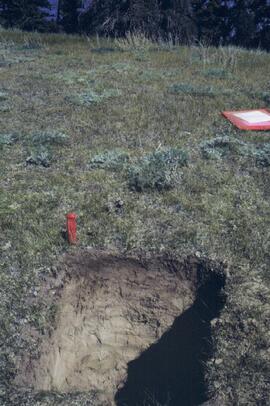
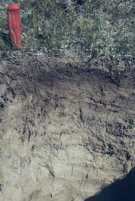
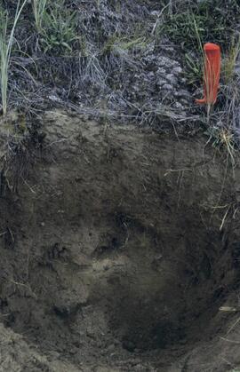
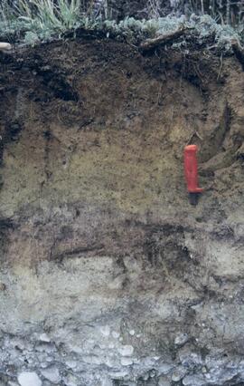
File consists "Report to the McGregor Model Forest Association: Development Plan for Theme 4: 'First Nations Sustainable Forestry Management' and a Report on 'Consolidating Traditional Ecological Knowledge Tools within the McGregor Model Forest (PG TSA)" Submitted by Annie L. Booth and Norm Skelton. Report includes: "First Nations, Sustainable Forest Management, and the Prince George Timber Supply Area, An Annotated Biography" including project introduction, conclusions and appendices.
File consists of a copy of "Ecosystem Based Management: Phase III Research Development Plan" prepared by Kathy J. Lewis, Susan Stevenson, Staffan Lindgren, Doug Thompson and Andra Bismanis.
File consists of "the McGregor Model Forest Association: A Defining Document" July 2003.
File consists of the "Canada's Model Forest Program: Advancing Sustainable Forest Management from the Ground Up."
File consists of "Creating a Balance: Sustainable Resource Management in British Columbia" created by the Integrated Resource Management Business Group.
File consists of the following data sets:
- Kluane crust Min N (2003) S671FINL.xls [mineralizable nitrogen for biological soil crusts & upper mineral soil, 2003 samples]
- Kluane Crust samples (2004) moisture contents.xls [moisture content of air-dry 2004 crust samples from Peninsula & Silver City sites; sampling procedures & locations in Marsh et al. (20060]
- Kluane Soil Crusts (2004) chemical analyses.xls [consolidated file of chemical data for 2004 crust samples from Peninsula & Silver City sites]
- Kluane 2003 soil & crust 15N data.xls [15N natural abundance, total N, organic & inorganic C for 2003 crust & upper mineral soil samples]
- Kluane 2003 soil data.xlsx [consolidated file of chemical data for 2003 crust and mineral horizon soil samples]
- Kluane Crust 2004 total C & N data.xls
- Kluane AMS dates (2003-2008 charcoal samples).xls [radiocarbon dates from the University of Arizona Accelerator Mass Spectrometry Lab]
- Kluane soil transect - texture data.xls [2009 soil particle size analysis data, with potential lithological breaks highlighted]
- Kluane surveys 2009.xls [topographic surveys for 3 soil transects cutting across eskers along Cultus Bay Rd., SE shore of Kluane L.]
- S1061_1069_Final_Rev1.xls [lab data report from Ministry of Forests Analytical Chemistry Laboratory for 2009 transect samples: total C, inorganic C, & total N]
- 100812003 (annotated) -corrected.xls [2009 transect samples: particle size analysis data report from CANTEST]
- Kluane soil transect - master data file.xls
This file contains the following photographs in both print photograph and negative format:
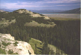
Slims River delta
Date: August 11, 2003
(location not recorded)
Print roll 5, #1-3 (Corresponding slides: Slides roll 3, #15-14)
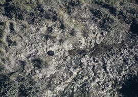
Grizzly bear
Date: August 12, 2003
(beside Cultus Bay Rd.; location not recorded)
Print roll 5, #6-7
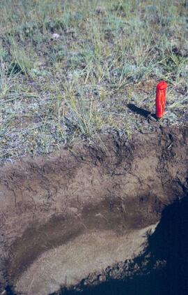
Y03-08 (Cultus Bay Rd. – at top of switchbacks)
Date: August 12, 2003
Location Coordinates: 61° 3’ 43.1” N, 138° 21’ 4.0” W, 833.8 m asl (± 5.1 m)
Site Description: good exposure of loess (35 cm) with Slims Soil over glaciofluvial terrace – pinches out downslope [note: this site was sampled because of development of buried paleosol, and was not part of biological crust study by Marsh et al. (2006)]
Sample Depths & Descriptions:
- Y03-08-01 - 45-48 cm - Ahkb (7.5YR 3/3 d; strongly effervescent)
- Y03-08-02 - 48-56 cm - Bmkb (7.5YR 4/3 d; strongly effervescent)
- Y03-08-03 - 56-70 cm - Ccab (2.5Y 5/2 d; strongly effervescent)
- (not sampled) - 70 cm+ - IICca (glaciofluvial; strongly effervescent)
- Intact sample: 56-36 cm - depth (including Slims Soil)
Print roll 5, #8-10, 17-18 (Corresponding slides: Slides roll 3, #13-11, 5-4)
Y03-09 (cliff top on E. shore of Kluane L. at Christmas Bay)
Date: August 12, 2003
Location Coordinates: 61° 4’ 0.0” N, 138° 22’ 35.3” W, 828.3 m asl (± 7.3 m)
Site Description: ~ 60 cm loess over glaciofluvial gravels
Sample Depths & Descriptions:
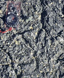
- Y03-09-01 - Nostoc crust
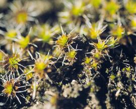
- Y03-09-02 - Tortula ruralis – Cetraria crust
- Y03-09-03 - 0-14 cm - ACk (10YR 3\2 d)
- Y03-09-04 - 14-16 cm - Ahkb1 (10YR 2/2 d)
- Y03-09-05 - 16-18 cm - Ck1 (10YR 4/3 d)
- Y03-09-06 - 18-20 cm - Ahkb2 (10YR 3/2 d; discontinuous)
- Y03-09-07 - 20-27 cm - Bmkb1 (10YR 4/3 d)
- Y03-09-08 - 27-33 cm - Bmkb2 (7.5YR 4/3 d)
- Y03-09-09 - 33-46 cm - Bmkb3 (10YR 4/3 d)
- Y03-09-10 - 46-55 cm - Ck2 (2.5Y 5/3 d)
- (not sampled) - 55-60 cm+ - IICk (glaciofluvial gravels)
Print roll 5, #11-15 (Corresponding slides: Slide roll 3, #10-6)
Y03-10 (shore bluff N. of Silver City)
Date: August 12, 2003
Location Coordinates: 61° 2’ 55.0” N, 138° 23’ 17.2” W, 806.7 m asl (± 7.3 m)
Site Description: 70% slope, SW aspect; vegetation: Elymus, Carex, Artemisia, Erigeron
Sample Depths & Descriptions:
- Y03-10-01 - Crust
- Y03-10-02 - 0-18 cm - ACk (10YR 4/2 m; strongly effervescent)
- Y03-10-03 - 18-25 cm - Ahkb(?) (10YR 4/2 m; strongly effervescent)
- Y03-10-04 - 25-40 cm - Ck (2.5Y 5/2.5 m; strongly effervescent)
- (not sampled) - 40 cm+ - IICk (glaciofluvial gravels; strongly effervescent)
Print roll 5, #19-22 (Corresponding slides: Slide roll 3, #3-1)
Silver City ghost town (location not recorded)
Date: August 12, 2003
Print roll 5, #23-24
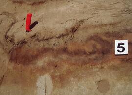
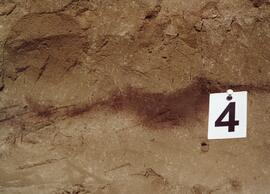
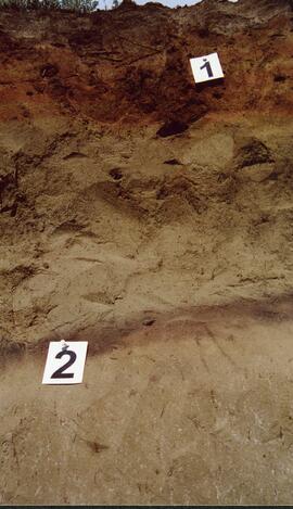
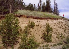
Y03-11 (Silver City road section)
Date: August 12, 2003
Location Coordinates: 61° 2’ 3.6” N, 138° 22’ 48.8” W, 806.7 m asl (± 8.7 m)
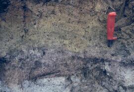
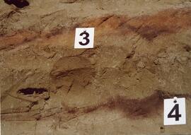
Site Description: roadcut through SW-facing hill exposes loess over glaciofluvial gravel, with 4 paleosols in colluviated loess
Sample Depths & Descriptions:
- Y03-11-01 - 0-18 cm - ACk (fresh loess)
- Y03-11-02 - 18-47 cm - Soil 1 – Bmk
- Y03-11-03 - 47-100 cm - Loess
- Y03-11-04 - 100-110 cm - Soil 2 – includes charcoal
- Y03-11-05 - 110-160 cm - Loess with secondary carbonate in root channel
- Y03-11-06 - 160-170 cm - Soil 3 – Ahk with charcoal
- Y03-11-07 - 160-170 cm - Soil 3 – Bmk
- Y03-11-08 - 170-198 cm - Loess with secondary carbonate in root channel
- Y03-11-09 - 198-202 cm - Soil 4 – Ahk – laterally continuous for ~ 1.5 m
- Y03-11-10 - 202-230 cm - Loess with secondary carbonates in roots
- Y03-11-11 - 230-255 cm - Soil 5 – Ahk – includes abundant charcoal bands
- Y03-11-12 - 230-255 cm - Soil 5 – Bmk – infilled squirrel burrows immediately below
- Y03-11-13 - 255-300 cm+ - Loess
Additional notes on modern soil & paleosols:
Soil 1 - consists of Bmk horizon material with 2 distinct colours: 7.5YR 4/3 d & 10YR 4/3 d
- loess between Soils 1 & 3 is sandier
Soil 2 - 90% Ahk material, 2-10 cm thick
- Ahk – 10YR 3/2 d
- Bmk – 7.5YR 4/2 d
- less abundant carbonate than in paleosols & loess below
Soil 3 - most of exposure has Ahk (2-5 cm thick) over Bmk (4-10 cm thick), with carbonates as for Soil 5
Soil 4 - mostly Ahk (10YR 3/2 d) material 2-8 cm thick, some Bmk (10YR 4/2 d) < 2 cm thick, with carbonates as for Soil 5
Soil 5 - complex intermixing of Ahk & Bmk material, charcoal most abundant in Ahk
- individual colour bands 2-10 cm thick
- overall dip of horizons (10° to W) is parallel to surface
- similar size & density of secondary carbonates as in loess above & below; associated with root channels, < 5 mm diameter, covering ~ 5% of surface
Print roll 5, #26-30 (Corresponding slides: Slide roll 4, #36-32)
Data sets for the Sulphur stable isotope tracer study (E.P. 886.15) include:
- 03-095 UNBC PS-For.xls Particle size analyses (Kenneth Creek 0-20 & 20-40 cm)
- 03-096 UNBC PS-For.xls Particle size analyses (Holy Cross 0-20 & 20-40 cm)
- 082037.xls XRF elemental analysis (Holy Cross pedon)
- 082038.xls XRF elemental analysis (Kenneth Creek pedon)
- 084996.xlsx XRF elemental analysis (HC & KC parent materials)
- EP 886 15 S isotope data (2001-2005) - foliage_completed (Feb 18).xls Pine foliage d34S (total S & total SO4-S)
- EP 886.15 2003 Foliage & Soil Chemistry Summary.xls
- EP 886.15 Foliar Analyses (selected) 2001-2006.xls Total N & S, SO4-S
- EP 886.15 Holy Cross & Kenneth Creek 2005 foliage.xls
- EP 886.15 Holy Cross & Kenneth Creek 2006 foliage.xls
- EP 886.15 Holy Cross 2001 FH (S516FINL).xls
- EP 886.15 Holy Cross 2001 Foliage (T727FINL).xls
- EP 886.15 Holy Cross 2001 Litter (S515FINL).xls
- EP 886.15 Holy Cross 2001 Mineral Soil (0-20 cm) (S507FINL).xls
- EP 886.15 Holy Cross 2002 Foliage (T785FINL).xls
- EP 886.15 Holy Cross 2003 FH (S642FINL).xls
- EP 886.15 Holy Cross 2003 Foliage (T836FINL).xls
- EP 886.15 Holy Cross 2003 Litter (S641FINL).xls
- EP 886.15 Holy Cross 2003 Mineral Soil (0-20 cm) (S643FINL).xls
- EP 886.15 Holy Cross 2004 FH (S702FINL).xls
- EP 886.15 Holy Cross 2004 Foliage (T904FINL).xls
- EP 886.15 Holy Cross 2004 Litter (S701FINL).xls
- EP 886.15 Holy Cross 2004 Mineral Soil (0-20 cm) (S703FINL).xls
- EP 886.15 Kenneth Creek 2001 FH (S521FINL).xls
- EP 886.15 Kenneth Creek 2001 Foliage (T727FINL).xls
- EP 886.15 Kenneth Creek 2001 Litter (S520FINL).xls
- EP 886.15 Kenneth Creek 2001 Mineral Soil (0-20 cm) (S508FINL).xls
- EP 886.15 Kenneth Creek 2001 Mineral Soil (20-40 cm) (S509FINL).xls
- EP 886.15 Kenneth Creek 2002 Foliage (T785FINL).xls
- EP 886.15 Kenneth Creek 2003 FH (S645FINL).xls
- EP 886.15 Kenneth Creek 2003 Foliage (T837FINL).xls
- EP 886.15 Kenneth Creek 2003 Litter (S644FINL).xls
- EP 886.15 Kenneth Creek 2003 Mineral Soil (0-20 cm) (S646FINL).xls
- EP 886.15 Kenneth Creek 2003 Mineral Soil (20-40 cm) (S647FINL).xls
- EP 886.15 Kenneth Creek 2004 FH (S705FINL).xls
- EP 886.15 Kenneth Creek 2004 Foliage (T905FINL).xls
- EP 886.15 Kenneth Creek 2004 Litter (S704FINL).xls
- EP 886.15 Kenneth Creek 2004 Mineral Soil (0-20 cm) (S706FINL).xls
- EP 886.15 Kenneth Creek 2004 Mineral Soil (20-40 cm) (S707FINL).xls
- EP 886.15 Sample Inventory.xls Listing of MoF Lab Job No.'s
- Fertilizer March 2003.xls d34S data for commercial fertilizer S sources
- hc_2002.xls Initial (2002) pine tree measurement data - Holy Cross
- kc_2002.xls Initial (2002) pine tree measurement data - Kenneth Creek
File consists of:
- Drafts of "Devil's Club, Black Flies, and Snowshoes" by John Revel from 2004
- Correspondence regarding publication of "Devil's Club, Black Flies, and Snowshoes" by John Revel
- Photocopied excerpts from Forest Service Annual Reports with highlighted portions relating to Aleza Lake Experiment Station
- Signed permissions for the photographs used in the book
File consists of the "McGregor Model Forest Association: Annual Report 2003-2004."
File consists of a CD-ROM containing three PDF documents: "Canada's Model Forest Program Publications Catalogue" September 2003, "Canada's Model Forest Program: Advancing Sustainable Forest Management from the Ground Up" c. 2003, "Canadian Model Forest Network Private Woodland Owners-Meeting the Stewardship Challenge" c. 2004. Documents exist in both French and English.
Slide roll contains the following photographs:
Y03-06
Date: August 10, 2003
Location Coordinates: 61° 4’ 1.5” N, 138° 21’ 57.4” W, 825.3 m asl (± 9.5 m)
Site Description: top of slope, E aspect
Sample Depths & Descriptions:
- Y03-06-01 - Crust
- Y03-06-02 - 0-6 cm - Ahk (10YR 3/2 m; strongly effervescent)
- Y03-06-03 - 6-14 cm - Bmk (2.5Y 3/3 m; strongly effervescent)
- Y03-06-04 - 14 cm+ - IICk (strongly effervescent)
Slide roll 3 #36-35 (corresponding prints and negatives: Print roll 4, #1-2)
Y03-07 (peninsula near Kluane visitor centre, Sheep Mt.)
Date: August 11, 2003
Location Coordinates: 61° 1’ 42.8” N, 138° 29’ 36.2” W, 786.7 m asl (± 5.7 m)
Site Description:
- recent (?) landslide with loess accumulation in pockets, thinner on boulder surfaces, dominated by dark cyanobacteria crusts
- limited loess accumulation due to exposure of site
- crust is calcareous at surface
Sample Depths & Descriptions: - Y03-07-01 - Crust
- Y03-07-02 - 0-6 cm - Ck
- Y03-07-03 - 6-9 cm - Ahkb
- Y03-07-03 - 9 cm+ - Rock
Slide roll 3 #34-30 (corresponding prints and negatives: Print roll 4, #3-10)
Lower Slims River (lookout knoll at parking lot N of visitor centre)
Date: August 11, 2003
Location Coordinates: 60° 59’ 56.4” N, 138° 33’ 36.4” W, 844.8 m asl (± 7.3 m)
Site Description: some fire disturbance, but lower slopes have more intact crusts on loess (calcareous to surface)
Slide roll 3 #29-26 (corresponding prints and negatives: Print roll 4, #11-17)
Lower Slims R (lowest bench below lookout knoll)
Date: August 11, 2003
Location Coordinates: 60° 59’ 51.8” N, 138° 33’ 36.2” W, 814.3 m asl (± 7.9 m)
Site Description: not burned; good intact crust; vegetation: A. frigida, Calamogrostis purpurea, Erigeron caespitosus, Linnaea, Carex filifolia (sparse cover ~ 50%)
Slide roll 3, #25-23 (corresponding prints and negatives: Print roll 4, #18-20)
Slims Soil
(Holocene paleosol with well-developed B horizon under Neoglacial calcareous loess – location not recorded, but likely from roadcut exposure along main Slims R trail)
Slides roll 3, #22 (corresponding prints and negatives: Print roll 4, #21)
Lower end of Sheep Creek
Date: August 11, 2003
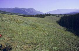
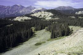
Misc. views of grassland vegetation and landscape (locations not recorded)
Slides roll 3, #21-18 (corresponding prints and negatives: Print roll 4, #26-33)
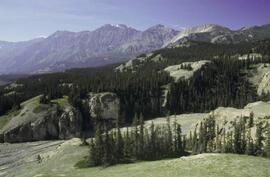
Overlook at lower end of Sheep Creek canyon
Date: August 11, 2003
Location Coordinates: 60° 59’ 42.2” N, 138° 34’ 38.1” W, 878.0 m asl (± 9.5 m)
Site Description: heavy use by sheep (abundant droppings) but still has ~ 50% crust coverage
Slides roll 3, #17-16 (corresponding prints and negatives: Print roll 4, #34-35)
Slims River delta
Date: August 11, 2003
(location not recorded)
Slides roll 3, #15-14: salt efflorescences (corresponding prints and negatives: Print roll 5, #1-3)
Y03-08 (Cultus Bay Rd. – at top of switchbacks)
Date: August 12, 2003
Location Coordinates: 61° 3’ 43.1” N, 138° 21’ 4.0” W, 833.8 m asl (± 5.1 m)
Site Description: good exposure of loess (35 cm) with Slims Soil over glaciofluvial terrace – pinches out downslope [note: this site was sampled because of development of buried paleosol, and was not part of biological crust study by Marsh et al. (2006)]
Sample Depths & Descriptions:
- Y03-08-01 - 45-48 cm - Ahkb (7.5YR 3/3 d; strongly effervescent)
- Y03-08-02 - 48-56 cm - Bmkb (7.5YR 4/3 d; strongly effervescent)
- Y03-08-03 - 56-70 cm - Ccab (2.5Y 5/2 d; strongly effervescent)
- (not sampled) - 70 cm+ - IICca (glaciofluvial; strongly effervescent)
- Intact sample: 56-36 cm - depth (including Slims Soil)
Slides roll 3, #13-11, 5-4 (corresponding prints and negatives: Print roll 5, #8-10, 17-18)
Y03-09 (cliff top on E. shore of Kluane L. at Christmas Bay)
Date: August 12, 2003
Location Coordinates: 61° 4’ 0.0” N, 138° 22’ 35.3” W, 828.3 m asl (± 7.3 m)
Site Description: ~ 60 cm loess over glaciofluvial gravels
Sample Depths & Descriptions:
- Y03-09-01 - Nostoc crust
- Y03-09-02 - Tortula ruralis – Cetraria crust
- Y03-09-03 - 0-14 cm - ACk (10YR 3\2 d)
- Y03-09-04 - 14-16 cm - Ahkb1 (10YR 2/2 d)
- Y03-09-05 - 16-18 cm - Ck1 (10YR 4/3 d)
- Y03-09-06 - 18-20 cm - Ahkb2 (10YR 3/2 d; discontinuous)
- Y03-09-07 - 20-27 cm - Bmkb1 (10YR 4/3 d)
- Y03-09-08 - 27-33 cm - Bmkb2 (7.5YR 4/3 d)
- Y03-09-09 - 33-46 cm - Bmkb3 (10YR 4/3 d)
- Y03-09-10 - 46-55 cm - Ck2 (2.5Y 5/3 d)
- (not sampled) - 55-60 cm+ - IICk (glaciofluvial gravels)
Slide roll 3, #10-6 (corresponding prints and negatives: Print roll 5, #11-15)
Y03-10 (shore bluff N. of Silver City)
Date: August 12, 2003
Location Coordinates: 61° 2’ 55.0” N, 138° 23’ 17.2” W, 806.7 m asl (± 7.3 m)
Site Description: 70% slope, SW aspect; vegetation: Elymus, Carex, Artemisia, Erigeron
Sample Depths & Descriptions:
- Y03-10-01 - Crust
- Y03-10-02 - 0-18 cm - ACk (10YR 4/2 m; strongly effervescent)
- Y03-10-03 - 18-25 cm - Ahkb(?) (10YR 4/2 m; strongly effervescent)
- Y03-10-04 - 25-40 cm - Ck (2.5Y 5/2.5 m; strongly effervescent)
- (not sampled) - 40 cm+ - IICk (glaciofluvial gravels; strongly effervescent)
Slide roll 3, #3-1 (corresponding prints and negatives: Print roll 5, #19-22)
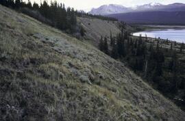
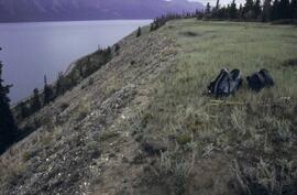
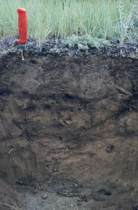
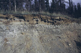
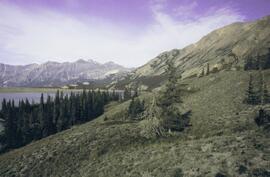
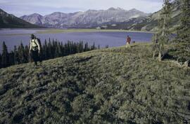
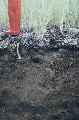
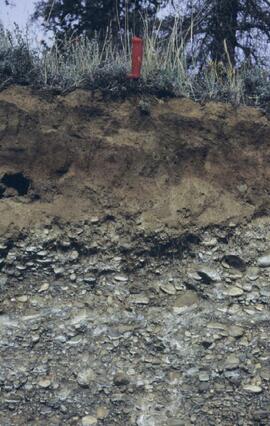
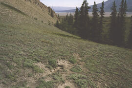
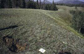
File consists of Kluane Lake photographs from 2003 in digital format.
File consists of the "A Sustaining Vision: Sustainable Forest Management in BC's Omineca Region" created by the McGregor Model Forest Association.
File contains the following Annual Reports of the Aleza Lake Research Forest Society:
- 2003
- 2005
- 2006
- 2008
