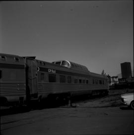
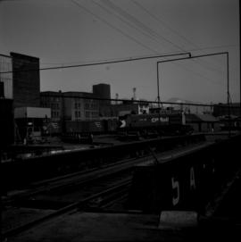
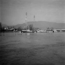
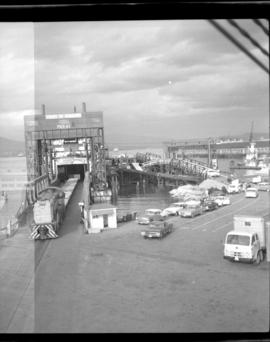
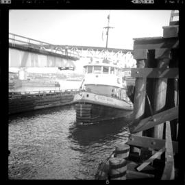
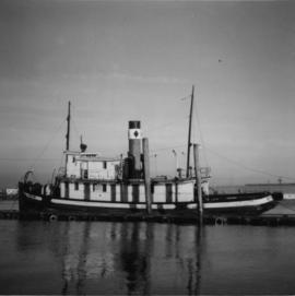
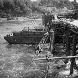
Photograph depicts the C.P.R. rail ferry transfer #4, registered at Victoria. It is tied to the western side of C.P.R. Pier A! at Vancouver. It holds four tracks and is not self-propelled.
Photograph depicts a section of floating dock on the north shore of the Vancouver Harbour, between Lynn Terminals and the Second Narrows Bridge. It is one of four sections and arrived here in mid 1965.
Photograph depicts Coal Harbour in Vancouver. The view is looking east.
Photograph depicts a CPR rail ferry slip in downtown Vancouver.
Photograph depicts the CPR line in Vancouver. Confusingly, the street is called "Mainland" but the box cars were spotted at the rear of 1152 Hamilton St. The nearest car is a Penn Central 167223, built in November 1972 and behind it is CP 165230 insulated box car. The view is looking northeast.
Photograph depicts the CPR line on Mainland St. in Vancouver.
Photograph depicts the CP rail and the edge of the Homer St. warehouse complex in Vancouver. The view is looking northeast at the western end of Mainland St. The building is at #1152 Mainland St. The right hand track (man's shadow it) goes down Mainland and is in apparent use. The rail on the left hand track is dated 1938.
Photograph depicts the CPR line approximately 100 yards south of the Richards and Pacific St. intersection in Vancouver. The waste ground on the right was formerly occupied by the Canadian Pipe Co., Canadian Wood Pipe & Tanks Ltd., and the Pacific Coast Pipe Ltd. from 1923-1972.
Photograph depicts an unnamed harbour road that runs to the north of , and parallel to Water St. The trackage is connected behind the camera to a CPR depot and at the other end to the mainline. No spurs lead off to the docks. The track is not used but usable.
Photograph depicts the CPR False Creek yards in Vancouver. Turning the "Canadian" on a 180 degree loop.
Photograph depicts the CPR False Creek yards in Vancouver. The view is looking northeast with the roundhouse immediately behind the camera. The switcher is moving on 180 degree loop.
Photograph depicts a tug towing gravel scow that was used to make concrete. Photograph taken at a BCER swing bridge.
Photograph depicts a derelict steam tug named "Sea Swell" on the Pitt River.
Photograph depicts a steam tug called "R.F.M". It was believed to not be in steaming condition.
Photograph depicts a replica of the "SS Beaver." It was built by the RCN in Esquimalt and was open for inspection in Vancouver.
Photograph depicts a replica of the "SS Beaver" built by the RCN in Esquimalt and moored in Vancouver, open to the public. The original ship left Gravesend on August 29, 1935 and reached Fort Vancouver (Oregon) on April 10. 1936.
Photograph depicts a Japanese cadet sailing ship called "Kaiuo Maru" at Centennial Pier, Vancouver. Its visit was part of 1966 Vancouver Sea Festival and the ship was open to the public for inspection.
Photograph depicts an old anchor that had been fished out of Coal Habour, Vancouver. One flulke was bent in towards the shank. Image captured outside the office of Kanata Marine Ways Ltd. (1965).
Photograph depicts work in progress on a new CNR lifting span bridge. Immediately in front of it was a coffer dam for a pier. Tidal conditions were a problem.
Photograph depicts a house that had been pushed on its side by a bulldozer.
Photograph depicts a house that provided an example of the few surviving homes left on Beach Ave.
Photograph depicts one of the surviving houses on Beach Ave, Vancouver, between Gilford and Chilco.
Photograph depicts a house that had a "sold" notice on it and was partly demolished. Up to the date the photograph was captured, this block on Beach Ave. was the sole remaining one to have only houses on it, as opposed to a mixture of houses and apartment blocks, or blocks only.
Photograph depicts a house that was probably built in 1890-1900. It had just been demolished.
Photograph depicts a house on the southern edge of Chinatown.
Photograph depicts the Great Northern Railway station on Main Street, Vancouver being demolished.
Photograph depicts Vancouver City College, formerly King Edward Secondary School.
Photograph depicts a Public Weigh Scale that was operated in Vancouver, on Main Street, opposite the CN Depot.
Photograph depicts a fire truck being used to deal with a bedroom fire in Vancouver.
Photograph depicts a Goodyear airship travelling over Spanish Banks, Vancouver. It took part in the Abbotsford Air Show of 1971.
Photograph depicts the demolition of the former CPR Pier A at the foot of Thurlow Street in Vancouver. Vancouver Pile Driving Co. undertook the work.
Photograph taken at Brockton Oval, Stanley Park in Vancouver. Depiction of the Presentation of 2 Colours to the Vancouver City Police Force by Lieutenant-Governor of B.C. At this point, the colours had just been consecrated on an alter of drums. Drummers were regaining their drums.
Photograph depicts the B.C. Electric Railway swing bridge at False Creek on the west side looking north.
Photograph depicts the fixed span of the B.C. Electric Railway swing bridge at False Creek looking south.
Photograph depicts the Second Narrows railway bridge in Vancouver, BC
Photograph depicts the Fraser St. road bridge over the north section of the north arm of the Fraser River (ie. between Vancouver and Mitchell Island). Shot is looking northeast.
Photograph depicts the Cambie St. Bridge in Vancouver, BC, looking east and showing the north fixed span of the bridge.
Photograph depicts what is believed to be the only remaining "summer cottage" on Beach Ave. in English Bay.
Photograph depicts a former Sailor's Home at the southeast corner of the intersection at Alexander St. and Jackson St. in Vancouver, B.C.
Photograph depicts the former "Terminus Hotel" on 32 Water St., 50 yards from the center of old Vancouver.
Photograph depicts the Mussenden Building used by the Hudson's Bay Company. It is located on Water St. in Vancouver, B.C. View is from the north side looking east.
Photograph depicts an old church or school being demolished at 1701-1721 West 3rd Ave. (and Pine), in Vancouver, B.C.
Photograph depicts a stone house on 17th St. and Esquimalt St. in West Vancouver, B.C.
Photograph depicts the corner building on West Georgia and Chilco St., facing Stanley Park in Vancouver B.C. View looking south across Georgia St.
Photograph depicts the Pacific Press Ltd. Vancouver Sun building at Beatty and West Pender St. The view is looking northeast from Beatty St. It was vacated by the Vancouver Sun at Christmas 1965 with the neon "Sun" sign on the tower removed.
Photograph depicts Pier B of C.P.R., just west of the C.P.R. railway station. This is the only pier accessible to ocean going passenger liners and is used by P&O vessels. Facilities generally in adequate for the 1960s.
Photograph depicts a former fire hall now used as a boy's club on 12th Ave and St. Catherine's St., in Vancouver, B.C. It is one and a quarter miles southeast of C.N.R. station.
Photograph taken at the VIA Rail depot in Vancover. It was the former CNR depot. Two passenger cars being served in a barn are visible.
Photograph taken at the VIA Rail depot in Vancouver. Visible is a former Grand Trunk Pacific car, 'Nechako,' now CNR #15105. It was a fairly permanent fixture with steam, water, and waste lines fixed up to the depot's facilities.