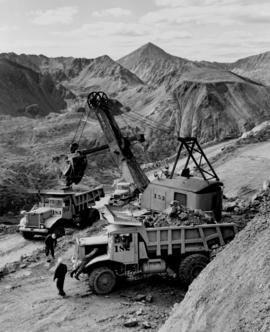
Affichage de 4134 résultats

Archival description
3619 résultats avec objets numériques Afficher les résultats avec des objets numériques
Two Dozers on Cliff
2000.1.1.3.15.12 · Pièce · [ca. 1958]
Fait partie de Cassiar Asbestos Corporation Ltd. fonds

Photograph depicts unknown men driving bulldozers on edge of mine area at high elevation. Dozers are Internationals, model TD24 (manufactured between 1947 and 1955). Mountain range in background.

Dozer on Cliff, Close View
2000.1.1.3.15.14 · Pièce · [ca. 1958]
Fait partie de Cassiar Asbestos Corporation Ltd. fonds

Photograph depicts unknown man driving bulldozer near edge of mine area at high elevation. Dozer is an International model TD24 (manufactured between 1947 and 1955). Valley and mountain range in background.

Shovel & Haul Trucks
2000.1.1.3.15.15 · Pièce · [ca. 1958]
Fait partie de Cassiar Asbestos Corporation Ltd. fonds

Photograph depicts cable-operated shovel loading Kenworth haul truck on road in mine area at high elevation. Pickup truck in background, four unidentified men are gathered around second Kenworth truck in foreground. Valley and mountain range in distance.

Plantsite
2000.1.1.3.18 · Dossier · 1953 - 1989
Fait partie de Cassiar Asbestos Corporation Ltd. fonds

This file contains operations at the plantsite:
Below is synopsis of the item level descriptions (see each item for further description)

  • locations depicted at Plantsite: mill building, dry rock storage building, tailings pile, gravel pit, power house, and office.
  • delivery and installation of a Caterpillar engine, welding repairs underway on a Rustin Diesel Engine in the power house, staff portrait taken by the main office building, and fibre testing
    Not done to item level but integrated into subseries file:
  • Photographic negatives included depict milling and packaging machinery in the mill building.
  • 93 slides depicting various activities and equipment at the plantsite including: dry rock storage, screens, collectors, loading trucks, bagging, pallets, tailing pile, lab work by engineers, lab equipment, fibre testing, and fibre samples.
  • photographs of conveyor foundations, tailings equipment, Grizzly truck, containers from site mechanical inspection, and portable crushing plant in June 1991.
  • photos of fibre samples from lab - on display
  • collection of photos of 1970 Mill modification Program of April 1978
  • collection of photos from 1961 and 1962 of plantsite lab and asbestos samples. file labeled "Suter - Webb VU Graph Analysis" and "Suter - Webb and Turner Comb Analysis"
  • Pressure Packer modification photos done by Chapman Industries in 1986
  • Powerhouse equipment from 1979
  • additional 43 slides of inside the mill in June 1978. Slides were used at a board meeting.
  • negatives of inside of mill
  • A photo album of 162 photographs depicting various operations at the plantsite including: drill dust collector, outdoor surroundings, conveyors, and the mine site. (album was originally labelled "Cassiar Plantsite).
1961 - 6430 Ore Bench
2000.1.1.3.19.002 · Pièce · July 1961
Fait partie de Cassiar Asbestos Corporation Ltd. fonds

Photograph depicts bench at 6430 elevation. Blasthole drills, shovels, dozers, and dump trucks can be seen on bench in midground. Mine valley in background. Handwritten annotation on verso of photograph: "1961".

1961 - Shovel on Peak
2000.1.1.3.19.012 · Pièce · 1961
Fait partie de Cassiar Asbestos Corporation Ltd. fonds

Photograph depicts a crawler cable shovel on right, and bulldozer partially visible on left. Rock face of mountainside in background. Handwritten annotation on verso of photograph: "1961", on recto: "Mining 80 D shovel on [?] 64/70 to 6560 saddle on peak."

Explosion of plug for diversion route
2000.13.1.64 · Pièce · [between 1962 and 1967].
Fait partie de Ray Williston fonds

Item is a photograph of the explosion which opened up the diversion route for the Peace River during construction of the W.A.C. Bennett Dam.

Three diversion tunnels
2000.13.1.66 · Pièce · [between 1962 and 1967].
Fait partie de Ray Williston fonds

Item is a photograph of the three tunnels built to divert the Peace River around the Bennett Dam construction site.

2008.27.3 · Dossier · 1935-1997
Fait partie de Knox McCusker Collection

File consists of the following items:

  • "Mac" by D.L. Surveyor
  • "Knox (Mac) McCusker: Dominion Land Surveyor" by E.L. Rutherford, V.C. Brink, R.S. Silver and M.Z. (Smokey) Neighbour
  • Excerpts from Men and Meridians by Don W. Thomson
  • Article re: Knox McCusker written on the occasion of his death (April 14, 1955)
  • "McKusker (sic) to open up Blueberry Mountain Area" (Alaska Highway News, June 8, 1950)
  • "McCusker was surveyor, big game guide….also rancher and trail blazer"
  • "Knox Freeman McCusker" written on the occasion of his death (The Canadian Surveyor, July 1955)
  • "Veteran Surveyor - Alaska Highway Stories"
  • Memories of Knox McCusker by his oldest niece Betty (McCusker) Rutherford
  • "Veteran Surveyor prefers horses for long bush treks" by Eric Young (Edmonton Journal)
  • Eulogy for Knox McCusker read by Stanley D. Seif at Burch Presbyterian Church in Fort St. John, B.C.
  • Eulogy for Gwendolyn Dorothy McCusker (July 1997)
  • "Tropical Valley No Myth: amazing story of woman who lived there" by Thomas A. Wayling (Vancouver Sun)
  • Photocopy of section of map: "Topographical sketch map showing route traversed by the Bedaux Sub-Arctic Expedition 1934 through the Rocky Mountains" (by Frank Swannell, March 27, 1935)
  • Memories of Knox McCusker by Bill McCusker, his oldest nephew
  • "There is always a reason; destiny made it a date. The corridor of the Alcan didn’t just happen" (Fort St. John publication)
  • Article on Knox McCusker (ALS News, Winter 1983)
Finlay River Rapids, B.C.
2009.5.1.42 · Pièce · 1930
Fait partie de Taylor-Baxter Family Photograph Collection

Handwritten caption below this photo reads: "Finlay River Rapids. - 1930."
A small peninsula extends into river in left midground, rapids in foreground, trees and hills on opposite shore in background.

Unidentified Man at Log Cabin
2009.5.1.50 · Pièce · [ca. 1910]
Fait partie de Taylor-Baxter Family Photograph Collection

Photograph depicts a man seated with bundles and briefcase in front of two small log cabins with sod roofs. What appears to be an elevated log cache stands to left behind cabins, with a ladder raised to its door. Rocky, dry field crosses foreground, mountains visible in background.

Hagwilget Bridge Crosses Bulkley River
2009.5.1.70 · Pièce · [ca. 1900]
Fait partie de Taylor-Baxter Family Photograph Collection

Close view of bridge built with wooden planks, poles, and wires, braced from below, with triangles built into its frame. The bridge crosses Hagwilget Canyon on the Bulkley River, five kilometres from its confluence with the Skeena River. This is one of the many bridge structures that have crossed this location since at least 1859. Photograph was taken from one side of canyon, near bridge. Opposite canyon wall in background. Typed annotation glued to verso of photograph: "HAGWILGET - 'the gentle or quiet people'."

Hagwilget Bridge Crosses Bulkley River
2009.5.1.71 · Pièce · [ca. 1900]
Fait partie de Taylor-Baxter Family Photograph Collection

Photograph depicts two men and a horse on a bridge built with wooden planks, poles, and wires, braced from below, with triangles built into its frame. The bridge crosses Hagwilget Canyon on the Bulkley River, five kilometres from its confluence with the Skeena River. This is one of the many bridge structures that have crossed this location since at least 1859. Photograph was taken from a distance. Rocky riverbank in foreground, opposite shore in background behind bridge. Typed annotation in red ink on verso of photograph: "INDIAN BRIDGE, NEAR HAZELTON, B.C."

Cariboo Road Postcard to H.F. Glassey
2009.5.2.31 · Pièce · [ca. 1900]
Fait partie de Taylor-Baxter Family Photograph Collection

Handwritten annotation on verso of photograph: "Early Days on the Cariboo Road. No. 8." Photograph depicts man driving two covered wagons pulled by team of six horses on gravel road. Valley crosses midground, hills in background. Handwritten annotation on recto of photograph: "H. F. Glassey Esq. P.O Box 950 Prince Rupert B.C. Dear Bert: We have been kept very busy have been on committee work all through the convention but it was wonderful will write you a long letter from Vancouver. Mrs Earley wants me to stay until Monday morning train. Met Mr. [Colley?] everything going fine here. I am sure you are busy [...?] Love from Sadie. Mr & Mrs. [Graif?] are living here."

Hydro Power Plant, Prince Rupert, BC
2009.5.2.59 · Pièce · [ca. 1930?]
Fait partie de Taylor-Baxter Family Photograph Collection

Photograph depicts power plant by waterfall. Extensive construction materials and structures can be seen scattered to left of plant. River in foreground, forest and hills in background. Typed annotation on verso of photograph: "Northern B.C. Power Co. Falls River Plant Prince Rupert B.C."

McKee Creek, BC
2009.5.2.81 · Pièce · 27 June 1937
Fait partie de Taylor-Baxter Family Photograph Collection

Photograph depicts dry creek bed, tall banks on either side. Hills and lake cross midground, mountains visible in background. Handwritten annotation on verso of photograph: "Looking down McKee Creek across Atlin Lake Towards Taku Glacier 6/27/37."

Atlin, BC in 1899
2009.5.2.87 · Pièce · 3 September 1899
Fait partie de Taylor-Baxter Family Photograph Collection

Photograph depicts the Atlin townsite, forest in foreground, hills in background. Town stands on edge of lake located in left midground. Handwritten annotation on verso of photograph: "Atlin City B.C., Sept. 3rd 1899. Copyrighted by S.A. Smythe Atlin, B.C."

Grotto near Atlin, BC
2009.5.2.118 · Pièce · [ca. 1935]
Fait partie de Taylor-Baxter Family Photograph Collection

Photograph depicts water flowing from ground in forest. Handwritten annotation on recto of photograph: "Atlin, The Grotto, Outlet of a subterranean stream (in limestone) on way to O'Donnell River."

Settlement on Shore
2009.5.2.136 · Pièce · [ca. 1930?]
Fait partie de Taylor-Baxter Family Photograph Collection

Photograph depicts a group of unidentified buildings in what appears to be an industrial area on opposite shore. River or lake in foreground, tree-covered hills in background.

Unknown Harbour
2009.5.2.142 · Pièce · [ca. 1930?]
Fait partie de Taylor-Baxter Family Photograph Collection

Photograph depicts what appears to be a row of small canoes in still water, opposite shore visible on horizon. Another small boat rests on dock in right foreground.

Mount Robson
2006.20.11.17 · Pièce · June 1923
Fait partie de Northern BC Archives Historical Photograph Collection

Photograph depicts the snowy peak of Mt. Robson in distant background. Trees and power lines in foreground, two smaller hills cross mid ground. Handwritten photo caption below photograph reads: "Mount Robson B.C. Jasper Park - June 1923."

Lake Beauvert
2006.20.11.20 · Pièce · June 1923
Fait partie de Northern BC Archives Historical Photograph Collection

Photograph depicts a body of water with trees on opposite bank crossing mid ground. Trees and rocks in foreground, hills visible in distant background. Handwritten photo caption below photograph reads: "Lake Beau Vert."

Canoe at Summit Lake
2005.3.23 · Pièce · [ca. 1945]
Fait partie de John Hart Highway Photograph Collection

Handwritten caption beside this photo reads: "I built this boat." Photograph depicts canoe and paddles afloat in water, grassy shore in foreground. A pair of pants can be seen in boat, as well as wood planks, box, and rope on shore.

Plane on Summit Lake, BC
2005.3.37 · Pièce · [ca. 1945]
Fait partie de John Hart Highway Photograph Collection

Handwritten caption above this photo reads: "Plane on Sumit Lake." Logs can be seen floating on water in foreground, as well as trees on opposite shore in background. The seaplane has the letters "CF-ATF" on its side.