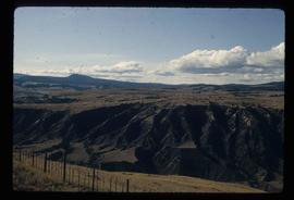
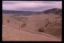
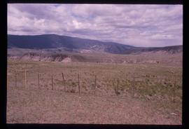
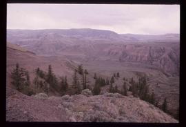
Image depicts the Fraser River passing through the upper Fraser Canyon.
Image depicts a view of the upper Fraser Canyon.
Image depicts an unknown woman on a road in the upper Fraser Canyon.
Image depicts a field north of Dog Creek in the upper Fraser Canyon.
Image depicts the grave of W.L. Meason in the upper Fraser Canyon.
Image depicts an unknown woman taking pictures. Nearby are the skeletal remains of an unknown animal. The location is somewhere near the upper Fraser Canyon.
Image depicts the Fraser River in the upper Fraser Canyon.
Image depicts a view of the upper Fraser Canyon. The Fraser River is visible on the left side of the image.
Image depicts a view of the upper Fraser Canyon.
Image depicts the Fraser River, and a sign pointing towards Gang Ranch, in the Upper Fraser Canyon.
Image depicts the Fraser River, and a sign pointing towards Gang Ranch with an unknown individual hugging it, in the Upper Fraser Canyon.
Image depicts Gang Ranch, with a sign warning that the area is patrolled by Range and Logging Patrols, in the Upper Fraser Canyon.
Image depicts the Upper Fraser Canyon from what appears to be the entrance to Gang Ranch.
Image depicts a road near or on Gang Ranch in the Upper Fraser Canyon.
Image depicts Gang Ranch in the Upper Fraser Canyon.
Image depicts the Gang Ranch House in the Upper Fraser Canyon.
Image depicts Gang Ranch in the Upper Fraser Canyon.
Image depicts a stream and field at Gang Ranch in the Upper Fraser Canyon.
Image depicts the Fraser River near Gang Ranch in the Upper Fraser Canyon.
Image depicts a bridge over the Fraser River in the Upper Fraser Canyon; possibly near Gang Ranch.
Image depicts a road somewhere in the Upper Fraser Canyon, and a view of the hills and trees.
Image depicts a view of the Upper Fraser Canyon.
Image depicts a view of some of the scenery near the Upper Fraser Canyon.
Image depicts the Upper Fraser Canyon.
Image depicts a couple of old buildings, and a field full of tree trunks and dead wood. Located somewhere in or around the Upper Fraser Canyon.
Image depicts a view of the Upper Fraser Canyon.
Image depicts a view of the Upper Fraser Canyon. The Fraser River is visible.
Image depicts the Alkali Lake Ranch in Alkali Lake, B.C.
Image depicts a house and numerous rundown vehicles in Dog Creek, B.C.
Image depicts a church and several other buildings in Canoe Creek.
Image depicts a house located somewhere in or near Canoe Creek.
Image depicts a view of Canoe Creek.
Image depicts an old building at an uncertain location. The slide is simply labelled "Spring house."
Image depicts several old buildings at an uncertain location. The slide is simply labelled "Spring house?"
Image depicts the Fraser River in the Lillooet, B.C.
Image depicts the Fraser River from the Moran railway point in the Lillooet area.
Image depicts the Fraser River somewhere in the Lillooet area.
Image depicts a view of the Fraser River in Lillooet, B.C.
Image depicts a view of the Fraser River near Lillooet, B.C.
Image depicts a view of the mountains surrounding Lillooet, B.C.
Image depicts a view of the Fraser River and the mountains surrounding Lillooet, B.C.
Image depicts a gathering of people for an uncertain event at an uncertain location, possibly in Lillooet, B.C. A few tents are set up in the picture.