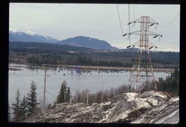
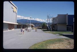
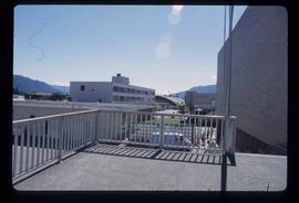
Image depicts several buildings in Kitimat, with the Bay being the tall one on the left.
Image depicts numerous docked boats in Kitimat, B.C.
Image depicts a view of the area surrounding Kitimat, with power-lines in the foreground the city partially visible in the distance.
Image depicts two individuals seated at a picnic table while a third stands closer to the water on a beach somewhere in Kitimat, B.C. What appears to be a harbour can be seen on the water.
Image depicts numerous individuals passing in front of the Bay in Kitimat, B.C.
Image depicts three picnic tables, one of which is occupied with three unknown individuals, on a beach somewhere in Kitimat, B.C.
Image depicts the Alcan smelter in Kitimat, B.C.
Image depicts a view of the forest and lake around Kitimat, B.C.
Image depicts a large group of people enjoying the Mount Layton Hot springs in the Lakelse Lake Provincial Park north of Kitimat, B.C.
Image depicts Nairn Falls.
Image depicts a lake and a mountain in the distance. The location is uncertain.
Image depicts a farm at an uncertain location.
Image depicts Nairn Falls in Nairn Falls Provincial Park.
Image depicts Nairn Falls.
Image depicts a lake with a "Swim at Own Risk" sign at an uncertain location.
Image depicts what is possibly the Lillooet River, full of driftwood.
Image depicts a ferry entering Horseshoe Bay in the Howe Sound region.
Image depicts a conveyor belt, possibly located inside one of the old buildings at what is possibly the closed Britannia Mine.
Image depicts a piece of industrial machinery, possibly located at the closed Britannia Mine. Two unknown individuals are also present in the image.
Image depicts two trucks on a road at an uncertain location.
Image depicts a view of Nairn Falls Provincial Park.
Image depicts the inside of a mine with an unknown individual present. It is possibly the inside of the closed Britannia Mine.
Image depicts a number of old buildings, possibly located at the closed Britannia Mine.
Image depicts an old building, possibly located at the closed Britannia Mine.
Image depicts a view of Nairn Falls Provincial Park.
Image depicts the condominiums in the "Pemberton Valley Estates" in Pemberton, B.C.
Image depicts the entrance to a mine with an unknown individual present. It is possibly the entrance to the closed Britannia Mine in the Howe Sound Region.
Image depicts Highway 99 near Pemberton, B.C.
Image depicts a farm near Pemberton, B.C.
Image depicts a train in an uncertain location, though it is possibly Howe Sound in the background.
Image depicts a train in an uncertain location.
Image depicts the Fraser River near Lillooet, B.C.
Image depicts rail road tracks and several buildings in Pemberton, B.C.
Image depicts some power lines and mountains near Pemberton, B.C.
Image depicts what appears to be an apartment building among several others in an uncertain location.
Image depicts Highway 99 north of Squamish and near Pemberton, B.C.
Image depicts the Nairn Falls in Nairn Falls Provincial Park south of Pemberton, B.C.
Image depicts a view of the scenery near Lillooet, B.C.
Image depicts Highway 99 north of Squamish, near Pemberton, B.C.
Image depicts the Nairn Falls in Nairn Falls Provincial Park south of Pemberton, B.C. There is an unknown child sitting on the rocks in the image.
Image depicts the Nairn Falls in Nairn Falls Provincial Park south of Pemberton, B.C.
Image depicts numerous power lines and a road somewhere north of Squamish.
Image depicts the Nairn Falls in Nairn Falls Provincial Park south of Pemberton, B.C.
Image depicts Howe Sound.
Image depicts a view of Howe Sound from the Stawamus Chief Nature Trail to the Stawamus Chief Mountain, which is often incorrectly referred to as "Squamish" Chief.
Image depicts the Duffey Lake Provincial Park.
Image depicts Cayoosh Creek.