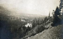
Showing 3619 results

Archival description
Upper Fraser Mill
2012.13.1.87.063 · Item · [between 1975 and 1995]
Part of J. Kent Sedgwick fonds

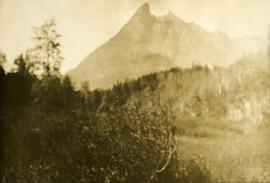
Image depicts the Upper Fraser mill yard with a CN train in Upper Fraser, B.C. Map coordinates 54°07'10.8"N 121°56'51.7"W

Upper Fraser Mill
2012.13.1.87.061 · Item · [between 1975 and 1995]
Part of J. Kent Sedgwick fonds

Image depicts the entrance to the Upper Fraser mill yard in Upper Fraser, B.C. Map coordinates 54°07'10.8"N 121°56'51.7"W

Upper Fraser Mill
2012.13.1.87.066 · Item · [between 1975 and 1995]
Part of J. Kent Sedgwick fonds

Image depicts the Upper Fraser Road running through Upper Fraser, B.C. A newer style round burner is seen in the background. Map coordinates 54°07'05.7"N 121°56'38.9"W

Upper Fraser Residences
2012.13.1.87.047 · Item · [between 1975 and 1995]
Part of J. Kent Sedgwick fonds

Image depicts an older building with numerous vehicles parked out front in Upper Fraser, B.C. Map coordinates 54°07'03.5"N 121°56'34.4"W

2012.13.1.87.041 · Item · [between 1975 and 1995]
Part of J. Kent Sedgwick fonds

Image depicts the Upper Fraser Road running through Upper Fraser, B.C. A beehive burner is seen in the background on the left and the mill office is seen on the right. Map coordinates 54°07'05.7"N 121°56'38.9"W

Upper Fraser Road in Winter
2012.13.1.89.016 · Item · Feb. 1973
Part of J. Kent Sedgwick fonds

Image depicts several unidentified individuals walking along the snow-covered Upper Fraser Road with numerous buildings on either side. Map coordinates 54°07'05.7"N 121°56'38.9"W

Uprooted Tree?
2012.13.1.78.19 · Item · 1982
Part of J. Kent Sedgwick fonds

Image depicts an individual standing next to what appears to be the base of a very large, uprooted tree, located somewhere in the coastal forest of Haida Gwaii, B.C.

Valemount
2012.13.1.85.25 · Item · [1976?]
Part of J. Kent Sedgwick fonds

Image depicts a view of Valemount, with numerous mountains in the background.

Valemount - Mountains
2012.13.1.85.21 · Item · 1976
Part of J. Kent Sedgwick fonds

Image depicts a view of a mountain range near Valemount, B.C. Valemount is barely visible among the trees on the right side of the image.

Valemount - Reservoir
2012.13.1.85.24 · Item · [1976?]
Part of J. Kent Sedgwick fonds

Image depicts a distant view of what appears to be a body of water, with numerous mountains in the background. The slide is labelled "Valemount reservoir."

Valley
2012.13.1.56.57 · Item · 1973
Part of J. Kent Sedgwick fonds

Image depicts a view of a small valley in Mt. Robson Provincial Park.

Valley?
2012.13.1.59.13 · Item · July 1980
Part of J. Kent Sedgwick fonds

Image depicts a river running through a valley-like area somewhere near Bralorne, B.C.

Van Bow Existing Zoning
2023.5.1.12 · Item · Apr. 1977
Part of UNBC School of Planning and Sustainability fonds

Item is a hand drawn and coloured map by the City of Prince George Planning Department depicting existing zoning for the Van Bow neighbourhood area. Also includes two hand-drawn mylar overlays for the map; one showing "Opportunities & Constraints" such as housing age and condition and the other showing "Subdivision Activity" over decades of development in the Van Bow area.

Varves
2012.13.1.124.16 · Item · Oct. 1975
Part of J. Kent Sedgwick fonds

Image depicts an example of varves, an annual layer of sediment or rock, with a pipe used for reference size. It is possibly located at the airport in Prince George, B.C.

Varves
2012.13.1.124.15 · Item · Oct. 1975
Part of J. Kent Sedgwick fonds

Image depicts an example of varves, an annual layer of sediment or rock, possibly located at the airport in Prince George, B.C.

2008.3.1.83.2 · Item · [after 1981]
Part of Bridget Moran fonds

Photograph depicts lake in surrounding field. Grave marker on rock in right foreground. Handwritten annotation on recto of photograph: "This is a picture of the lake (part of it) the rock is in the bottom right corner on a knoll. You can see the plaque on it. But it isn't very clear."

View from Gunn Point
2012.13.1.3.060 · Item · Nov. 1979
Part of J. Kent Sedgwick fonds

Image depicts a view of Prince George from Gunn Point in the L.C. Gunn Park looking north. Map coordinates 53°54'26.2"N 122°43'35.8"W.

View from Gunn Point
2012.13.1.3.061 · Item · Nov. 1979
Part of J. Kent Sedgwick fonds

Image depicts a view of Prince George from Gunn Point in the L.C. Gunn Park looking north. Map coordinates 53°54'26.2"N 122°43'35.8"W.

View from Gunn Point
2012.13.1.3.059 · Item · Nov. 1979
Part of J. Kent Sedgwick fonds

Image depicts a view of Prince George from Gunn Point in the L.C. Gunn Park looking north. Map coordinates 53°54'26.2"N 122°43'35.8"W.

View from Gunn Point
2012.13.1.3.064 · Item · Nov. 1979
Part of J. Kent Sedgwick fonds

Image depicts a view of Prince George from Gunn Point in the L.C. Gunn Park looking north. Map coordinates 53°54'26.2"N 122°43'35.8"W.

View from Gunn Point
2012.13.1.3.065 · Item · Nov. 1979
Part of J. Kent Sedgwick fonds

Image depicts a view of Prince George from Gunn Point in the L.C. Gunn Park looking north. Map coordinates 53°54'26.2"N 122°43'35.8"W.

View from Gunn Point
2012.13.1.3.058 · Item · Nov. 1979
Part of J. Kent Sedgwick fonds

Image depicts a view of Prince George from Gunn Point in the L.C. Gunn Park looking north. Map coordinates 53°54'26.2"N 122°43'35.8"W.