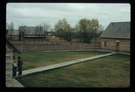
The item is a photograph depicting a mural around the centennial fountain in Prince George.
The item is a photograph depicting the centennial fountain in Prince George.
Image depicts the Woodpecker School building.
Image depicts a piece of industrial machinery, likely for either mining or forestry, in an uncertain location near McLeod Lake, B.C.
Image depicts a river, possibly either the Nechako or the Fraser, and a mountain range from an unknown location.
Image depicts the historic Hudson's Bay Company office in Fort St. James, B.C.
Image depicts the interior of the historic Hudson's Bay Company office in Fort St. James, B.C.
Image depicts the interior of the historic Hudson's Bay Company Trading Post in Fort St. James, B.C.
Image depicts the interior of the historic Hudson's Bay Company Trading Post, with several unknown individuals present, in Fort St. James, B.C.
Image depicts a lake, possibly Stuart Lake in Fort St. James, B.C.
Image depicts the Hudson's Bay Company historic site in Fort St. James, B.C.
Image depicts the Barkerville Cemetery.
Image depicts the grave of John A. Cameron at Barkerville, B.C.
Image depicts the grave of John A. Fraser in Barkerville, B.C.
Image depicts Blackwater River.
Image depicts a wooden structure at Gang Ranch. It is possibility an elevated water trough.
Image depicts a view of the property of the Gang Ranch.
Image depicts the Fraser River in the upper Fraser Canyon.
Image depicts an unknown woman on a road in the upper Fraser Canyon.
Image depicts the grave of W.L. Meason in the upper Fraser Canyon.
Image depicts Gang Ranch, with a sign warning that the area is patrolled by Range and Logging Patrols, in the Upper Fraser Canyon.
Image depicts Gang Ranch in the Upper Fraser Canyon.
Image depicts a couple of old buildings, and a field full of tree trunks and dead wood. Located somewhere in or around the Upper Fraser Canyon.
Image depicts a view of the Upper Fraser Canyon. The Fraser River is visible.
Image depicts the Fraser River running through the Upper Fraser Canyon.
Image depicts the Alkali Lake Ranch in Alkali Lake, B.C.
Image depicts a house and numerous rundown vehicles in Dog Creek, B.C.
Image depicts a house located somewhere in or near Canoe Creek.
Image depicts a view of Canoe Creek.
Image depicts several old buildings at an uncertain location. The slide is simply labelled "Spring house?"
Image depicts rows of water, possibly being irrigation ditches, somewhere in Lillooet, B.C.
Image depicts the Fraser River near Lillooet, B.C.
Image depicts a train in an uncertain location, though it is possibly Howe Sound in the background.
File contains slides depicting locations in and around Bralorne, B.C.
Image depicts the Terzaghi Dam on the Bridge River, looking from the upstream (reservoir) side located near Bralorne, B.C. The water is Carpenter Lake.
Image depicts an elevated view of a lake and a road located somewhere near Bralorne, B.C.
Image depicts a dirt road leading through a forest.
Image depicts a river running through a valley-like area somewhere near Bralorne, B.C.
Image depicts a river full of logs, somewhere near Bralorne, B.C.
Image depicts the Bridge River No. 1 hydroelectric station on the shore of Seton Lake (rear side of powerhouse).
Image depicts the Lajoie Dam on the Bridge River, upstream side, showing part of Downton Lake and, in the foreground, the spillway intake.
Image depicts a view of the land surrounding Bralorne, B.C.
Image depicts what appears to be a motel somewhere near Bralorne, B.C.