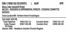
Showing 610 results

Archival description
2007.1.45.49.03 · Item · 1936
Part of Aleza Lake Research Forest fonds

Item is the 1936 strip notes accompanying the BC Forest Service report from Myra, BC titled "Southern Interior District Experimental Plot No. 160: Conditions After Logging of a Spruce-Balsam Forest in Relation to Spruce Reproduction and to the Rate of Growth of the Second Story".

2023.2.2.2.2 · Item · 30 June 1997
Part of Dr. Paul Sanborn fonds

This Ministry of Forests internal memorandum of 30 June 1997 from Paul Sanborn to Regional & Research Branch soil scientists provides comparison of Morgan's extractant and BaCl₂ for cations, using the 57 samples from the regional soil mineralogy study.

The key results from the study were later published as:
J.M. Arocena and P. Sanborn. 1999. Mineralogy and genesis of selected soils and their implications for forest management in central and northeastern British Columbia. Canadian Journal of Soil Science 79: 571-592. https://doi.org/10.4141/S98-07

2023.2.2.3 · Subseries · 2004-2006
Part of Dr. Paul Sanborn fonds

As part of a multidisciplinary team led by Grant Zazula (then a Ph.D. student at Simon Fraser University; later a palaeontologist with the Government of Yukon) and Duane Froese (Professor, University of Alberta), Dr. Paul Sanborn examined a set of buried paleosols (fossil soils) preserved in frozen sediments exposed by placer mining in the spring of 2004.

The findings were published in:
Zazula, G.D., D.G. Froese, S.A. Elias, S. Kuzmina, C. La Farge, A.V. Reyes, P.T. Sanborn, C.E. Schweger, C.A.S. Smith, and R.W. Mathewes. 2006. Vegetation buried under Dawson tephra (25,300 14C yr BP) and locally diverse late Pleistocene paleoenvironments of Goldbottom Creek, Yukon, Canada. Palaeogeography, Palaeoclimatology, Palaeoecology 242: 253–286. https://doi.org/10.1016/j.palaeo.2006.06.005

2023.2.2.4 · Subseries · 2004-2005
Part of Dr. Paul Sanborn fonds

The eastern flank of the Mackenzie Mountains has a complex history of multiple glaciations by both the Laurentide and Cordilleran ice sheets, recorded in thick sequences of glacial sediments that were documented at 3 locations (Katherine Creek, Little Bear River, Inlin Brook) by:
Duk-Rodkin, A., R.W. Barendregt, C. Tarnocai, and F.M. Phillips. 1996. Late Tertiary to late Quaternary record in the Mackenzie Mountains, Northwest Territories, Canada: stratigraphy, paleosols, paleomagnetism, and chlorine-36. Canadian Journal of Earth Sciences 33 (6): 875-895. https://doi.org/10.1139/e96-066

Of the 3 sites, the exposure on Inlin Brook, a tributary of the Keele River, was the least well-documented, so in summer 2004 Dr. Paul Sanborn joined a field party of the Geological Survey of Canada (GSC) based at Tulita, NWT, and was given helicopter support to visit Inlin Brook (August 5-8). A brief visit was also made to the Little Bear River site.

On August 9-10, Sanborn joined Alejandra Duk-Rodkin (GSC) and Rene Barendregt (U Lethbridge) in helicopter-assisted field work at sites in the Franklin Mountains and elsewhere east of the Mackenzie River.

2023.2.2.5 · Subseries · 1991-2023, predominant 2004
Part of Dr. Paul Sanborn fonds

The Lost Chicken Mine, a placer gold mine in eastern Alaska, approximately 120 km west of Dawson City, Yukon, is an important fossil locality for the late Pliocene (approximately 2.5 – 3.0 million years ago). A comprehensive account of the stratigraphy and paleontology of this site was given by:
Matthews, J.V., Jr., J.A. Westgate, L. Ovenden, L.D. Carter, and T. Fouch. 2003. Stratigraphy, fossils, and age of sediments at the upper pit of the Lost Chicken gold mine: new information on the late Pliocene environment of east central Alaska. Quaternary Research 60: 9-18. https://doi.org/10.1016/S0033-5894(03)00087-5

Dr. Paul Sanborn visited the site on July 20, 2004, as part of a group led by Duane Froese (Professor, University of Alberta). The group concentrated on a single exposure (~ 2 m thick) straddling the Lost Chicken tephra, a volcanic ash bed (2.9 ± 0.4 myr) which is a major stratigraphic marker at the site. Sanborn described, photographed, and sampled this exposure, and obtained a basic set of characterization data. Intact samples were collected but thin sections were never produced.

"Burns Bog Analysis"
2023.7.3.10 · Item · June 1993
Part of Grant Hazelwood fonds

Item is a reproduction of a report entitled "Burns Bog Analysis" by Catherine Berris & Associates for the Ministry of Environment, Lands & Parks. The scope of this Burns Bog Analysis was inventory and preliminary analysis; the process included information collection and review, preliminary analysis of existing and potential land uses and a public open house.

"Kwadacha Park 1976"
2023.7.3.56 · Item · Oct. 1976
Part of Grant Hazelwood fonds

Item is an original "Kwadacha Park 1976" trip report by W.G. Hazelwood. Includes original photographic prints pasted into the report. Also includes a "Kwadacha Wilderness Park Proposal" accompanying map.

2023.7.4.33 · Item · 1990, 2015
Part of Grant Hazelwood fonds

Item is a draft of "B.C. Hydro Proposed 287 kV Transmission Line - Kitimat to Terrace - Preliminary Environmental Assessment of Fish and Wildlife Values" by Grant Hazelwood. Also includes accompanying print pages for a 2015 BC Hydro powerpoint slideshow regarding the Terrace to Kitimat Transmission Project (TKTP).

The Asbestos Sheet Apr. 1971
2000.1.3.1.240 · Item · Apr. 1971
Part of Cassiar Asbestos Corporation Ltd. fonds

"The Asbestos Sheet" is a newspaper that documents the community and work life of the residents of Cassiar BC. Content includes text and photographs, as well as jokes, comics, and games. (Note: Page seven is missing from this issue)