
Title and statement of responsibility area
Title proper
General material designation
- Graphic material
- Electronic record
Parallel title
Other title information
Title statements of responsibility
Title notes
Level of description
Reference code
Edition area
Edition statement
Edition statement of responsibility
Class of material specific details area
Statement of scale (cartographic)
Statement of projection (cartographic)
Statement of coordinates (cartographic)
Statement of scale (architectural)
Issuing jurisdiction and denomination (philatelic)
Dates of creation area
Date(s)
-
1991-2023, predominant 2004 (Creation)
Physical description area
Physical description
- 5 documents (.PDF)
- 4 data sets (.XLS)
- 20 photographs
Publisher's series area
Title proper of publisher's series
Parallel titles of publisher's series
Other title information of publisher's series
Statement of responsibility relating to publisher's series
Numbering within publisher's series
Note on publisher's series
Archival description area
Name of creator
Scope and content
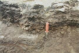
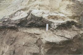
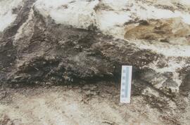
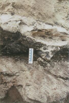
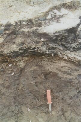
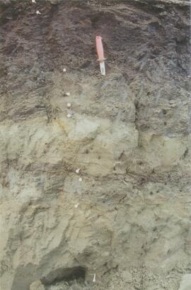
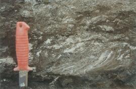
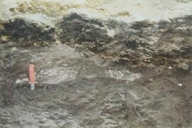
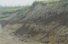
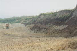
The Lost Chicken Mine, a placer gold mine in eastern Alaska, approximately 120 km west of Dawson City, Yukon, is an important fossil locality for the late Pliocene (approximately 2.5 – 3.0 million years ago). A comprehensive account of the stratigraphy and paleontology of this site was given by:
Matthews, J.V., Jr., J.A. Westgate, L. Ovenden, L.D. Carter, and T. Fouch. 2003. Stratigraphy, fossils, and age of sediments at the upper pit of the Lost Chicken gold mine: new information on the late Pliocene environment of east central Alaska. Quaternary Research 60: 9-18. https://doi.org/10.1016/S0033-5894(03)00087-5
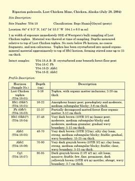
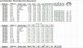
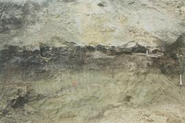
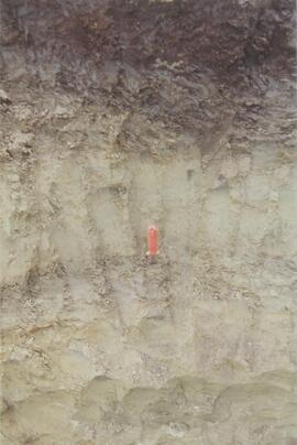
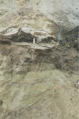
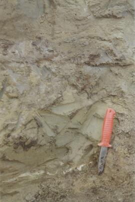
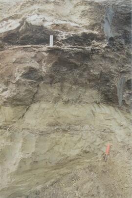
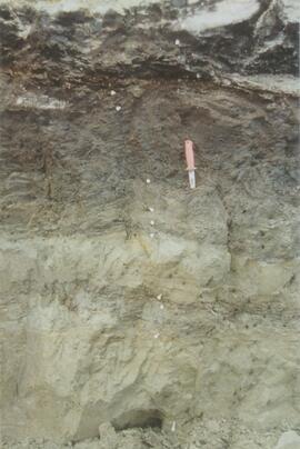
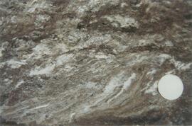
Dr. Paul Sanborn visited the site on July 20, 2004, as part of a group led by Duane Froese (Professor, University of Alberta). The group concentrated on a single exposure (~ 2 m thick) straddling the Lost Chicken tephra, a volcanic ash bed (2.9 ± 0.4 myr) which is a major stratigraphic marker at the site. Sanborn described, photographed, and sampled this exposure, and obtained a basic set of characterization data. Intact samples were collected but thin sections were never produced.
Notes area
Arrangement
Language of material
- English
Script of material
Location of originals
Availability of other formats
Restrictions on access
No restrictions.
Terms governing use, reproduction, and publication
Personal or academic use of materials is welcomed under the standard fair dealing and educational use clauses of Canadian Copyright Law. Commercial use is, however, forbidden without the express permission of the copyright holder. For information on obtaining written permission from the copyright holder, please contact the Northern B.C. Archives and Special Collections.