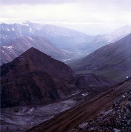
Photograph depicts the West Peak of the Cassiar mine on McDame Mountain. Pit area visible between West Peak and road in foreground. Mine valley and north mountain range in background. Photo speculated to have been taken from a point on or near the South or North Peak.
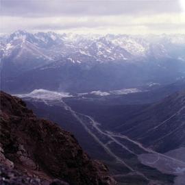
Photograph depicts mine valley and road in foreground. Cassiar plant and tailings pile visible in left midground, townsite in right midground. Mountainside of McDame Mountain in foreground, southern mountain range in background.
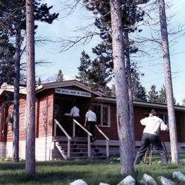
Photograph depicts two unidentified men entering building with the sign "THE ROYAL BANK OF CANADA" above main entrance. Photographer with tripod in foreground.
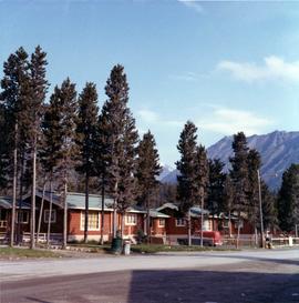
Photograph depicts row of houses behind trees. Road, front yards, and vehicle in foreground, mountains in background.
Photograph depicts unknown individuals seated in chairs of room speculated to be a living room or common area. Potted plants, television, open door, and wall hangings in background. Lamps, chairs, and side tables in foreground.
Photograph depicts line of men across serving counter in building believed to be cafeteria. Two unknown employees dishing food in left foreground.
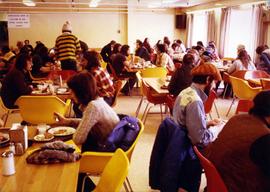
Photograph depicts men and women seated in red and yellow chairs at tables. Windows and curtains visible in right background. Sign hanging in left background reads: "DINNING ROOM MUST BE VACATED [10?] MIN. AFTER CLOSING TIME POSTED".
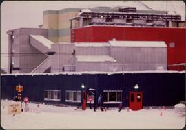
Photograph depicts long building with blue siding. Security was located at corner of building in centre foreground, behind stop sign. Single red door on left was main entrance into mine dry, where individuals were checked through security. Two larger windows on left indicate the location of the mine store where work apparel could be purchased. Building also housed change house (see item 2000.1.1.3.19.121) and offices of the mine department supervisory staff. Employee parking lot located out of frame to right. Mill building stands in background, tramline dump station on left. Ore car visible, about to enter dump station. Unidentified man and child can be seen in foreground.
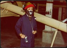
Photograph depicts woman wearing safety gear in second floor of mill building, holding unidentified instruments. Helen Joseph took air quality tests in the working areas and town (see item 2000.1.1.3.19.147).
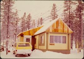
Photograph depicts mobile home modified for Cassiar winters (steeply sloped roof added). Yellow suburban parked in driveway in left foreground. Forest trees and mountainside visible in background. Sign reading "686" posted on tree in left foreground. Believed to be the home of Gerry Cooper.
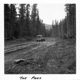
Photograph depicts a truck on a newly cleared dirt road in a mountain pass and a wooded area.
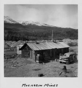
Photograph depicts a wooden structure in a gravel landscape. Truck with open door in foreground, forest and snow capped mountains in background. Mounds of gravel visible behind structure.
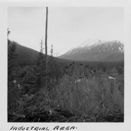
Photograph depicts the wooded area of the Cassiar valley. The projected plant site is outlined in blue ink. Trees and bushes in foreground, snow-capped mountains in background.
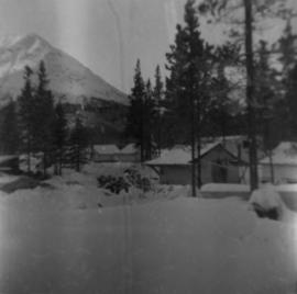
A collection of photographs from the site that Cassiar was being built in the early 50s. Photos depict lumber piles, early camp area, the first buildings, mountains, and the creek.
Along with this collection there are a set of images also from the early Cassiar site mainly depicting a dirt road and various individuals and machinery along it.
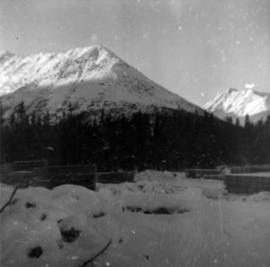
Photograph depicts approximately six lumber piles in the northwest corner of snow-covered plant site. Forest and snow-capped mountains in background. Photo taken facing west.
Photograph depicts tent structures among trees at the temporary Cassiar construction camp. Taken from future site of garage building, looking northwest, snow-capped mountain in background.
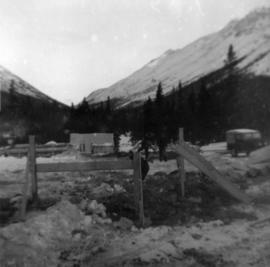
Photograph depicts three men building garage foundation in snow-covered plant site. Truck to right of men, wood fence structure in foreground, Asbestos Valley in background.
Photograph depicts a wet mud road in forest. Truck and people on left in distance, one man in foreground on right.
Photograph depicts a wet mud road in forest. Truck in distance, woman and shadow of unknown person in foreground.
Photograph depicts a truck and two men on a wet mud road in forest. Photo taken from side of road, road in foreground, trees in background.
Photograph depicts two men in front of truck on a wet mud road in forest. Road in foreground, one man in shade on left, trees in background.
A collection of aerial photos of the Clinton Creek area.
Included is a flight index for 68 aerial photographs. Map depicts Clinton Creek area, identifying airfield and mine.
Aerial photograph of Clinton Creek, south east of plant site.
Aerial photograph of Clinton Creek, south east of plant site.
Aerial photograph of Clinton Creek, south east of plant site.
Aerial photograph of Clinton Creek, north west of plant site.
Aerial photograph of Clinton Creek, south west of plant site.
Aerial photograph of Clinton Creek, south west of plant site.
Aerial photograph of Clinton Creek, west of plant site.
Aerial photograph of Clinton Creek, north west of plant site.
Aerial photograph of Clinton Creek, north west of plant site.
Aerial photograph of Clinton Creek, north of plant site.
Aerial photograph of Clinton Creek, south of plant site.
Aerial photograph of Clinton Creek, south west of plant site.
Aerial photograph of Clinton Creek, west of plant site.
Aerial photograph of Clinton Creek, south of plant site.
Aerial photograph of Clinton Creek, east of plant site.
Photograph collection of various foothills around Cassiar.
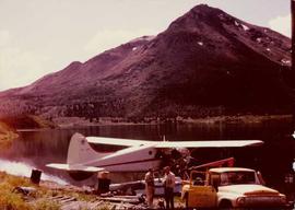
Photograph depicts Cassiar's Chief Geologist Bill Plumb and unidentified man standing on shore by yellow Cassiar supervisor's truck. Airplane is parked on lake behind them, and miscellaneous equipment lies on shore at Bill's feet. Photograph speculated to have been taken at Aeroplane Lake, approximately 35 miles east of Cassiar. Bill Plumb led many expeditions for the purposes of Cassiar's outside exploration endeavours.
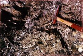
Photograph depicts a geologist's hammer, believed to belong to Cassiar's Chief Geologist Bill Plumb. The hammer provides a scale for the exposed asbestos, indicating the percent of fibre in the rock as well as the expectation of grade.
Photograph depicts freight truck being ferried across the Stewart River, north bound. It is believed that this truck may have been owned by United Keno Hills Mines Ltd. It is speculated that this photograph was taken for research purposes.
Photograph depicts a transport truck being loaded with concentrates of silver-lead and zinc ores at Elsa Mill, Mayo Mining district, Y.T (owned by United Keno Hill Mines Ltd.). It is speculated that this photograph may have been kept for research purposes.
Photograph depicts two miners loading holes for blasting high grade rock face in the Hector mine (owned by United Keno Hill Mines Ltd.). It is speculated that the photograph may have been kept for research purposes.
Photograph depicts the Calumet townsite owned by United Keno Hill Mines Ltd. Photograph faces east, tramline beneath mine tailings pile runs to the Elsa mill. It is speculated that the photograph may have been kept for research purposes.
Photograph depicts top of framed building, mountain in background.
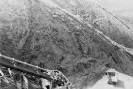
Photograph depicts dump truck on hill believed to be in mine area, unknown structure on left.
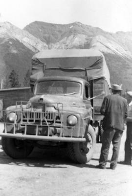
Photograph depicts tarp-covered truck, two men on right, mountains in background.
Photograph depicts bridge crossing river, trees in background.
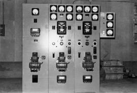
Photographs depict electrical room.
Photographs depict electrical room.
