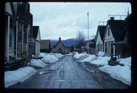
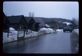
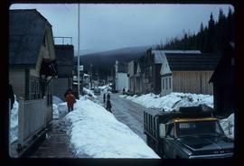
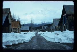
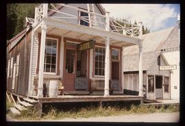
Aperçu avant impression Fermer

Affichage de 2481 résultats

Archival description
1595 résultats avec objets numériques Afficher les résultats avec des objets numériques
Bare Logs
2012.13.1.122.17 · Pièce · [1979?]
Fait partie de J. Kent Sedgwick fonds

Image depicts numerous logs that have been stripped of their bark at a saw mill in Prince George, B.C.

Barkerville
2012.13.1.6.043 · Pièce · July 1976
Fait partie de J. Kent Sedgwick fonds

Image depicts the back of the main street Barkerville, B.C.

Barn
2012.13.1.13.15 · Pièce · Oct. 1984
Fait partie de J. Kent Sedgwick fonds

Image depicts an old barn somewhere in the Fort George Canyon Provincial Park, B.C.

Barn and Cabin
2012.13.1.13.17 · Pièce · Oct. 1984
Fait partie de J. Kent Sedgwick fonds

Image depicts an old barn and a collapsing cabin somewhere in the Fort George Canyon Provincial Park, B.C.

Bear Lake
2012.13.1.4.35 · Pièce · [2000?]
Fait partie de J. Kent Sedgwick fonds

Image depicts some houses most likely in Bear Lake, B.C.

Bear Lake (?)
2012.13.1.4.36 · Pièce · [2000?]
Fait partie de J. Kent Sedgwick fonds

Image depicts some buildings along a dirt road, possibly near Bear Lake, B.C.

Becher's Prairie
2012.13.1.65.69 · Pièce · Aug. 1980
Fait partie de J. Kent Sedgwick fonds

Image depicts what appears to be a small ranch. The slide is labelled "Becher's Prairie," possibly meaning Becher's Prairie Provincial Park in B.C.

Bee Hive Burner
2012.13.1.7.001 · Pièce · Oct. 1975
Fait partie de J. Kent Sedgwick fonds

Image depicts a bee-hive burner beside a rail-road track at an unidentified mill somewhere in Prince George, B.C.

Beehive Burner
2012.13.1.3.088 · Pièce · 12 Oct. 1989
Fait partie de J. Kent Sedgwick fonds

Image depicts a Beehive Burner along the Nechako on River Road. Map coordinates 53°55'34.1"N 122°44'58.0"W