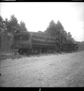
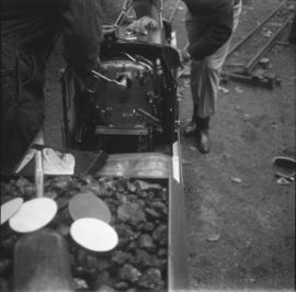
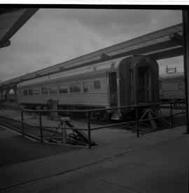
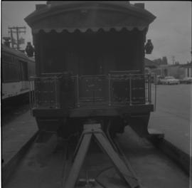
Showing 4832 results

Archival description
4073 results with digital objects Show results with digital objects
2013.6.36.1.059.33 · Stuk · Apr. 1973
Part of David Davies Railway Collection

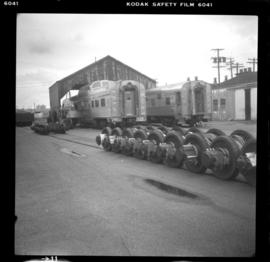
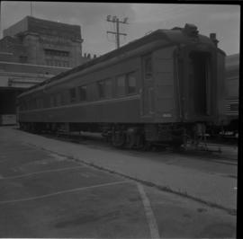
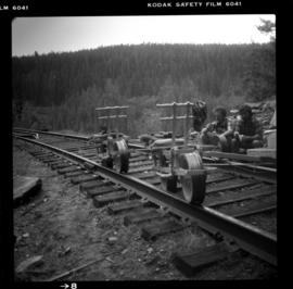
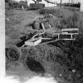
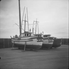
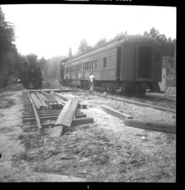
Photograph depicts temporary yards, on the western outskirts of Victoria, being part of the leased CNR's Victoria- Duncan line. On the left is Hillcrest Lumber #10, Climax, that was built in 1928. It was sold to Terry Ferguson in April, 1969 and then moved to Victoria in September, 1970. On the right is a CPR Montreal Surburban commuter car that was built in 1932, and behind that is a 1913 steam crane/

2013.6.36.1.059.20 · Stuk · Apr. 1973
Part of David Davies Railway Collection

Photograph depicts temporary yards that were sited at View Royal, northwest of downtown Victoria. They use two and a half miles of the CNR's Victoria-Sooke-Duncan line. Visible is a Baldwin that was built in 1929. Its last revenue owner was Comox Logging and Railway Co. It was then purchased by the West Coast Railway Association from Crown Zellebach in 1964. At the time the picture was taken, it had been purchased by the Victoria Pacific Railway that commenced work on this line on June 24, 1972.

VIA Rail shack
2013.6.36.1.116.05 · Stuk · Aug. 1995
Part of David Davies Railway Collection

Photograph depicts a shack built by VIA because the depot in Boston bar was unused, empty, locked and awaiting a buyer.

VIA Rail Rail, Vancouver
2013.6.36.1.035.14 · Stuk · [25 June 1983]
Part of David Davies Railway Collection

Photograph taken at the VIA Rail depot in Vancouver. Visible is a former Grand Trunk Pacific car, 'Nechako,' now CNR #15105. It was a fairly permanent fixture with steam, water, and waste lines fixed up to the depot's facilities.

VIA Rail Rail, Vancouver
2013.6.36.1.035.13 · Stuk · [25 June 1983]
Part of David Davies Railway Collection

Photograph taken at the VIA Rail depot in Vancouver. Image captures the view end of the Grand Trunk Pacific Railway car, now called the CNR 'Nechako' #15105. Davies notes that it was normally spotted at the location as a semi-fixed installation.

Velocipede beside track
2013.6.36.1.007.121 · Stuk · [July 1965]
Part of David Davies Railway Collection

Photograph depicts a velocipede north of C.P.R. track and immediately west of Port Hammond in the Fraser Valley. These three-wheeled hand/foot powered track vehicles were mostly used by track patrolmen.

Vancouver Fireboat #2
2013.6.36.1.013.09 · Stuk · [17 June 1965]
Part of David Davies Railway Collection

Photograph depicts Vancouver Fireboat #2 having its hull sandblasted in a dry dock at the Burrard Shipyard & Marine Ways Ltd. at 1729 West Georgia St., Vancouver.

US military plane
2013.6.36.1.084.16 · Stuk · 2 Aug. 1981
Part of David Davies Railway Collection

Photograph taken at the Penticton Airport where WWII military airplanes meet. This US military plane was flown by a US Air Militia on a courtesy visit. It was built in the early 1950's.

2012.13.1.87.041 · Stuk · [between 1975 and 1995]
Part of J. Kent Sedgwick fonds

Image depicts the Upper Fraser Road running through Upper Fraser, B.C. A beehive burner is seen in the background on the left and the mill office is seen on the right. Map coordinates 54°07'05.7"N 121°56'38.9"W

Upper Fraser Mill
2012.13.1.87.062 · Stuk · [between 1975 and 1995]
Part of J. Kent Sedgwick fonds

Image depicts the entrance to the Upper Fraser mill yard in Upper Fraser, B.C. Map coordinates 54°07'10.8"N 121°56'51.7"W

Upper Fraser Mill
2012.13.1.87.063 · Stuk · [between 1975 and 1995]
Part of J. Kent Sedgwick fonds

Image depicts the Upper Fraser mill yard with a CN train in Upper Fraser, B.C. Map coordinates 54°07'10.8"N 121°56'51.7"W

Upper Fraser Mill
2012.13.1.87.061 · Stuk · [between 1975 and 1995]
Part of J. Kent Sedgwick fonds

Image depicts the entrance to the Upper Fraser mill yard in Upper Fraser, B.C. Map coordinates 54°07'10.8"N 121°56'51.7"W

Upper Fraser Mill
2012.13.1.87.066 · Stuk · [between 1975 and 1995]
Part of J. Kent Sedgwick fonds

Image depicts the Upper Fraser Road running through Upper Fraser, B.C. A newer style round burner is seen in the background. Map coordinates 54°07'05.7"N 121°56'38.9"W

2006.20.12.29 · Stuk · [ca. 1940]
Part of Northern BC Archives Historical Photograph Collection

Handwritten photo album caption below this photo reads: "Unloading at Watson Lake." Photograph depicts plane with the number "553"on its side landed in airstrip. Group of luggage, three men in uniform, and movable staircase in front of plane. Snow in foreground, trees in background.

Zonder titel
2006.25.1.52 · Stuk · Apr. 1963
Part of Al Elsey Moving Images Collection

Footage of men unloading hay for cattle from a horse-drawn flat bed trailer, a panoramic view of the surrounding mountains, and people being driven in flat bed tractor out to a small silver plane and taking off.

Unknown Women and Child
2009.5.2.268 · Stuk · 1937
Part of Taylor-Baxter Family Photograph Collection

Photograph depicts an elderly woman standing beside two younger women who kneel beside small girl on front yard. Trees, car, road, and neighbouring yards visible in background. Young girl speculated to be also featured in item 2009.5.2.5.

Unknown Women and Child
2009.5.2.18 · Stuk · 1937
Part of Taylor-Baxter Family Photograph Collection

Photograph depicts an elderly woman standing beside two younger women who kneel beside small girl on front yard. Trees, car, road, and neighbouring yards visible in background. Young girl speculated to be also featured in item 2009.5.2.5.

Unknown Man & Talus Ore
2000.1.1.3.14.07 · Stuk · [ca. 1951]
Part of Cassiar Asbestos Corporation Ltd. fonds

Image of man seated with shovel in mountainous area, loose asbestos fibre in background. This photograph is believed to be either a double exposure of two images, or a print made from two negatives at once. Photo depicts an unidentified man sitting on the south ridge of the Cassiar ore body, where the crusher and rock reject plant would eventually sit. Valley in background appears to depict the "Footwall Road," which was cut into the mountain from the pit to the crusher plant and became the mine's main haul road.